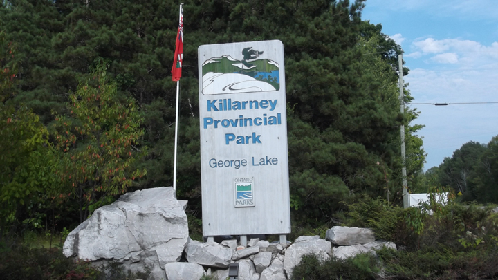
Killarney Provincial Park
|
Rating: ★★★★☆ Killarney Tenting
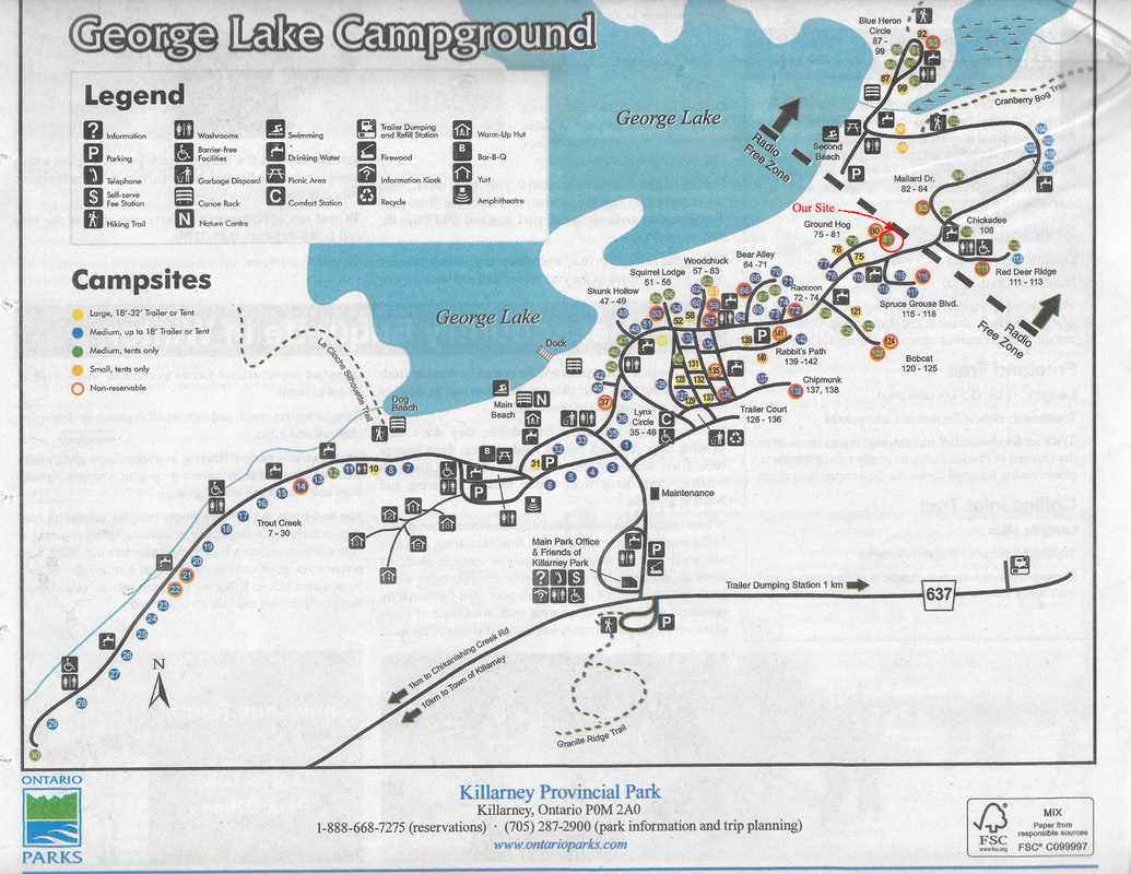
★★★★★ Killarney Backpacking 960 Highway #637, Killarney, ON, P0M 2A0 (705) 287-2900 No. of Sites (128) 128 non-electrical sites, 0 electrical sites, 0 group sites , 6 Yurts, Note: Campground “D” (sites #82 to #113 including the East Beach) are radio-free, 216 Back Country sites (183 canoe-in sites and 33 hike-in sites) Wheel Chair Accessible Campgrounds - Yes (2) Operating Dates: Open year round |
Blog Entries: Killarney Tenting - August 2015
- Connecting With The Land
- Hiking up "The Crack"
- Saying Good Bye To Killarney
Killarney Backpacking - Into The Wild - August 2016
- Backpacking Killarney - Day 2
- Backpacking Killarney - Day 3
Killarney Tenting - Back to Tenting - Day 4
- Back to Tenting - Day 5
- Back to Tenting - Day 6
- Back to Tenting - Day 7
Terrain - Well treed, lots of oak and birch and pine trees. More shady than sunny.
Staff - Pleasure to deal with and great to talk to. They are very informative and very friendly.
Bathrooms - 1 comfort station (flush toilets/ running water) Moderately clean, looking a little run down
Showers - 7 Water pressure is pretty good and water is fairly warm as long as not too many people have showered before you. Pop machine and laundry facilities are located here as well.
Beach -2 beaches. The smaller one (in the radio free area) is the better of the two. Both are sandy, with clear clean water.
Out Door Water Faucets - 16 with no signs to indicate where they are. They blend in to the woodland background very well. The water from these faucets is drinkable.
Hiking Trails - The Crack (6 km) - The entrance is a 7 km drive outside the park and the entrance has no signs. It is a difficult trail but it is very rewarding. It is not a loop so you have to turn around and come back the way you came or you will be headed on the much longer 78 km La Cloche trail. Note: Do not try to reach the Crack unless you are in good shape and can get an early start
- La Cloche Silhouette Trail (78 km) - This trail is very strenuous. It is rated as the second most difficult trail in Canada. This trail is recommended to be done in 7 - 10 days (but I recommend about 14 - 16 days) and has campsites situated along the way.
There are two entrances (one inside the park and the other is 7 km outside the park).
- Chickanishing Trail (3 km) - A moderately rocky and wooded trail that takes you to the shores of Georgian Bay.
Old iron rings used for mooring lines during logging days can still be seen along the trail.
- Granite Ridge Trail (2 km) - The entrance is located directly across the road from the camp office. This trail winds through old fields and forests and climbs to a ridge with two lookouts over the park.
- Cranberry Bog Trail (4 km) - Bogs, marshes and swamps are exactly what you expect to see on this trail. You will also see beaver feed piles and you can look for turtles and various birds.
- Lake Of The Woods Trail (3.5 km) - A looped trail that circles Lake Of The Woods. At one point, the trail descends to the lakeshore where a short boardwalk connects to the lake’s only island.
Pet Amenities - A dog beach is located just off to the side of the main beach
Playground - none
Park Store - Located In the main office and features a variety of souvenirs (The T-shirts are way over priced though). There are no groceries available at this store.
Boat/Canoe Rentals - A huge selection of canoes, kayaks and stand up paddle boards. These are provided by Killarney Outfitters located 4 minutes down the road from the park where you go to pick up your key to unlock them. There are storage racks located in the park by the beach. No motorized boats are allowed. If you have your own canoe or kayak, there is also a public storage rack available as well.
.
- Connecting With The Land
- Hiking up "The Crack"
- Saying Good Bye To Killarney
Killarney Backpacking - Into The Wild - August 2016
- Backpacking Killarney - Day 2
- Backpacking Killarney - Day 3
Killarney Tenting - Back to Tenting - Day 4
- Back to Tenting - Day 5
- Back to Tenting - Day 6
- Back to Tenting - Day 7
Terrain - Well treed, lots of oak and birch and pine trees. More shady than sunny.
Staff - Pleasure to deal with and great to talk to. They are very informative and very friendly.
Bathrooms - 1 comfort station (flush toilets/ running water) Moderately clean, looking a little run down
Showers - 7 Water pressure is pretty good and water is fairly warm as long as not too many people have showered before you. Pop machine and laundry facilities are located here as well.
Beach -2 beaches. The smaller one (in the radio free area) is the better of the two. Both are sandy, with clear clean water.
Out Door Water Faucets - 16 with no signs to indicate where they are. They blend in to the woodland background very well. The water from these faucets is drinkable.
Hiking Trails - The Crack (6 km) - The entrance is a 7 km drive outside the park and the entrance has no signs. It is a difficult trail but it is very rewarding. It is not a loop so you have to turn around and come back the way you came or you will be headed on the much longer 78 km La Cloche trail. Note: Do not try to reach the Crack unless you are in good shape and can get an early start
- La Cloche Silhouette Trail (78 km) - This trail is very strenuous. It is rated as the second most difficult trail in Canada. This trail is recommended to be done in 7 - 10 days (but I recommend about 14 - 16 days) and has campsites situated along the way.
There are two entrances (one inside the park and the other is 7 km outside the park).
- Chickanishing Trail (3 km) - A moderately rocky and wooded trail that takes you to the shores of Georgian Bay.
Old iron rings used for mooring lines during logging days can still be seen along the trail.
- Granite Ridge Trail (2 km) - The entrance is located directly across the road from the camp office. This trail winds through old fields and forests and climbs to a ridge with two lookouts over the park.
- Cranberry Bog Trail (4 km) - Bogs, marshes and swamps are exactly what you expect to see on this trail. You will also see beaver feed piles and you can look for turtles and various birds.
- Lake Of The Woods Trail (3.5 km) - A looped trail that circles Lake Of The Woods. At one point, the trail descends to the lakeshore where a short boardwalk connects to the lake’s only island.
Pet Amenities - A dog beach is located just off to the side of the main beach
Playground - none
Park Store - Located In the main office and features a variety of souvenirs (The T-shirts are way over priced though). There are no groceries available at this store.
Boat/Canoe Rentals - A huge selection of canoes, kayaks and stand up paddle boards. These are provided by Killarney Outfitters located 4 minutes down the road from the park where you go to pick up your key to unlock them. There are storage racks located in the park by the beach. No motorized boats are allowed. If you have your own canoe or kayak, there is also a public storage rack available as well.
.
Things To Do At Killarney Provincial Park
- Biking
- Swimming
- Canoeing and Kayaking
- Self Guided trails
- Picnicking
- Natural Heritage Education
- Birding
- Winter camping (6 heated Yurts and a warm up hut)
- Snow shoeing
Note: Killarney Lake is a fish sanctuary which enjoys protection from the Canadian Government, meaning that fishing of all species is prohibited year-round.
Attractions And Places To Go Near Killarney Provincial Park
Closest City or Town - Killarney, Ontario or Sudbury, Ontario
- Herbert's World Famous Fish and Chips, in the town of Killarney
- Killarney North West Light House
- Killarney East Light House
- Science North
- The Big Nickel and Dynamic Earth
- Art Gallery of Sudbury
- Sudbury Downs Racetrack and Casino
- Biking
- Swimming
- Canoeing and Kayaking
- Self Guided trails
- Picnicking
- Natural Heritage Education
- Birding
- Winter camping (6 heated Yurts and a warm up hut)
- Snow shoeing
Note: Killarney Lake is a fish sanctuary which enjoys protection from the Canadian Government, meaning that fishing of all species is prohibited year-round.
Attractions And Places To Go Near Killarney Provincial Park
Closest City or Town - Killarney, Ontario or Sudbury, Ontario
- Herbert's World Famous Fish and Chips, in the town of Killarney
- Killarney North West Light House
- Killarney East Light House
- Science North
- The Big Nickel and Dynamic Earth
- Art Gallery of Sudbury
- Sudbury Downs Racetrack and Casino
Directions:
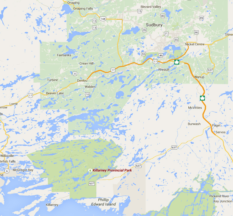
Follow Trans-Canada Hwy and then turn onto Hwy 637. Follow Hwy 637 for about 49.2 km until you reach the park.
Signs For Directions To Park - There are not a lot of them and you drive for quite awhile before you see them. However, they are easy to see and easy to find.
Follow Trans-Canada Hwy and then turn onto Hwy 637. Follow Hwy 637 for about 49.2 km until you reach the park.
Signs For Directions To Park - There are not a lot of them and you drive for quite awhile before you see them. However, they are easy to see and easy to find.