|
2238 County Road 48, Kirkfield, ON, K0M 2B0 (705) 454-3324
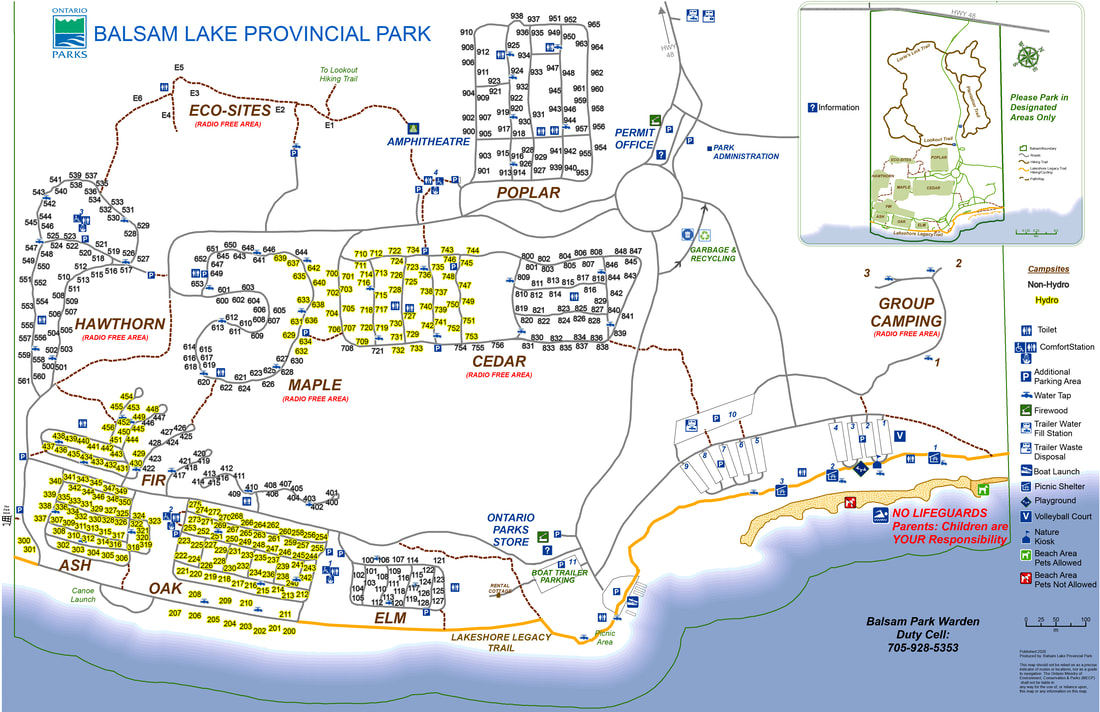
No. of Sites (506) 293 non-electrical sites, 213 electrical sites, 3 group sites, 6 Walk In sites Wheel Chair Accessible Campsites - Although all three comfort stations, and the amphitheatre are barrier free, there does not seem to be any sites designated specifically as barrier free. Operating Dates: May 12, 2023 to October 31, 2023 |
Blog Entries: - Road Trip To Autumn (October 2022)
- The Great Snake Stand Off (October 2022)
- Point The Way To Indian Point (October 2022)
- The Great Snake Stand Off (October 2022)
- Point The Way To Indian Point (October 2022)
Terrain: Forest landscape in a mature, wooded setting. Meadow lands are found throughout. Particular attention is being made to preserve and
protect the local Endangered Alvar Ecosystem. These Alvar Ecosystems are shallow soil over limestone bedrock.
Staff: Fairly friendly, helpful, and professional
Bathrooms: Clean enough, but could use a bit of an update. Automated lights in most of the vault toilets. There are 3 comfort stations in the park.
Shower: There are showers at each of the comfort stations in the Hawthorn, Oak and Elm campgrounds; three in all.
Beach : One long sandy beach on the shores of Balsam Lake, with no life guards There are three large picnic shelters located near the main
beach area.
Out Door Water Faucets - Clean, drinkable water and easy to find throughout the park
Hiking Trails:
Lookout Trail – 2.6 km (1.5 hours) walk through eskers and kames formed over 10,000 years ago from the Wisconsin Glacier. Enjoy a panoramic
view of the surrounding area.
Plantation Trail (Also known as Woodland Trail and Pond Trail)– 4.2 km (2 hours) – a moderate forest trek with both natural and pioneer
highlights.
Pet Amenities - The far end of the main beach is designated as the Pet Beach. It is not sectioned off and is only indicated as such by a sign. .
Playground - There is a jungle gym with a twisty slide attached to it down by the beach. There is a "Face In The Hole" photo opportunity board
there as well.. There are also a couple of benches for the adults to sit at.
Park Store - Located along the road near the boat launch. The park gift shop offers clothing items, souvenirs, ice, ice cream, coffee and firewood.
Groceries are available just outside the park at "The Park Store" and in the town of Coboconk.
Boat/Canoe Rentals - Canoes, kayaks and paddle boats are available to rent on the beach.
Your browser does not support viewing this document. Click here to download the document.
Things To Do At Balsam Lake Provincial Park
- Swimming
- Canoeing
- Boating
- Kayaking
- Paddle Boarding
- Birding
- Hiking
- Biking
- Picnicking
- Discovery Program
- Fishing (Fish for Walleye, Muskellunge, Large and Small Mouth Bass. There is a Learn to Fish program, a free, hands-on program that teaches
new anglers how to fish in Ontario. This fun and engaging two-hour program combines a practical teaching session with an hour of
supervised hands-on fishing. For more information and program times visit ontario.ca/learntofish)
Attractions And Places To Go Near Balsam Lake Provincial Park
Closest City (town) - Coboconk, Ontario
- Coboconk Jailhouse (craft store and used books)
- Coboconk Go-Carts and Mini Putt
- Victoria Road playground and baseball diamond
- Forget-Me-Not Alpacas (Beaverton)
- North Mountain Estates Private ATV Tours
- Kawartha Settler's Village (Bobcaygeon)
- The Little Pie Shack (Fenelon Falls)
Directions:
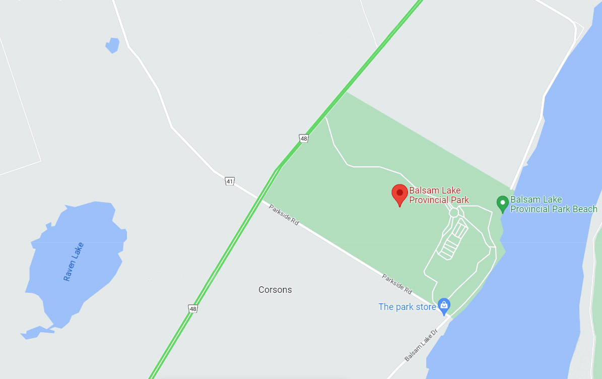
Coming From the West - Follow Trans-Canada Hwy 11 to the City of Orillia. Take Hwy 12 out of Orillia and follow it until you come to Hwy 48. Turn left onto Hwy 48. Follow this until you reach Balsam Lake Provincial Park. It will be on your right.
Coming From the East - Follow Hwy 401 W to Hwy 115 N in Clarington. Take the ON-35/ON-115 exit toward Orono/Lindsay . Continue onto ON-115 N/ON-35 N. Take exit 19 for ON-35 toward Lindsay. .Continue onto ON-35 N. Turn left onto Hwy 7/Trans-Canada Hwy/ON-35 N/ON-7 (signs for Orillia/Minden/Fenelon Falls). Turn left onto Glenarm Rd/Kawartha Lakes County Rd 8. Turn right onto Fenel Rd/Kawartha Lakes County Rd 35 (signs for County Rd 35). Turn right onto Portage Rd/County Rd 48/Kawartha Lakes County Rd 48. Turn right at the Balsam Lake Provincial Park sign.
Signs For Directions To Park - There are not a lot of them and you drive for quite awhile before you see them. However, they are easy to see and easy to find.


