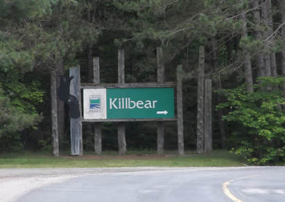
Killbear Provincial Park
|
Rating: ★★★★★★★★☆☆ Killbear Park
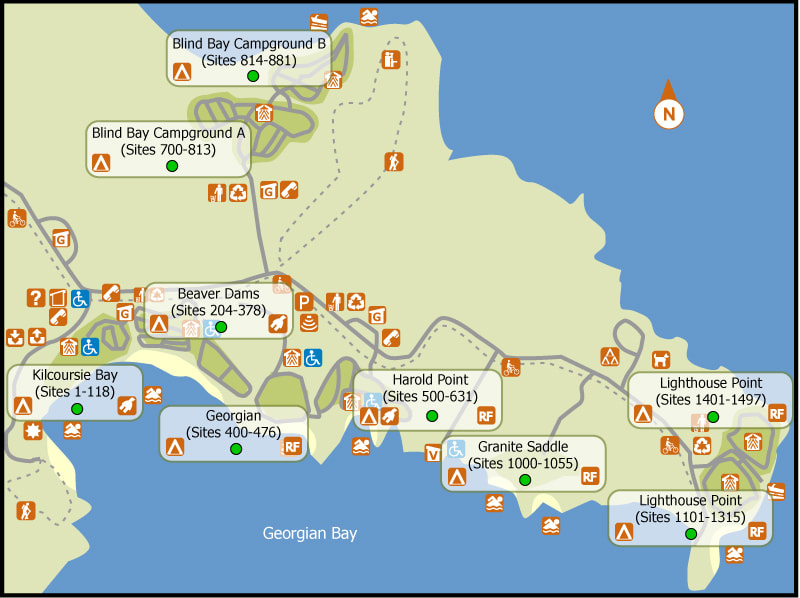
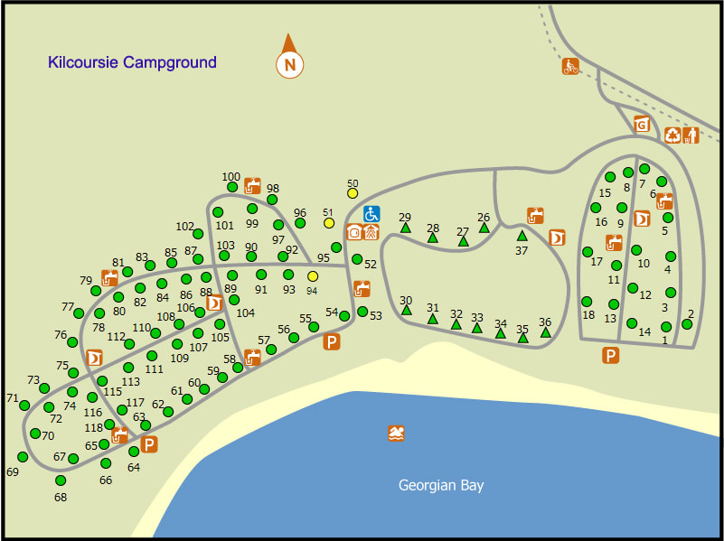
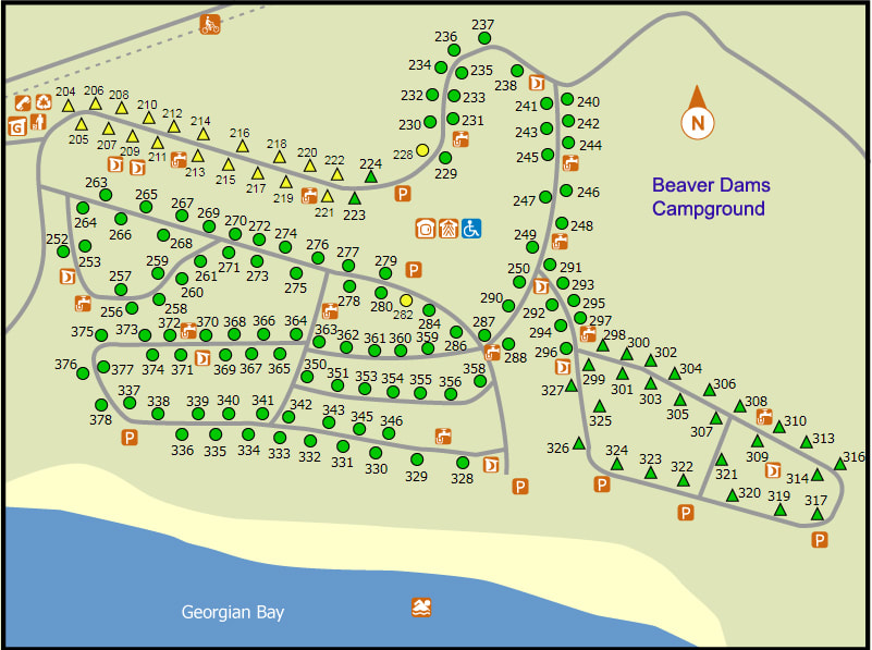
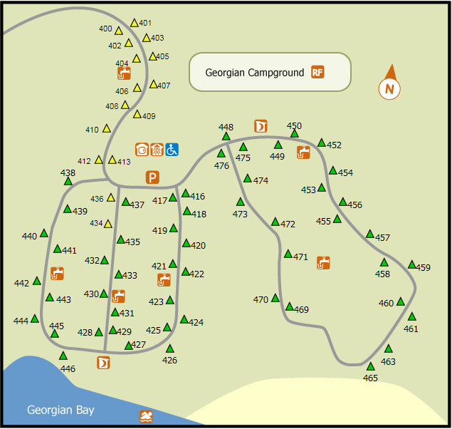
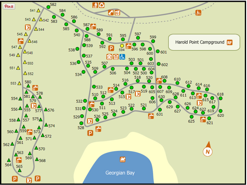
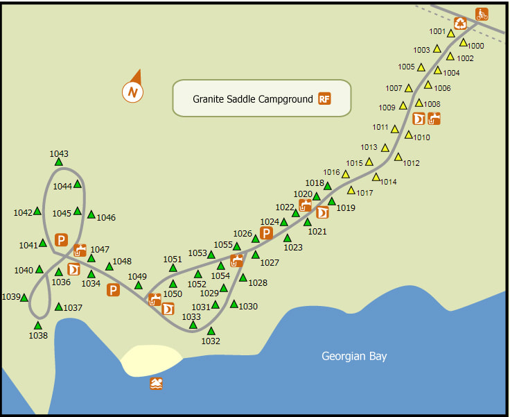
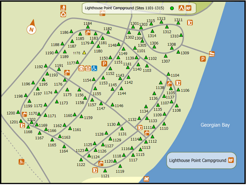
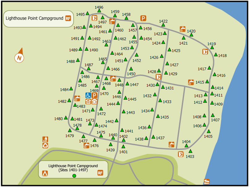
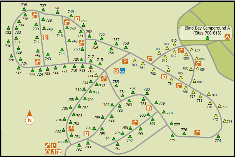
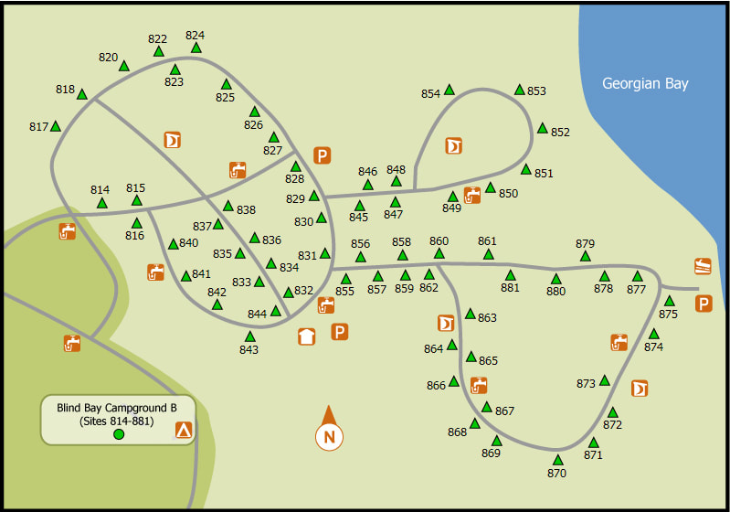
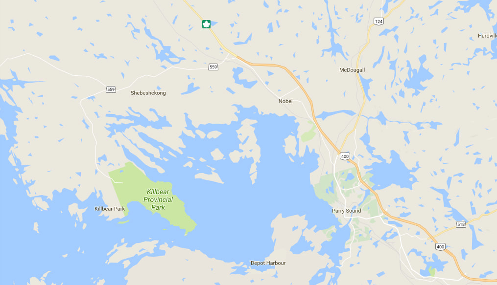
35 Killbear Park Road, Nobel, Ontario, P0G 1G0 (705) 342 5492 No. of Sites (882) - Seven different campgrounds in the park. 108 of the campsites are non-reservable (first come-first serve). 604 non-electrical sites, 278 electrical sites, 3 group sites that can hold up to 25 people on each Wheel Chair Accessible Campsites - All comfort stations are barrier-free. There are nine designated wheelchair accessible campsites (#’s 50, 51, 94, 228, 282, 434, 436, 594, 1178). Operating Dates: May 12, 2017 to October 9, 2017 During the closed season (November until early May) visitors are allowed to park at the main office for free and go for a hike, bike, ski or snowshoe. The bathrooms at the main office are open year round. Please note that dogs must be on leash at all times in the park, even when the park is closed. |
Terrain - Kilometers of rugged, rocky shoreline mixed with numerous sand beaches. Beautiful views of windswept pines on rocky islands.
Staff - They are very informative and very friendly.
Bathrooms - The only campground without a comfort station is Granite Saddle. Flush toilets are found in various locations throughout the
campgrounds as well as at the Day-Use area.
Showers - Showers available at every comfort station in the park. Pop machine and laundry facilities are located here as well.
Beach -Each campground has its own designated beach plus there is a beach at the Day- Use area. In addition there are kilometers of adjacent
shoreline, some rocky and some sandy, that are suitable for swimming. Kilcoursie, Beaver Dams and the Day-Use Beach share a 2 km
horseshoe shaped beach. Beaches at Georgian, Harold Point, Granite Saddle, Lighthouse Point and Blind Bay Campgrounds are all on
smaller beaches flanked by rocky headlands.
Out Door Water Faucets - 16 with no signs to indicate where they are. They blend in to the woodland background very well. The water from these faucets is drinkable.
Hiking Trails - Twin Points Trail 1.6 km loop (40 minutes) easy.
The trail crosses over rock outcrops and through different types of forest until it makes its way to the rocky points and sandy
beaches of the shoreline. A trail guide interprets the geological features found along the way.
Lookout Point Trail 3.5 km loop (1.5 hours) moderate
This trail winds through a variety of forest types and rock outcrops and provides a breathtaking view of Georgian Bay at the midway
point. A trail guide explains the ecology of the area.
Lighthouse Point Trail 800 m loop (25 minutes) easy to moderate
This short trail takes you to the tip of Killbear Point and offers superb views of Georgian Bay and interesting rockscapes.
Recreational Trail – 6 km linear (3 hours) easy to moderate
The recreational trail runs parallel to the main park road from the park entrance to Lighthouse Point. The trail winds through hemlock
groves, hardwood forest and rock outcrops and is ideal for hiking, jogging, cycling or nature watching.
Pet Amenities - There is a dog beach located near the Group Camping area which is the only location in the park where your pets are allowed off
leash.
Playground - none
Park Store - Located In the Visitor Center. Fantastic prices on items and a very friendly staff. Ice and groceries are available outside the park at
local stores or in Parry Sound (35 km from the park)
Boat/Canoe Rentals: None
Things To Do At Killbear Provincial Park
- Biking (A 6 km Recreational Trail runs the length of the park and is a very popular for cyclists)
- Swimming (multiple beaches. Each campground has its own designated beach plus there is a beach at the Day- Use area)
- Canoeing and Kayaking
- Self Guided trails
- Picnicking
- Birding
- Visitor Center (Popular attractions include the live Massasauga Rattlesnake and Eastern Foxsnake.)
- Natural Heritage Education - (Interpretive programs are held daily during the summer months and focus on the natural and human history of the
area. Programs include Children’s Programs, Guided Hikes, Evening Programs at the amphitheater, plus special
musical concerts by groups such as the Wakami Wailers.)
Attractions And Places To Go Near Killbear Provincial Park
Closest City or Town - Nobel, Ontario or Parry Sound, Ontario
- Island Queen Boat Cruise in the town of Parry Sound
- Georgian Bay Airways plane tours
- Bobby Orr Hall Of Fame
- The Museum on Tower Hill in Parry Sound
- The Wold Den gift shop in Parry Sound
- Jessica Vergeer Studios
- Parry Sound Golf And Country Club
-The Ridge At Manitou (golf course)
- Bear Claw Tours (ATV riding)
- Chippewa III Boat Cruise through the 3000 Islands
Directions:
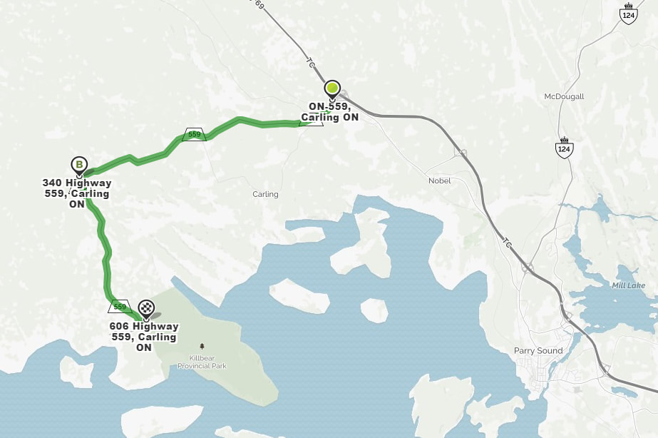
Follow Highway 69 and take Exit 241 (or 247 if coming from the north) onto highway 559. Drive about 10.5 kilometers (10 minutes) where the highway makes a left turn. Keep following Highway 559 for another 7 kilometers (5 minutes) and you will arrive at the park.
Follow Highway 69 and take Exit 241 (or 247 if coming from the north) onto highway 559. Drive about 10.5 kilometers (10 minutes) where the highway makes a left turn. Keep following Highway 559 for another 7 kilometers (5 minutes) and you will arrive at the park.
Signs For Directions To Park - They are easy to see and easy to find.