We woke up at 8 a.m. It was a bit chilly but not too bad once you got moving. It didn't rain during the night after all and we were grateful for that.
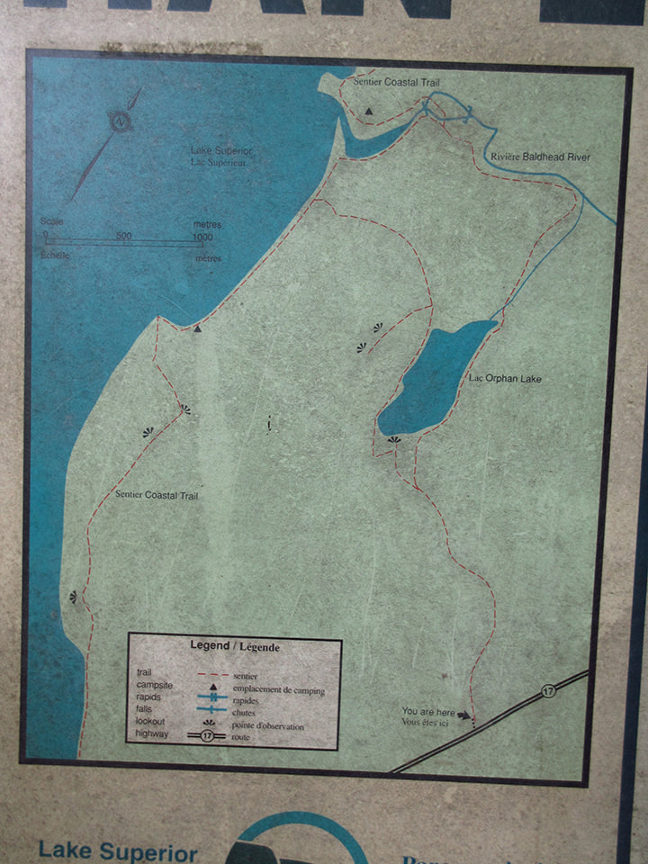
Our plan was to spend 5 nights in the back country and then come out and spend one more night in the campground before heading home. We would start on the Orphan Lake Trail that connects to the Coastal Trail. We planned to go as far as Mermaid Lagoon and then turn around and come back the way we came.
Once we had eaten breakfast and packed up our gear, we headed over to the gatehouse to register for the back country. While we were there, we noticed a white van that was filling up with people who, I overheard, were also going to Orphan Lake, the trail we were about to start our journey on. It seemed to be a shuttle bus and we were curious about it. So, when we arrived at the Orphan Lake Trail head, my sister, Heather, took a moment to talk to the driver. He said that his name was Morgan and that he worked for Naturally Superior Adventurers in the town of Wawa. When Heather asked him about the pricing of a shuttle, Morgan did not know the pricing off hand. He said that it depended on where you were going, but that it was in the hundreds. That seemed a little pricey to us but I suppose if you only wanted to hike the Coastal Trail in one direction then it would be an option for you.
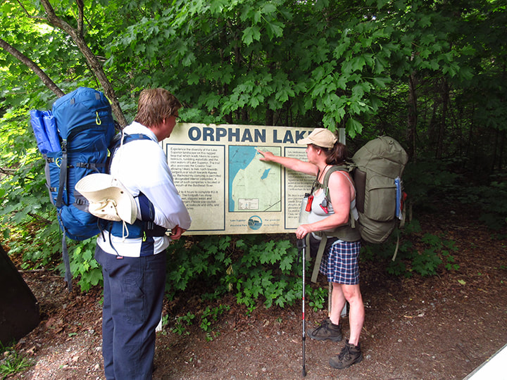
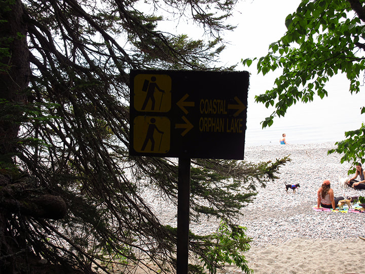
With our packs on our backs, we headed over to the large map to take a quick look at where we were and where the Orphan Trail would take us.
Our plan was to spend 5 nights in the back country and then come out and spend one more night in the campground before heading home. We would start on the Orphan Lake Trail that connects to the Coastal Trail. We planned to go as far as Mermaid Lagoon and then turn around and come back the way we came.
Once we had eaten breakfast and packed up our gear, we headed over to the gatehouse to register for the back country. While we were there, we noticed a white van that was filling up with people who, I overheard, were also going to Orphan Lake, the trail we were about to start our journey on. It seemed to be a shuttle bus and we were curious about it. So, when we arrived at the Orphan Lake Trail head, my sister, Heather, took a moment to talk to the driver. He said that his name was Morgan and that he worked for Naturally Superior Adventurers in the town of Wawa. When Heather asked him about the pricing of a shuttle, Morgan did not know the pricing off hand. He said that it depended on where you were going, but that it was in the hundreds. That seemed a little pricey to us but I suppose if you only wanted to hike the Coastal Trail in one direction then it would be an option for you.
With our packs on our backs, we headed over to the large map to take a quick look at where we were and where the Orphan Trail would take us.
We only had to do half of the Orphan Lake trail. We decided to take the left leg of the trail and planned to maybe take the right leg of the trail on the way back. The Orphan Lake Trail is an 8 km loop which meant we only needed to hike about 4 km to reach the Coastal Trail. Then we estimated another 1 or 2 km to get to the Baldhead North campsite where we would be staying for the night.
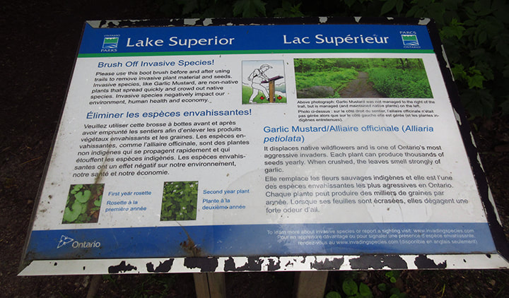
The the Orphan Lake Trail head they had something I had never seen provided in any other park trails before. It was a boot brush area where you were encouraged to brush off any potential invasive species of plants both before and after using the trail.
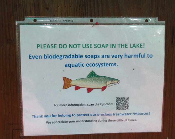
They also requested that you do not use soap of any kind in the lake, Not even biodegradable soaps.
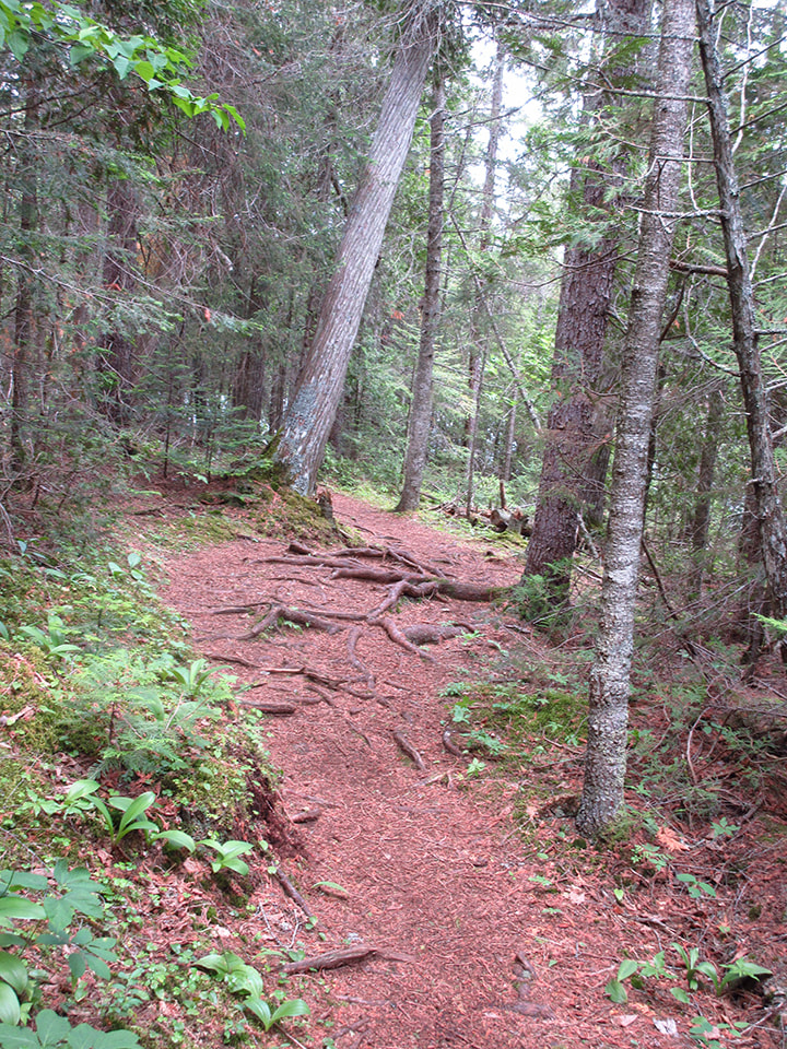
With these things in mind, I turned on my pedometer and we began our hike down the Orphan Lake Trail. The Orphan Lake Trail is a day-use trail and is rated as "Moderate" which means it is well marked, with some steep inclines and uneven rooting. The Coastal Trail is a 65 km linear trail. We would not be going the full 65 kms. It is rated as "Very Demanding" which means the route is not well marked, has steep, rugged areas and uneven footing. So we knew we would be going from a relatively easy trail onto a much more difficult one.
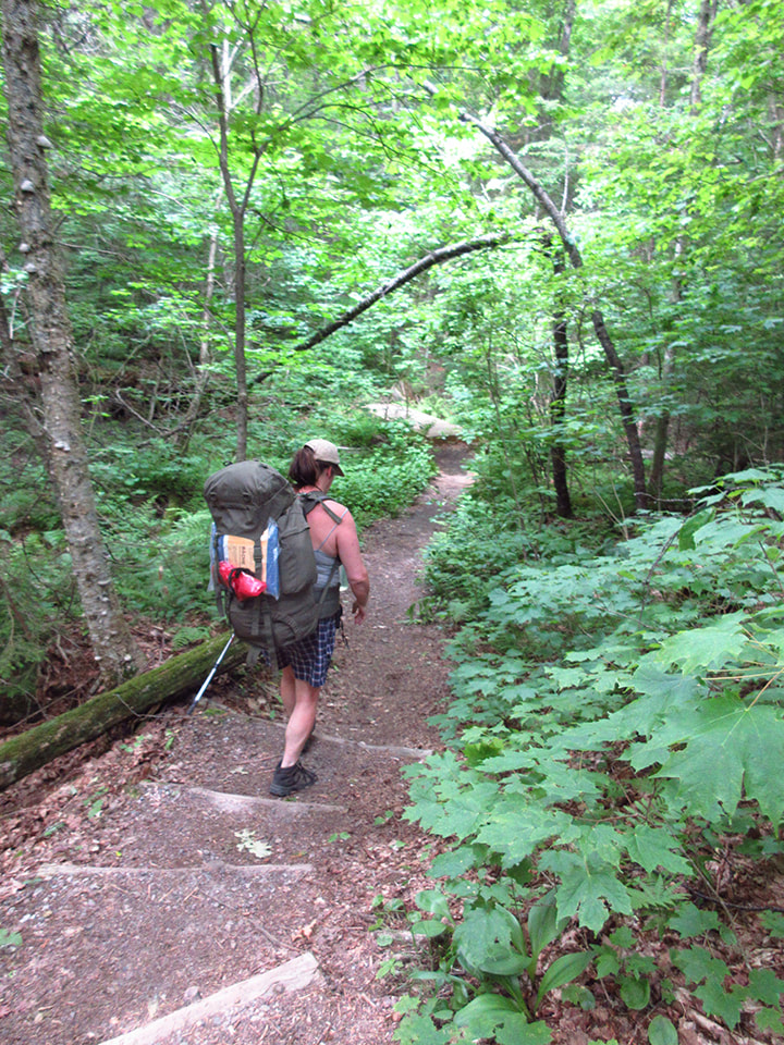
Now, normally we do our backpacking in August when the bug level is much lower. Knowing that we were in the height of mosquito season I opted to put on some bug spray which I don't normally do. I am glad I chose to do this because the bugs were definitely plentiful. However, I they did not bother me much this day because although they were flying around us, they didn't seem to be biting. So, naturally, I was grateful for that.
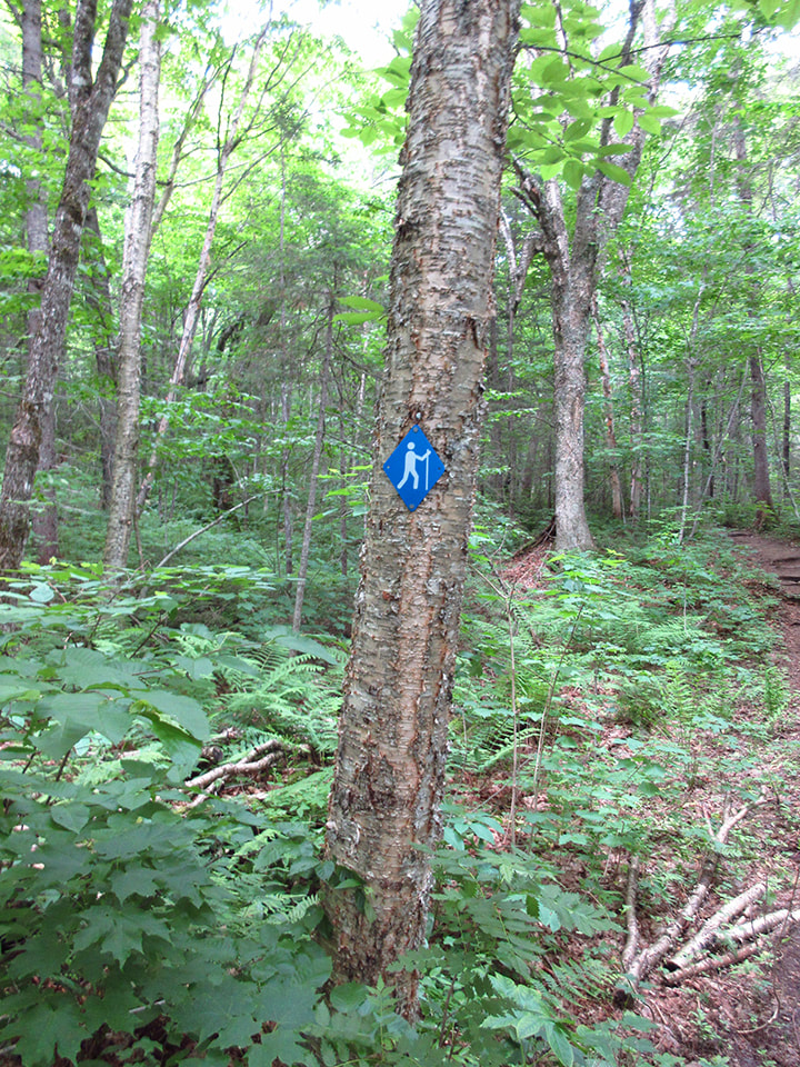
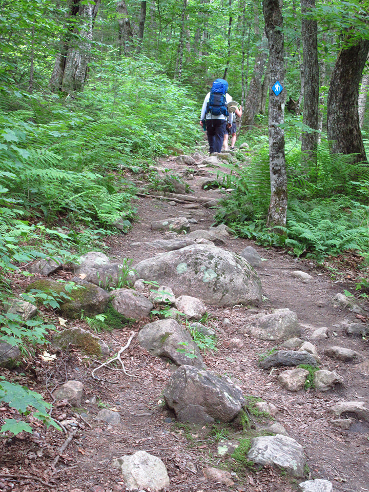
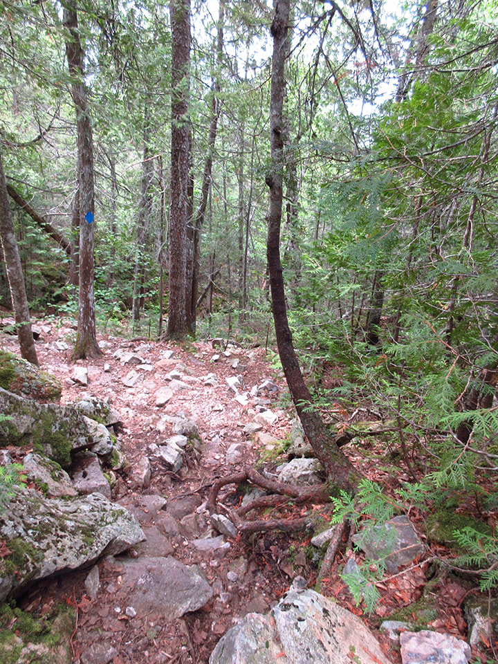
The trail markers that we needed to keep an eye out for were blue. But we also had to watch out for rock cairns (markers made of piles of rocks) in places that were not well marked.
The trail markers that we needed to keep an eye out for were blue. But we also had to watch out for rock cairns (markers made of piles of rocks) in places that were not well marked.
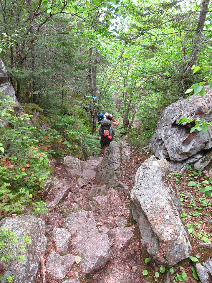
Although the Orphan Lake trail was not a really difficult one, it did still have areas that were rocky and rugged.
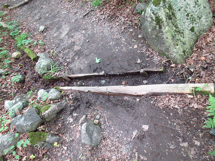
This particular trail was well maintained (nothing at all like our hike at Halfway Lake Provincial Park last year). They had even created a way to divert any rain water from the trail in certain sections (but not everywhere on the trail) by taking two portions of a split log and pegging them into place with a space between them. This would allow the water to travel in the space between the pieces of log instead of making a muddy mess on the trail.
There were sections full of rocks and other sections full of roots.
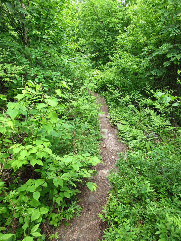
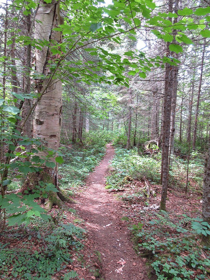
And other sections were thick with vegetation on either side of us. The scenery was ever changing all around us. We never knew what to expect next.
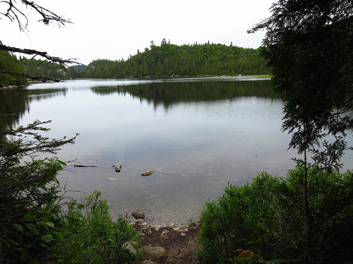
About half way up the trail you come to Orphan Lake. According to my pedometer we had travelled about 1.49 km (Note: my pedometer may not be 100% accurate). We were beginning to think that this trail was going to be a breeze all the way through.
But then the trail became a little more rocky after that. The Orphan Lake Trail was starting to show a bit of it's true colours.
And shortly after we had passed the lake, we began climbing up steeper slopes and down rocky inclines.
The terrain was starting to remind me a little bit of the La Cloche trail in Kilarney.
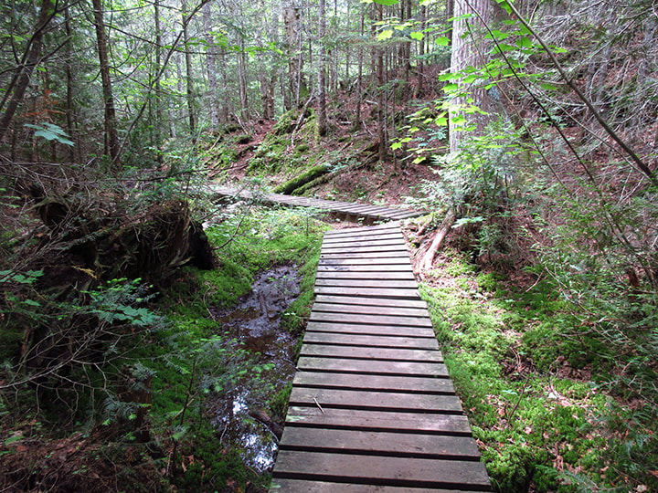
But it wasn't all hard climbs and struggles. Actually, after you got over the one big rugged hill, the terrain gave way to gentler paths. There were wooden boardwalks over wet areas.
And the trail became more level and open.
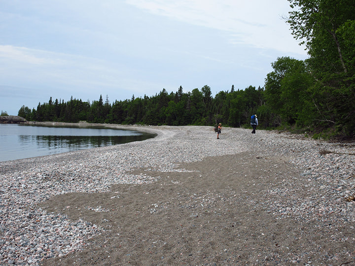
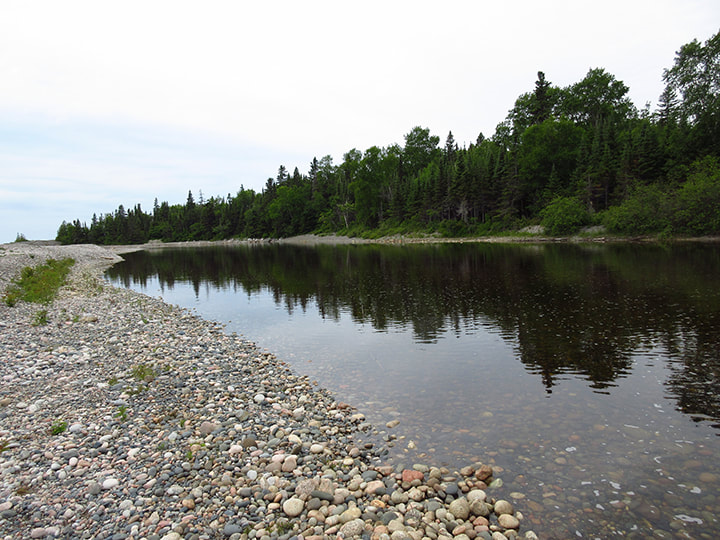
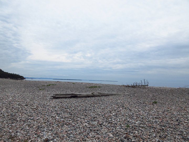
After traveling 3.45 km (according to the pedometer) the tree line opened out onto a rocky beach. A family of day-trippers were enjoying the sun and the water with their dogs on the stone filled shores.
The stones crunched beneath our feet as we headed further down the shore, away from the people and closer to our destination.
It was nice to get out of the woods for a bit and away from all the bugs. There was a bit of a breeze coming off the lake which both kept the bugs at bay as well as cooled us down a bit. As of yet, I did not have a single bug bite. heather had a couple, but she was wearing shorts and short sleeved shirt and Carsten and I were not.
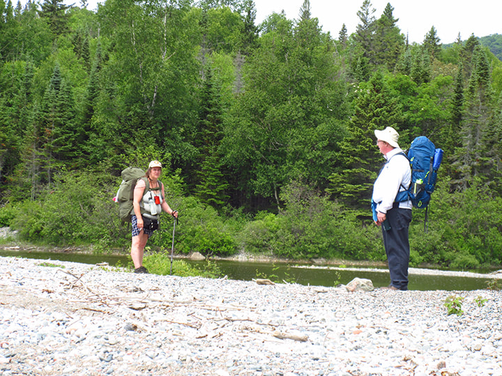
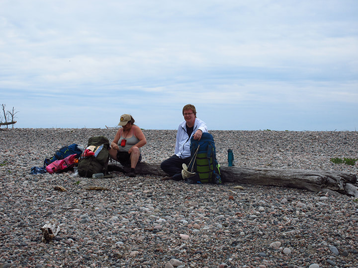
We decided that here would be a good place to take our packs off and take a break and have a snack. We saw a couple of logs near the shore line and headed over to them to use them as seats.
The sky was a bit overcast, but the scenery and the lake was beautiful.

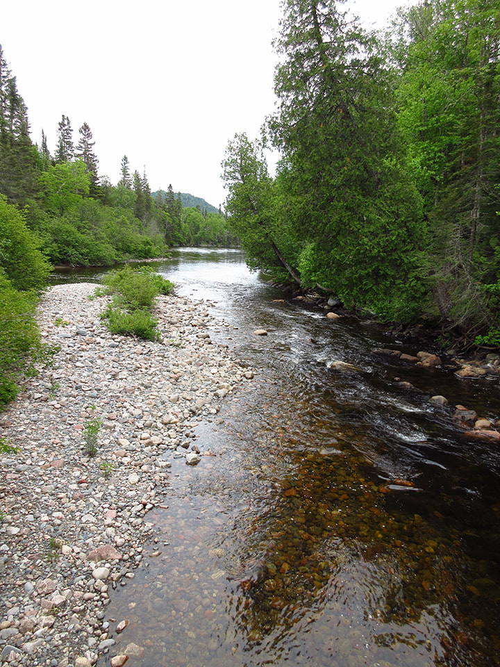
From where we sat, the lake was behind us and the river from a near-by water fall was in front of us. To our left it almost appeared as though the rocky shore was attached to the tree line in the distance. But if you stood up you would see that it wasn't. What we didn't know at the time was that we were actually looking across at our campsite across the river. If we had been able to wade across we would be right there!
We sat for awhile and rested and ate our lunch. It really is a nice picnic spot.
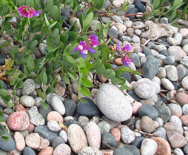
The pinks and purples of the Seaside Pea flowers were stunning against the greys of the rocks beneath them.
And the yellows of the Northern Evening-Primrose also popped out among the stones.
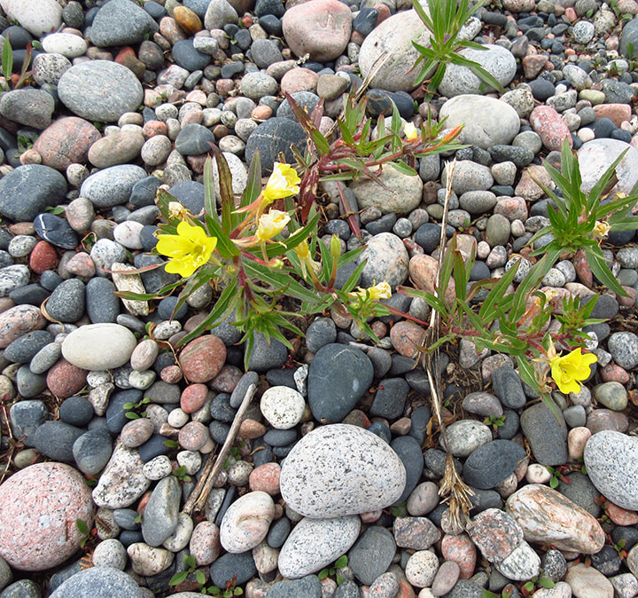
But there were definitely more rocks here than there were flowers.
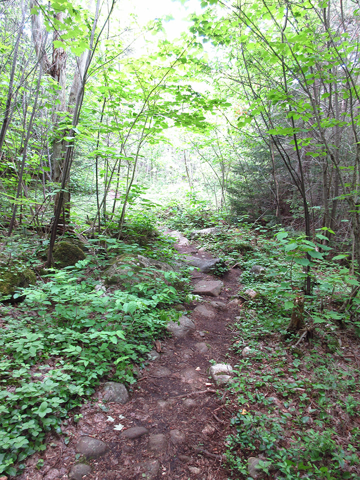
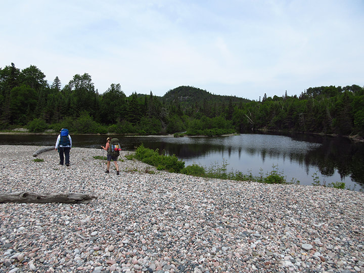
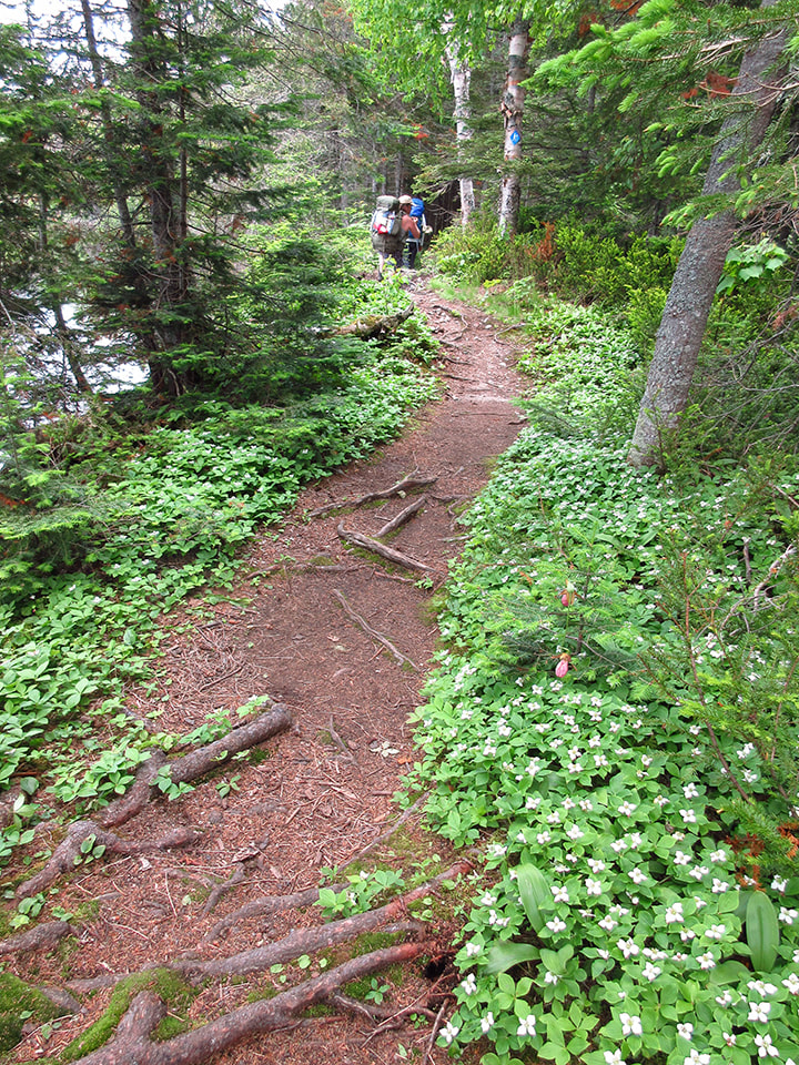
After lunch we continued on our way. The trail led back into the woods, but this time it followed the shores of the river. Both sides of the trail were covered in the white flowers and green leaves of bunch berry plants.
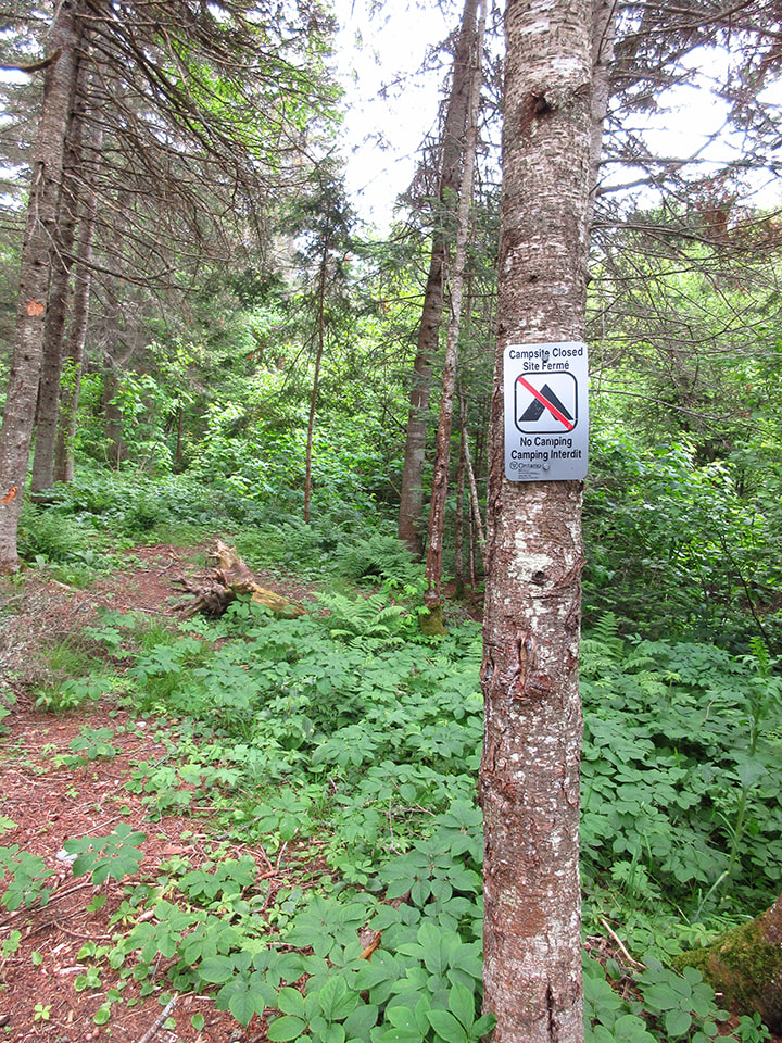
To our right we passed by an area that the park had closed off to campers. They were reclaiming an old campsite. There were signs there that clearly indicated that there was no camping here. Now these are the sorts of signs that should have been present on our hike last year at Halfway Lake in order to prevent any confusion. The staff at this park got it right.
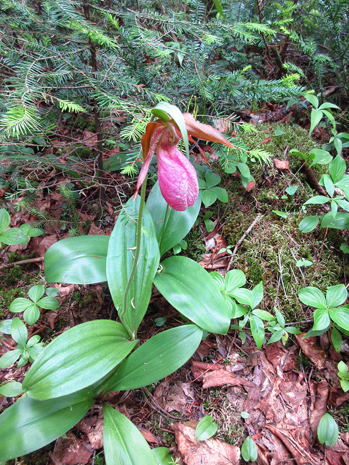
Along the side of the trail Pink Lady's Slipper flowers were quite plentiful.
In order to get to the campsites you have to cross the Baldhead River. There are a couple of wooden bridges that will get you across. It is at this point where the Orphan Lake Trail and the Coastal Trail no longer share the same path. We were now officially hiking the Coastal Trail.
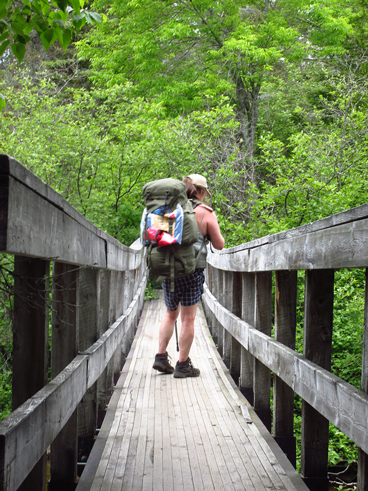
Under the bridge the waters of the rapids flowed by. It was beautiful and I loved the sound of the running water and the sweet smell of the cedars in the air. This is the life!
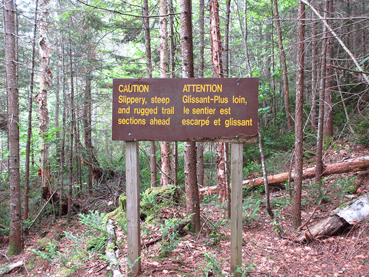
There was a large sign posted that read "Caution. Slippery, steep and rugged trail sections ahead". For anyone intending to hike this trail I highly suggest that you head this warning. This cautionary sign should be taken quite seriously. Make sure that your hiking boots, and gear are all up to snuff because this sign is no exaggeration. We now know this from experience.
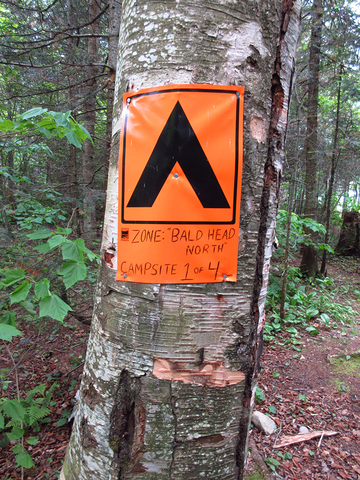
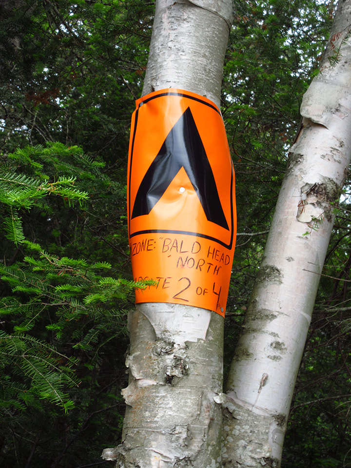
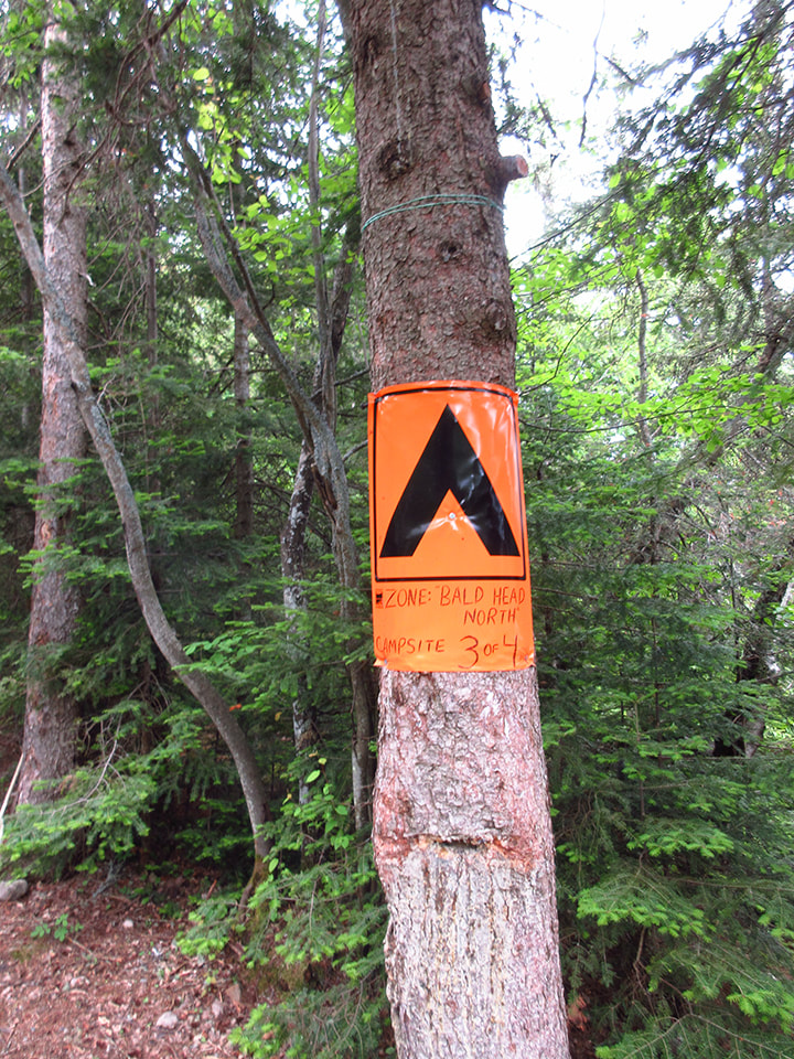
Finally we made it to the first of the 4 Baldhead North campsites. The big orange signs made sure that the sites were well marked. it was only an additional 1.53 km from where we had lunch by the Orphan Lake Trail. We had come about a total of 5 km. It was 2 pm so it had taken us roughly 2 and a half hours to get here. (Half an hour per kilometer).
The first site was nice enough but we wanted to see the others before we picked which one we wanted. As far as we could tell, we were the only ones in the area and the first ones here so we had some choices.
The second camp site was not far away at all. It was just a quick walk a little further down the shore.
This site was a little smaller and didn't feel as open as the last one. Nothing wrong with it, but it wasn't our favourite one.
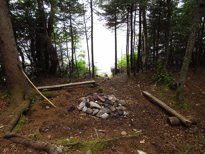
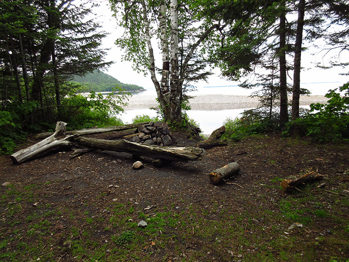
The third one was where we decided to lay our hats. The fourth one was quite a distance away (about another kilometer) and we didn't feel like going all the way there to find out we didn't like it and come all the way back. So it was a choice between these 3 and this one fit the bill for us.
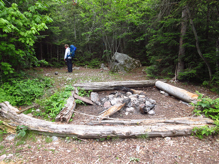
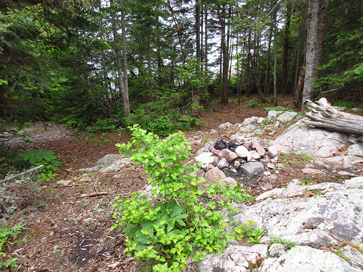
It was quite large and open. It had a big fire pit area with logs for seats all around it. It was on the point so there was lake on either side of the campsite.
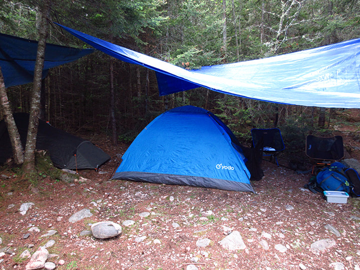
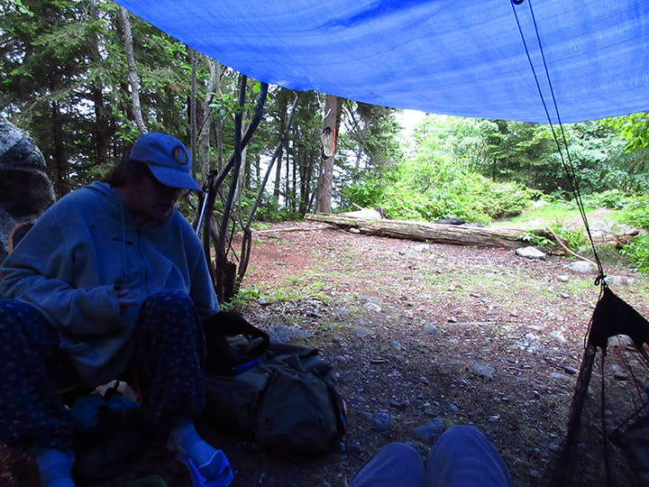
The weather man predicted rain for the night and then good weather for the rest of the trip. In light of this Carsten had decided to bring his large tarp for the night and then we would stash it under a rock and pick it up again on our way back out so that we wouldn't have to carry the extra 3 pounds for the whole trip. He figured if someone found it and took it home with them then so be it. He would just buy another one. And if it was still there when we got back in a few days then that was a bonus.
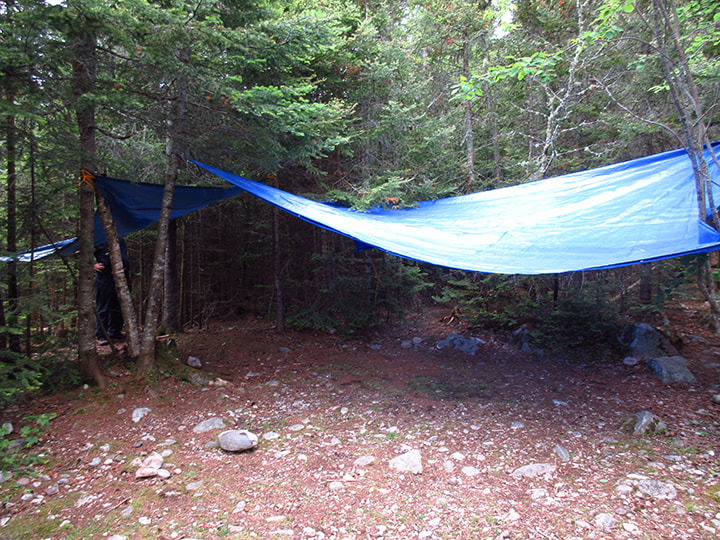
Heather also had a smaller tarp and we set that one up too. Heather was bringing her tarp for the whole trip though and not leaving it behind. Both tents fit perfectly under the tarps.
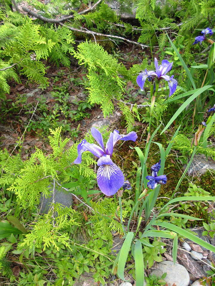
Once the campsite was set up, we had some time to explore the area. Growing nearby were some lovely Northern Blue Flag Irises.
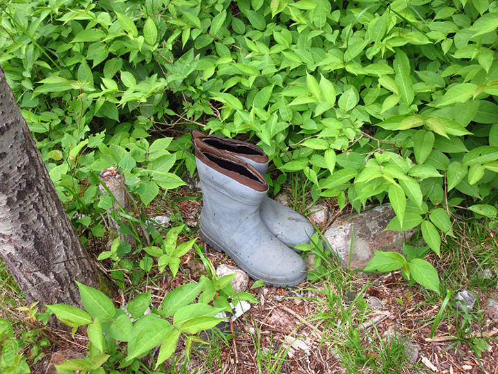
Someone had left an old pair of rubber boots behind. They looked like they had been there a long time. I don't think anyone is coming back for them.
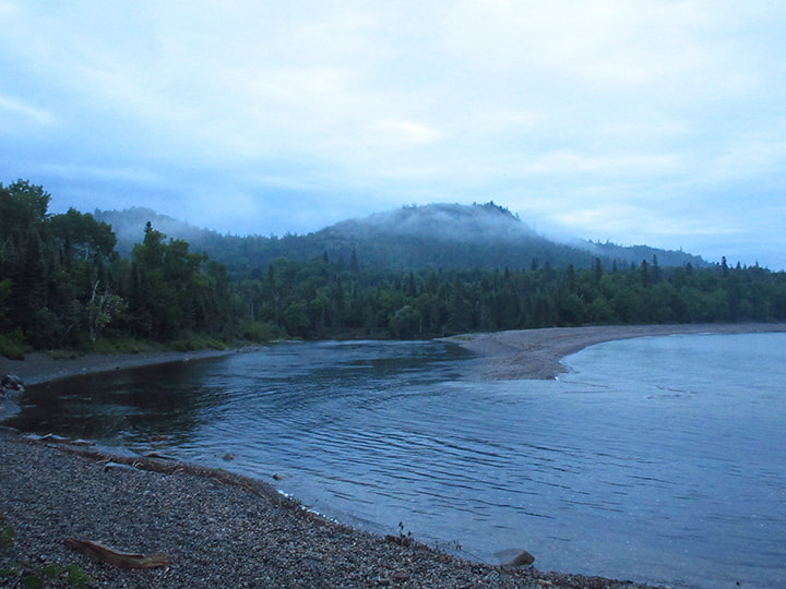
Out on the point we climbed a rock outcrop and got a good view of Lake Superior.
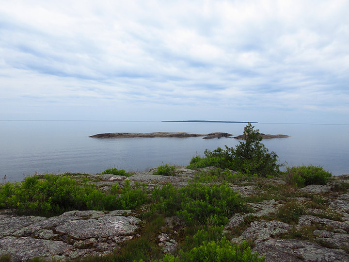
On the same rock outcrop we could see the lake on the other side of our campsite and could see the direction we would be travelling in the next day.
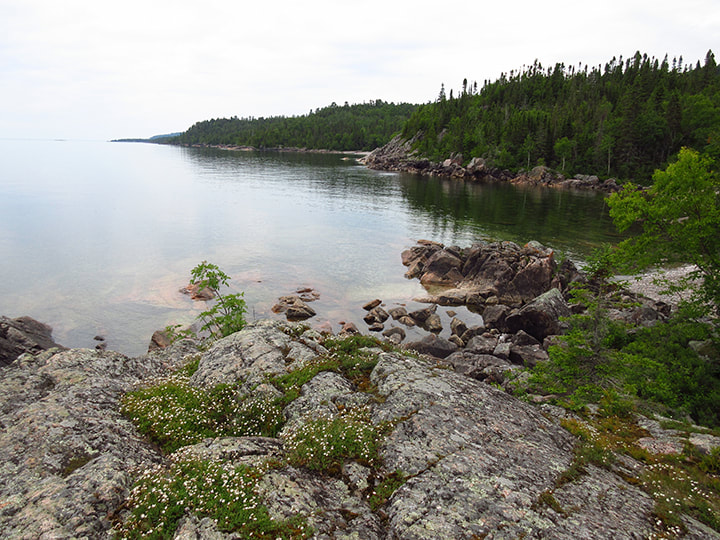
From the shore we could look across the river at the mouth of the lake and see where we had eaten lunch earlier in the day.
Right next to our campsite was n additional firepit. I am not sure if this used to be an old site or if larger groups just use it as a secondary fire pit. It looked used so it is possible that canoers use this spot. There were some areas that a couple small tents could be set up.
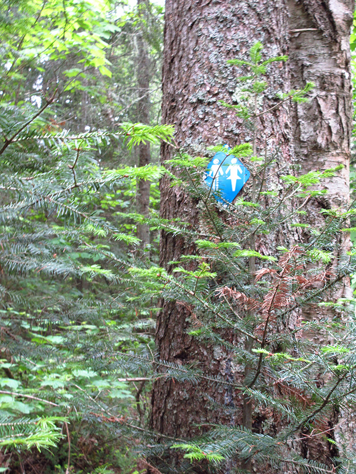
The next thing to check out were the Thunder boxes. The markers for the bathroom were blue like the trail markers and were easy to find.
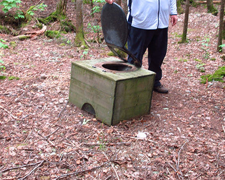
The Thunder box was decent enough, however, the seat was not attached. That meant that every time you sat down, there was a possibility that your butt would slide off and you might end up on the ground. So that made it a little tricky to use.
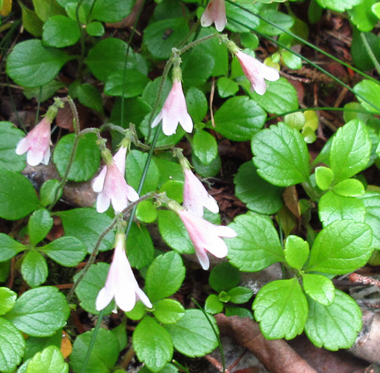
Growing all over the place were bunched of Twinflower with their dainty light pink flowers.
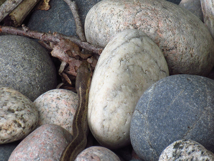
As I gathered some firewood I came across a little brown snake. Just a regular garter snake. He was trying his best to get out of sight in a pile of rocks. It didn't take him long to disappear.
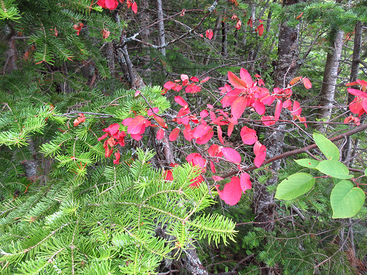
I was surprised to see some very red leaves on a tree. I do not know what kind of tree it was but I was thinking that it was way too early for autumn colours just yet.
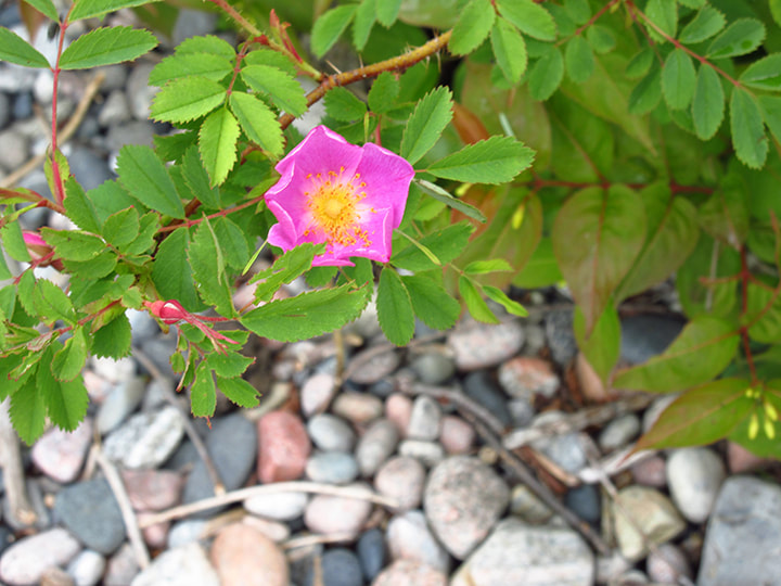
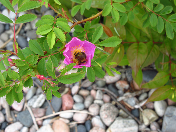
In many places throughout the trails we came across wild roses. Often times a bumble bee or some flies would be doing some sort of happy dance in the center of one of the blooms.
 |  |
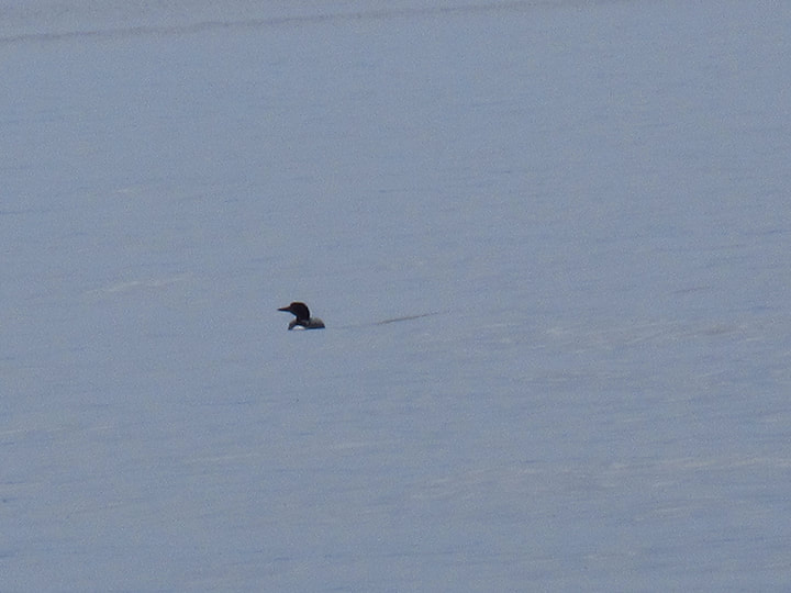
And what would be a camping trip on a lake without a visit from a loon?
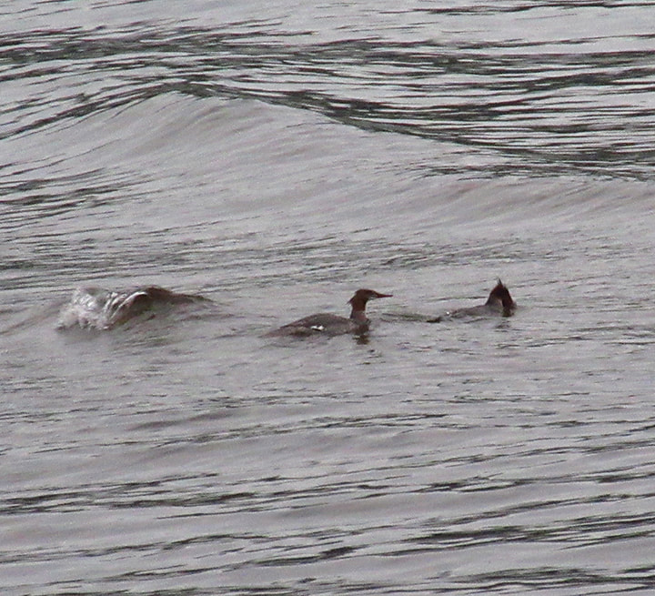
And he had a couple of Merganser ducks as fishing buddies out on the waves.
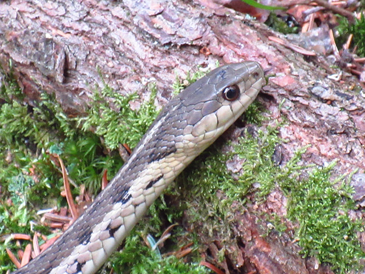
Then, I came across my second Garter snake of the day. Same colouring, but this one was much bigger. He didn't disappear as fast so I was able to get a closer picture of this one.
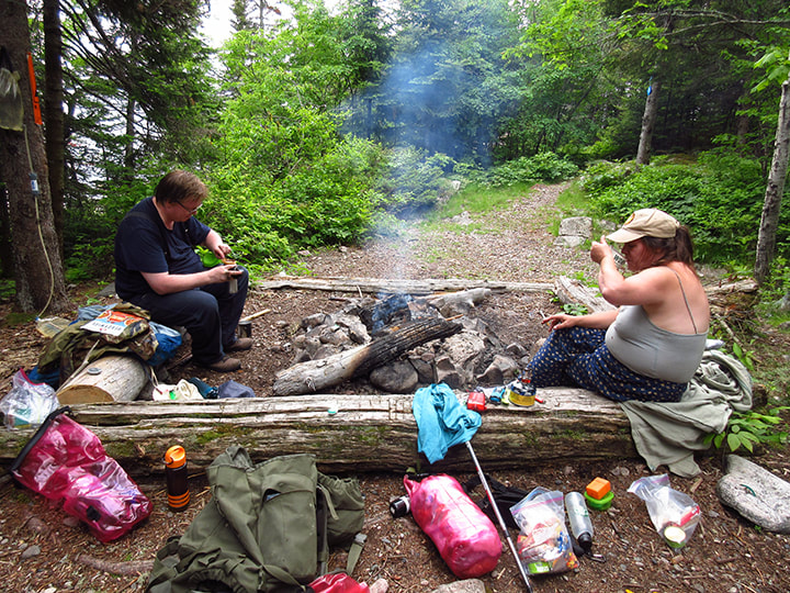
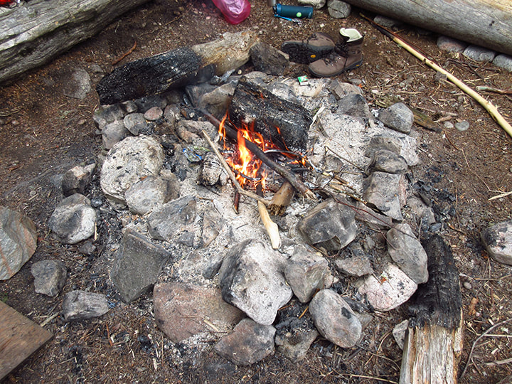
At about 5 pm we had the fire going and sat down to eat our supper. the mosquitoes started to get a bit annoying at this point. probably because we were sitting still and were an easy target. I still didn't get bit though. They were just noisy and in your face.
We figured that we were going to play a board game or two later that night. But since we didn't have the big red tent with us to escape into away from the bugs, we decided to try something different. Heather had brought along a large thing of mosquito netting that is intended to go over a single mat so that you can lie down outside and read and take a nap. It is intended for only one person. We figured that we would try to jerry-rig it so that it would fit over the entrance of our tent in order to make enough bug-free zone for 3 people to sit comfortably in. We attached it to the tarp and to the tent using some string and clips that we had. In the end we made it work but it wasn't very good. makes me want to invent something of our own for future use that will fit much better. But we made do with it and it was good enough for a couple hours in the evening. We didn't need it to work all night long; just while we played games..
At around 7 pm a mist started forming across the lake. Shortly after that a very light rain started to fall. Just what we call "spitting".
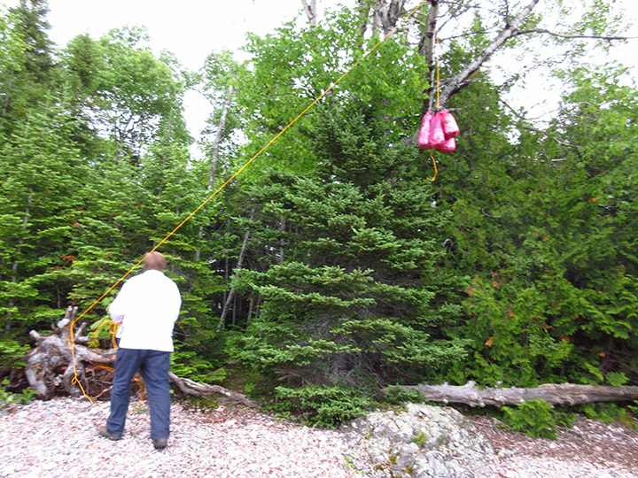
Since we were done eating and we knew the rain would put the fire out soon, we decided to pack up the food and find a tree to store it in for the night.
We found a good one near the beach on the other side of the campsite. It ws a good distance away and the tree was nice and tall. with a log nearby to secure the rope to it.
At about 9 it started to rain harder so we went under the tarp and into our mosquito netted area and played cards for awhile. We discussed how we had not seen a single squirrel or chipmunk on the entire trip so far, which is highly unusual for a provincial park.
With the sound of the waves on the shore and the patter of rain on the tarp, it sounded like I could hear faint voices in the distance . But it was just my mind playing tricks. We didn't have a single neighbour at the nearby sites that night.
We went to bed around 11 pm and fell asleep to the sound of the rain, the waves and the loons. It was a wonderful night.
 RSS Feed