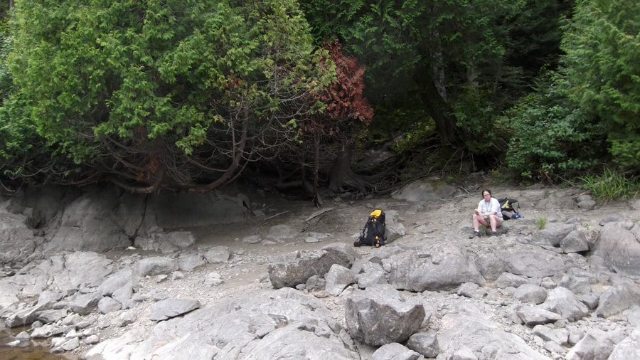
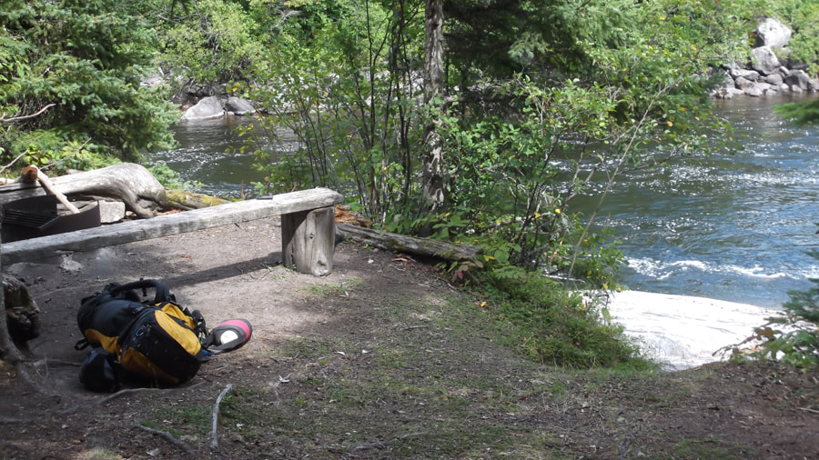
It had rained during the night, but it was not raining when we woke up at 8:30 a.m. The sky was grey and it was a bit chilly but not too bad. The leaves were still wet with rain water that hadn't evaporated yet.
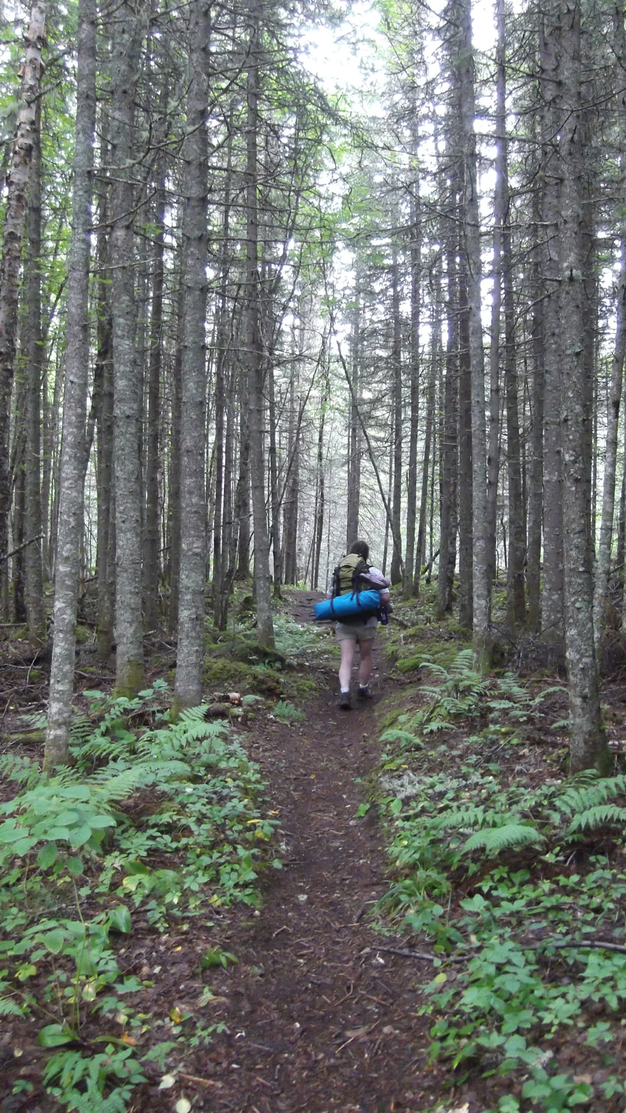
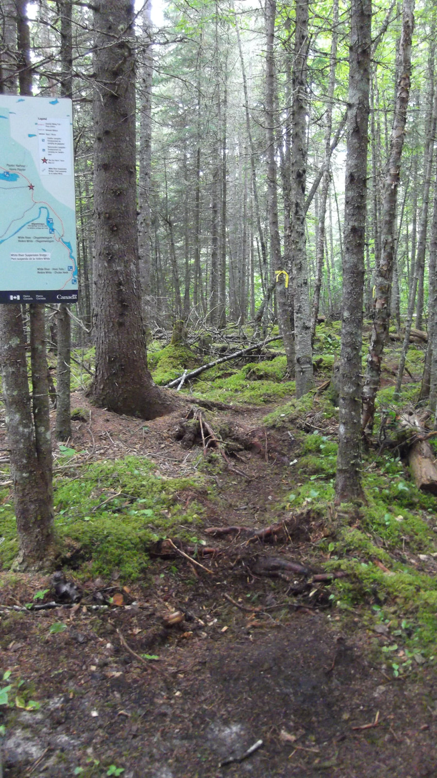
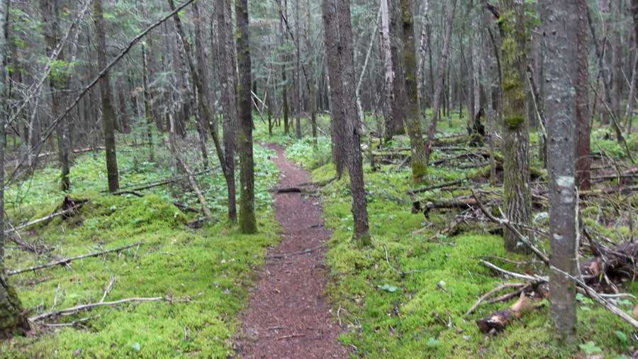
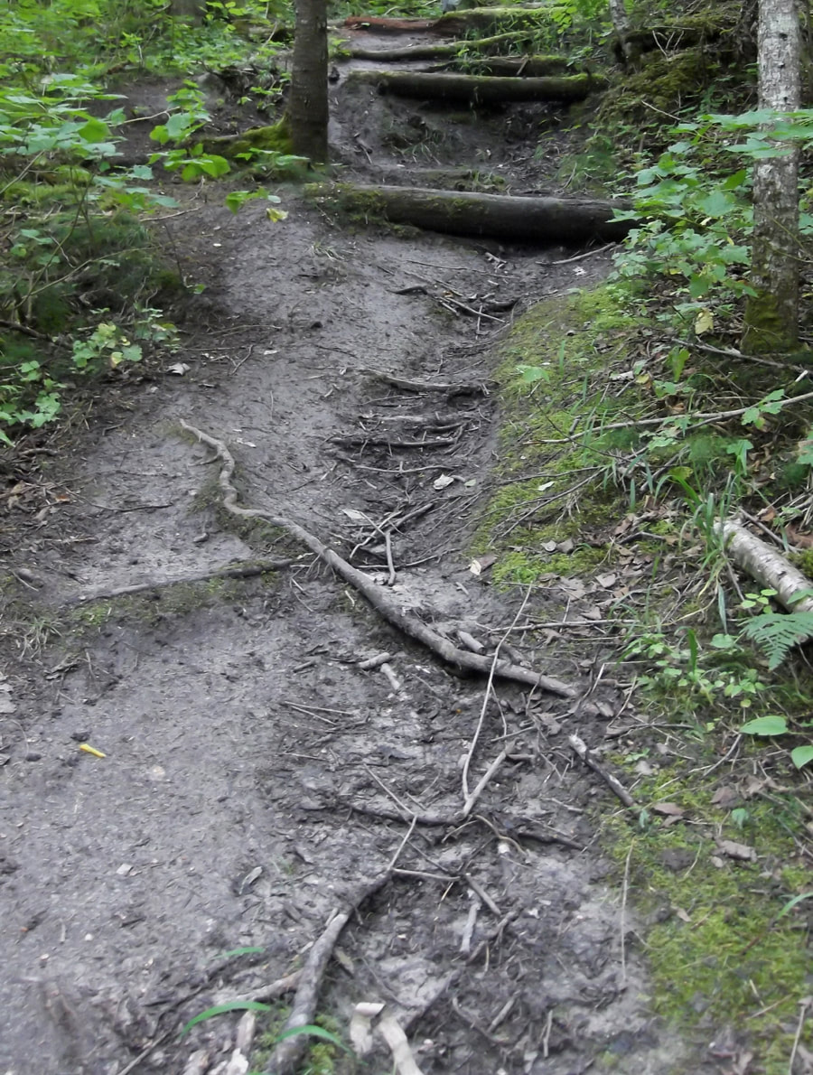
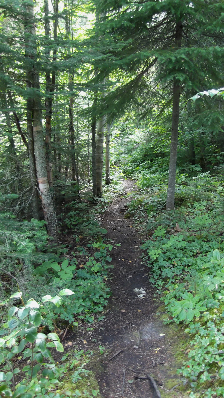
We packed up camp and left at about 10:50 a.m. We had about a 3.7 km hike ahead of us today. We were headed to Chigamiwinigum which is located on White River. I found Chigamiwinigum too hard to pronounce so I just call it "Chig" for short. The trail was a bit wet but there were not too many hills and the ups and downs were at a minimum.
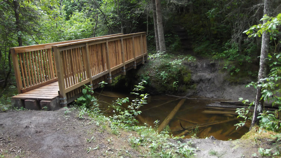
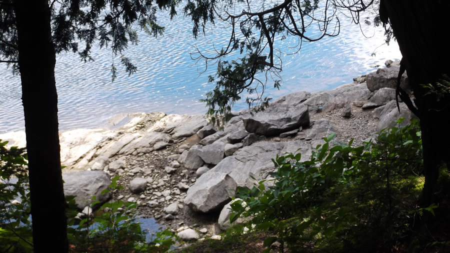
During the first leg of the trail between Playter Harbour and Chigamiwinigum there are quite a few sets of little bridges.
As we hiked today we were on the look out for a good place to make a makeshift camp on the way back. The reason for this was because we were not able to reserve the site we wanted for the trip back and the one we were able to get (site # PH2) was down the new loop trail called Mdaabii Miikna (purple lines on the map) which would make us have to hike over 9 km each day on two different days. We know that 9 km is a bit much for us in a day (we prefer 4 - 6 km a day) so we decided to camp off-site but still along the trail somewhere on the last night of our trip. Since we knew we were coming back the way we came we just scouted out all the different areas along the way.
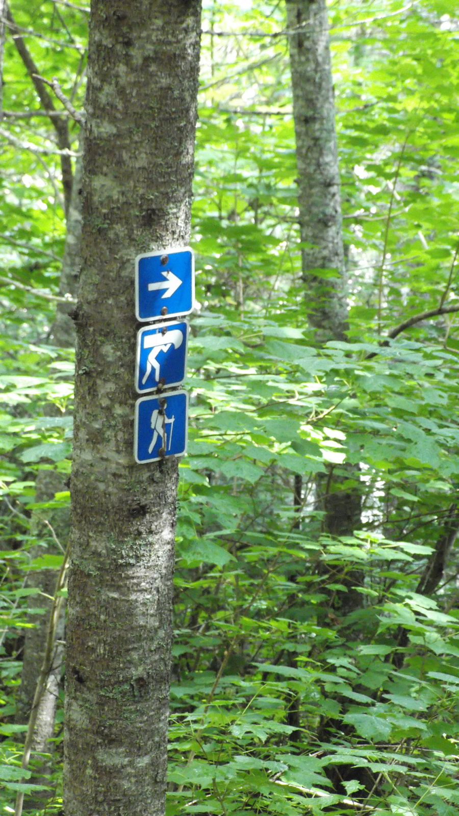
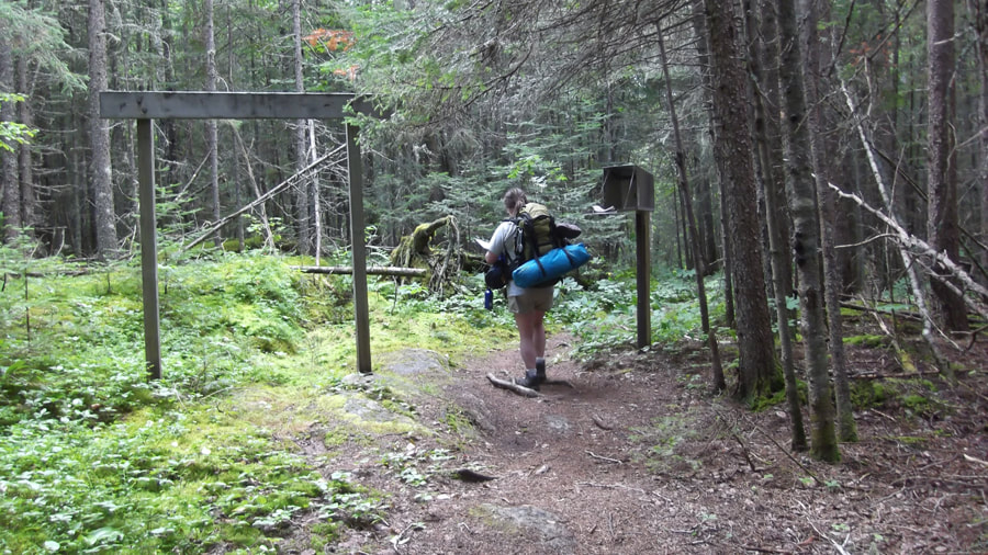
When we came to the sign for where the trail branches off into the Mdaabii Miikna loop it was about 12:10 pm. We stopped to rest for about 15 minutes. It was good to take the packs off of our back for a bit.
When we came to the sign for where the trail branches off into the Mdaabii Miikna loop it was about 12:10 pm. We stopped to rest for about 15 minutes. It was good to take the packs off of our back for a bit.
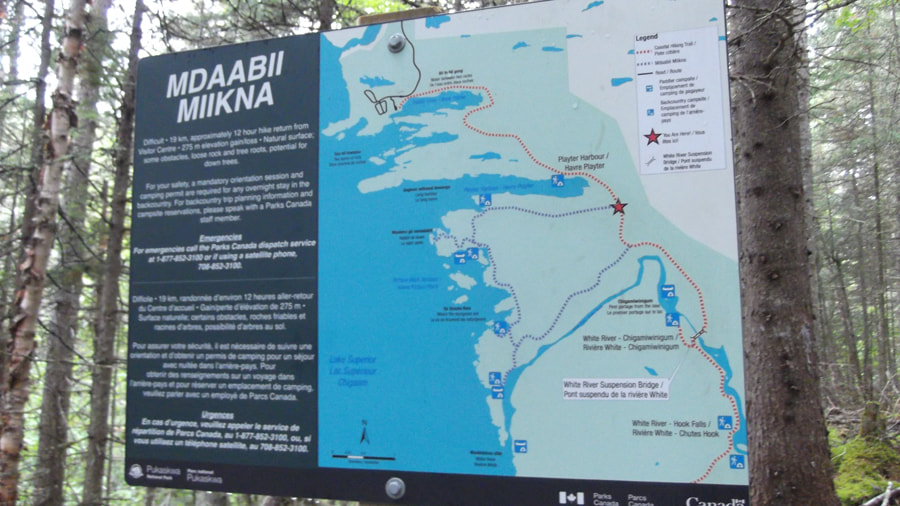
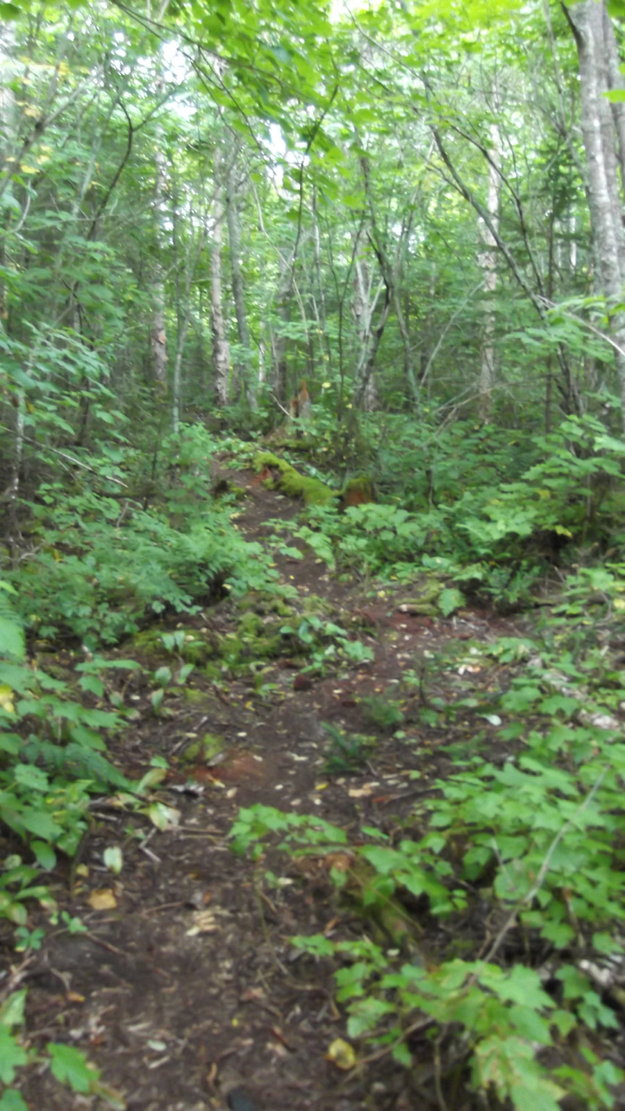
The Mdaabii Miikna loop was newly made this year. It is so new that that it looks more like a deer trail than a hiking trail. If the big sign wasn't there then you would probably miss it all together.
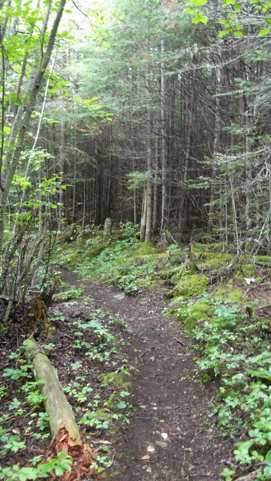
Once we were rested we put our packs back on and continued on our way through the trail bordered by many pine trees.
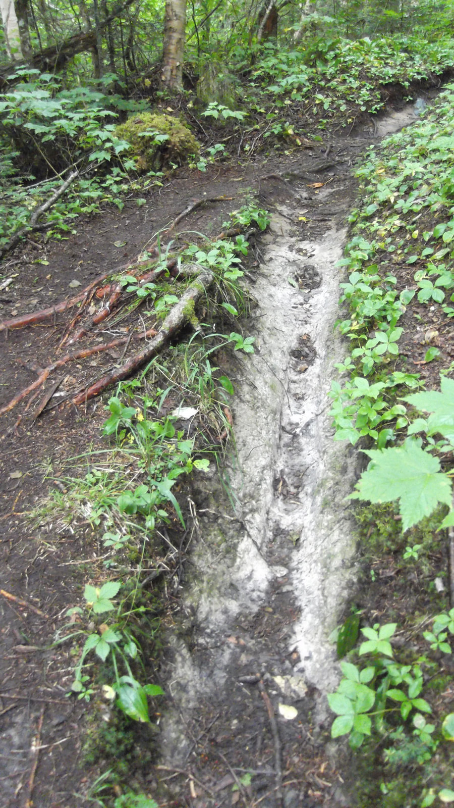
Some spots had muddy ditches you had to climb through.
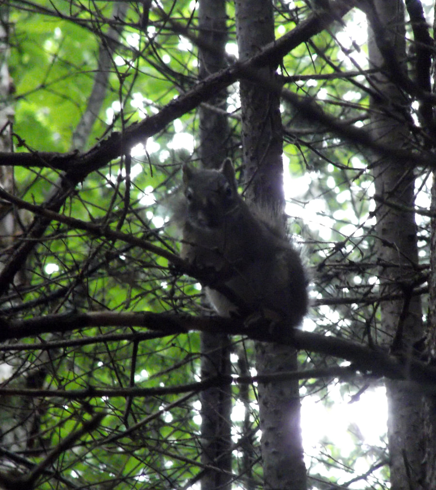
When we got to a particular section of pines a little squirrel was not happy about it and let us know by chattering up a storm and telling us to go away.
We came to the other end of the Mdaabii Miikna loop, which was marked by another large sign, at about 12:50 pm. Once again we stopped for about 10 to 15 minutes or so.
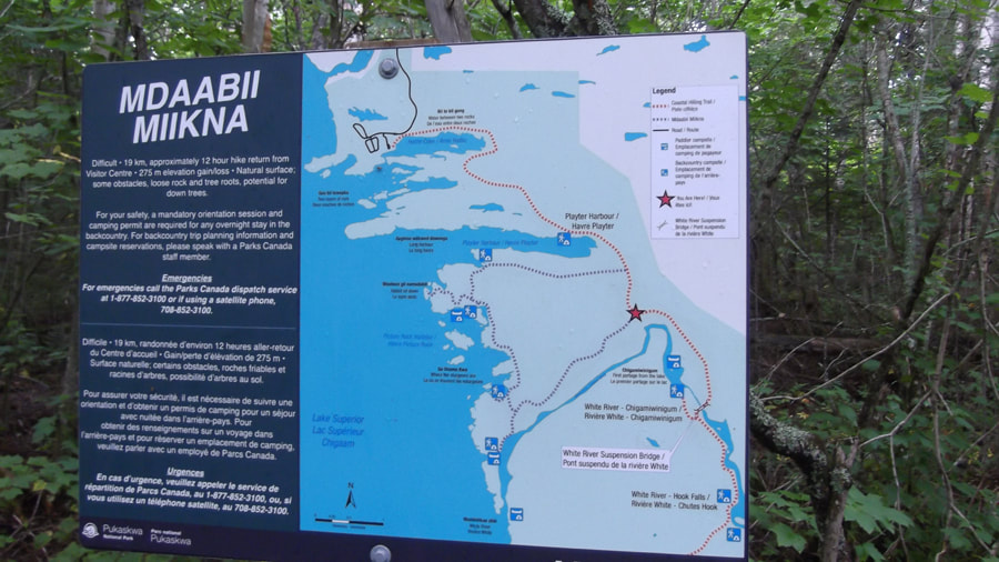
The trail at this end of the loop didn't look like much more than a deer trail either. I am sure though that given some time with more hikers starting to use it the trail will eventually get packed down and look more like a hiking trail.
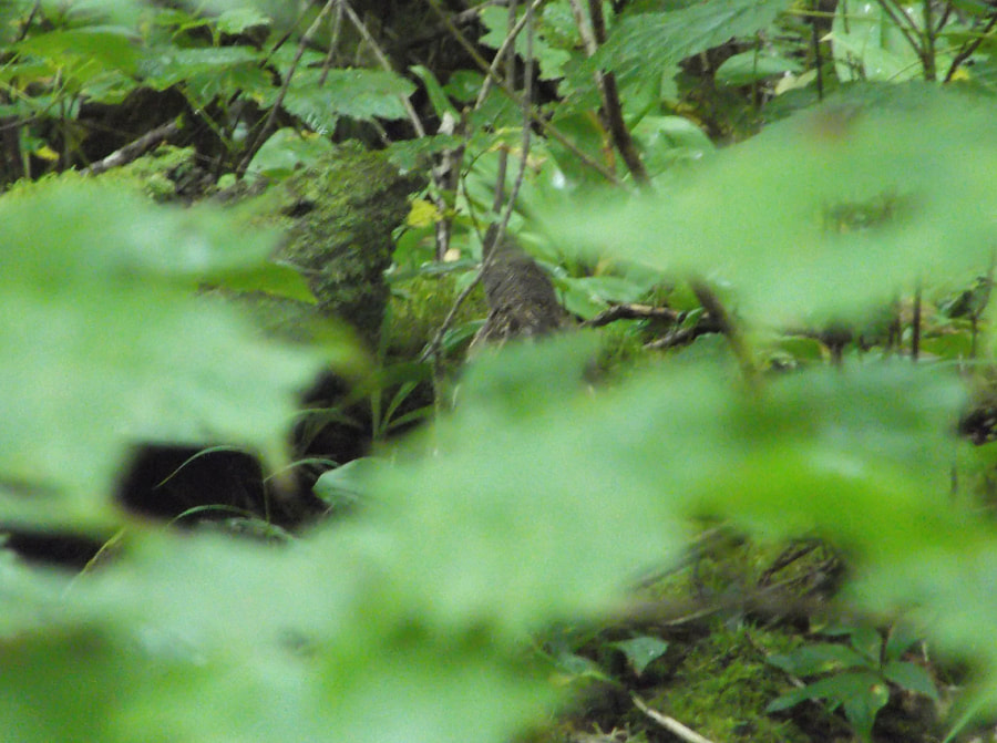
We continued on through some heavy underbrush and out of the corner of her eye Heather spotted a grouse. She stopped still and pointed and whispered "Look! It's a Forest Chicken!" I looked and saw it weaving in and out of the undergrowth trying not to be seen. I tried to get a picture but all I could get was it's tail because it wouldn't sit still long enough.
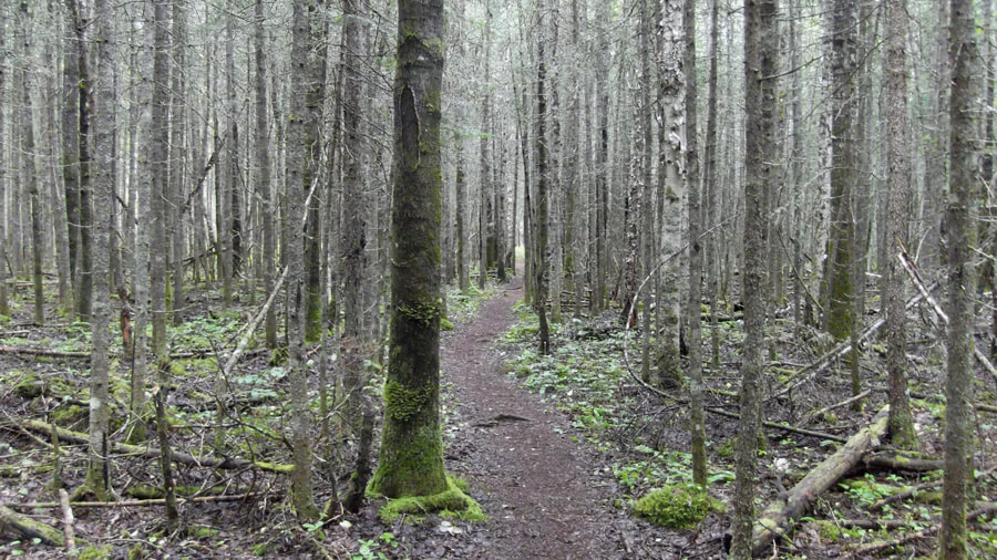
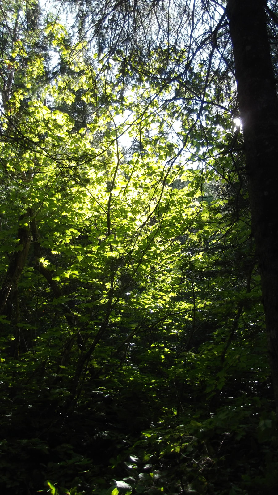
Not long after, we entered an immense forest of old, grey pines. They went on and on as far as the eye could see. We felt like Little Red Riding Hood going to see granny and wondering if there was the wolf lurking around the next tree.
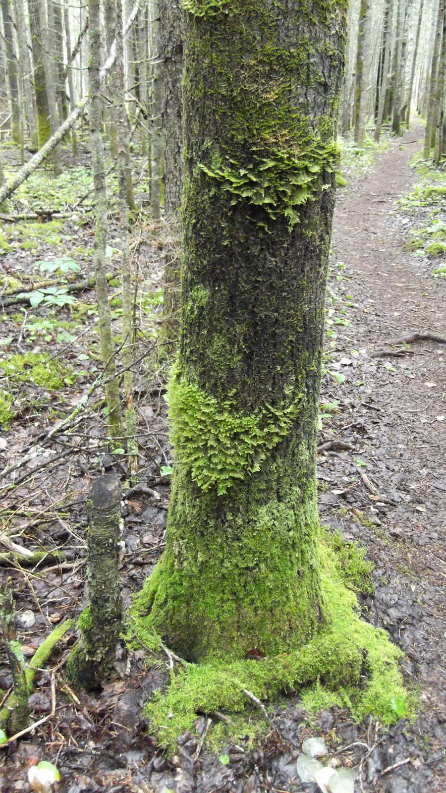
But it wasn't long before the ground turned into a carpet of moss. Again as far as the eye could seethe ground was just covered in it. It was so beautiful. And it was so peaceful and quiet. It was kind of surreal.
Even some of the trees were covered in beautiful filigree moss.
We met up with a couple on this part of the trail who were on their way out of the bush. They had taken a boat to the opposite end of the trail and had started at the other end and were working their way back. We had heard that it was possible to have someone take you in a boat either all or part of the way down the trail so that you didn't have to go both directions if you didn't want to. Since we were curious we asked them how much this would cost. We were floored to find out that it cost about $800 to take the boat! We couldn't believe it and we were glad we had decided to just hike it on our own.
We met up with a couple on this part of the trail who were on their way out of the bush. They had taken a boat to the opposite end of the trail and had started at the other end and were working their way back. We had heard that it was possible to have someone take you in a boat either all or part of the way down the trail so that you didn't have to go both directions if you didn't want to. Since we were curious we asked them how much this would cost. We were floored to find out that it cost about $800 to take the boat! We couldn't believe it and we were glad we had decided to just hike it on our own.
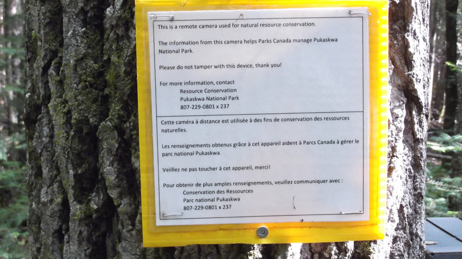
Near the beginning of this part of the trail we spotted the wildlife camera that the staff had spoken about at the Visitor Center.
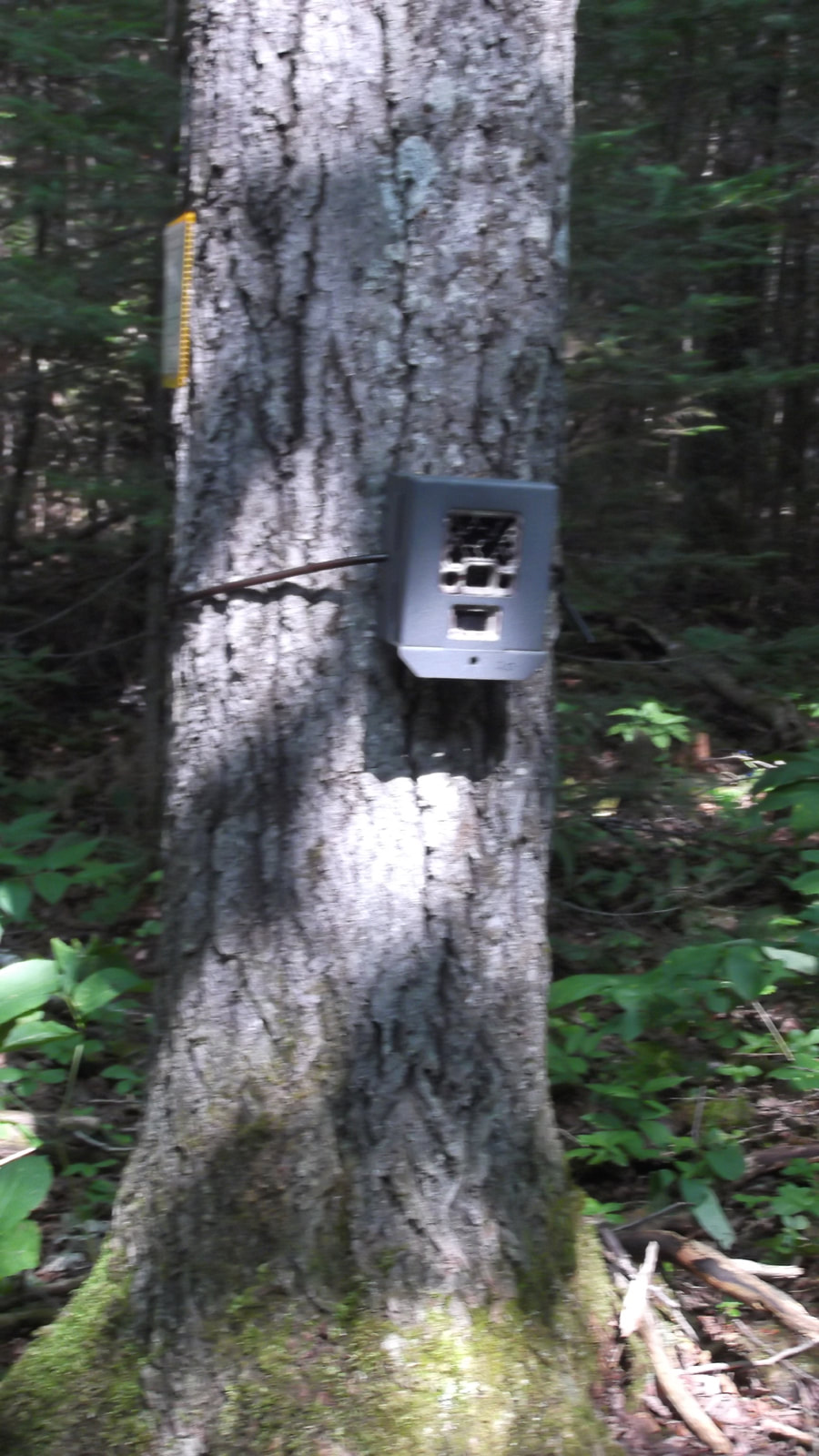
They had told us that unless they caught someone doing something illegal on the camera they usually erase or edit out any people that they catch on film.
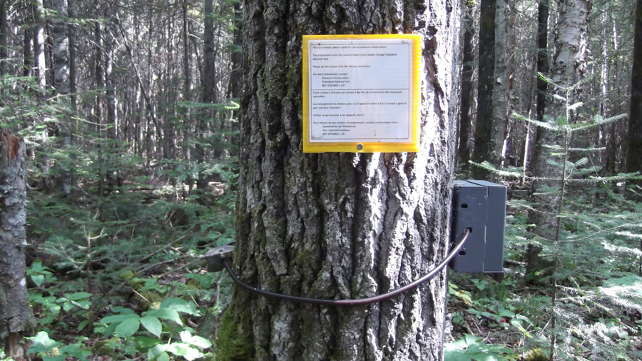
As the posted sign stated, they use this camera and the others like it through out the park to keep tabs on the various animals and to monitor how they are doing. The footage of the animals from these cameras are played on the screen int he Visitor Center.
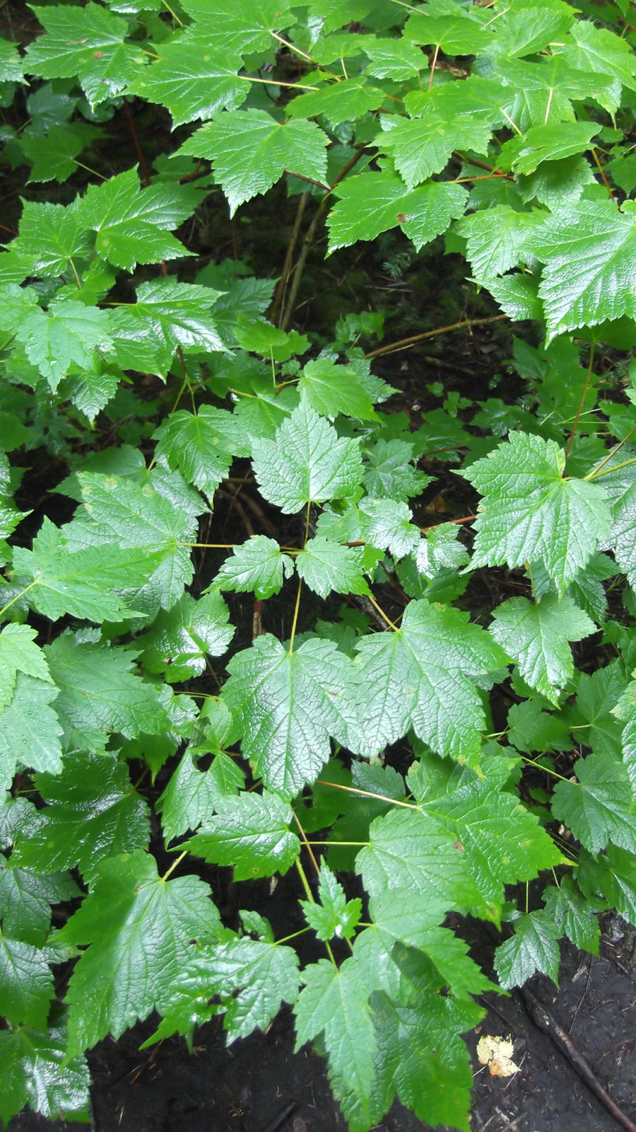
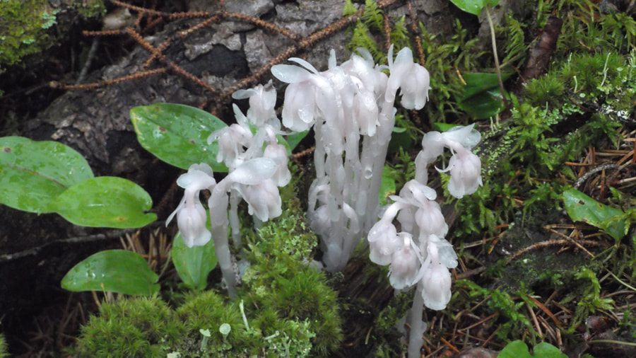
Since this area of the trail is so mossy, I was not surprised to see more Ghost plants growing at the base of the trees. These plants were rather plentiful throughout this section.
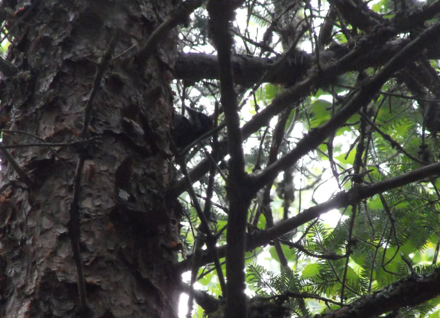
The moss carpet forest went on for a very long time. It was all flat and easy to travel on but there was not much to see in the way of wildlife. You could hear the birds but the only ones that we really saw were some woodpeckers high up in the tree tops.
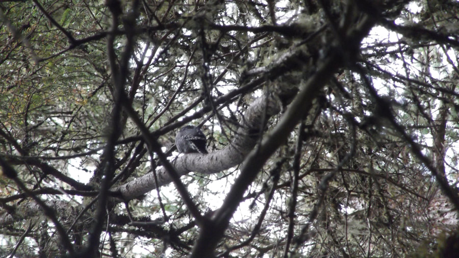
And even the woodpeckers were not the easiest to spot.
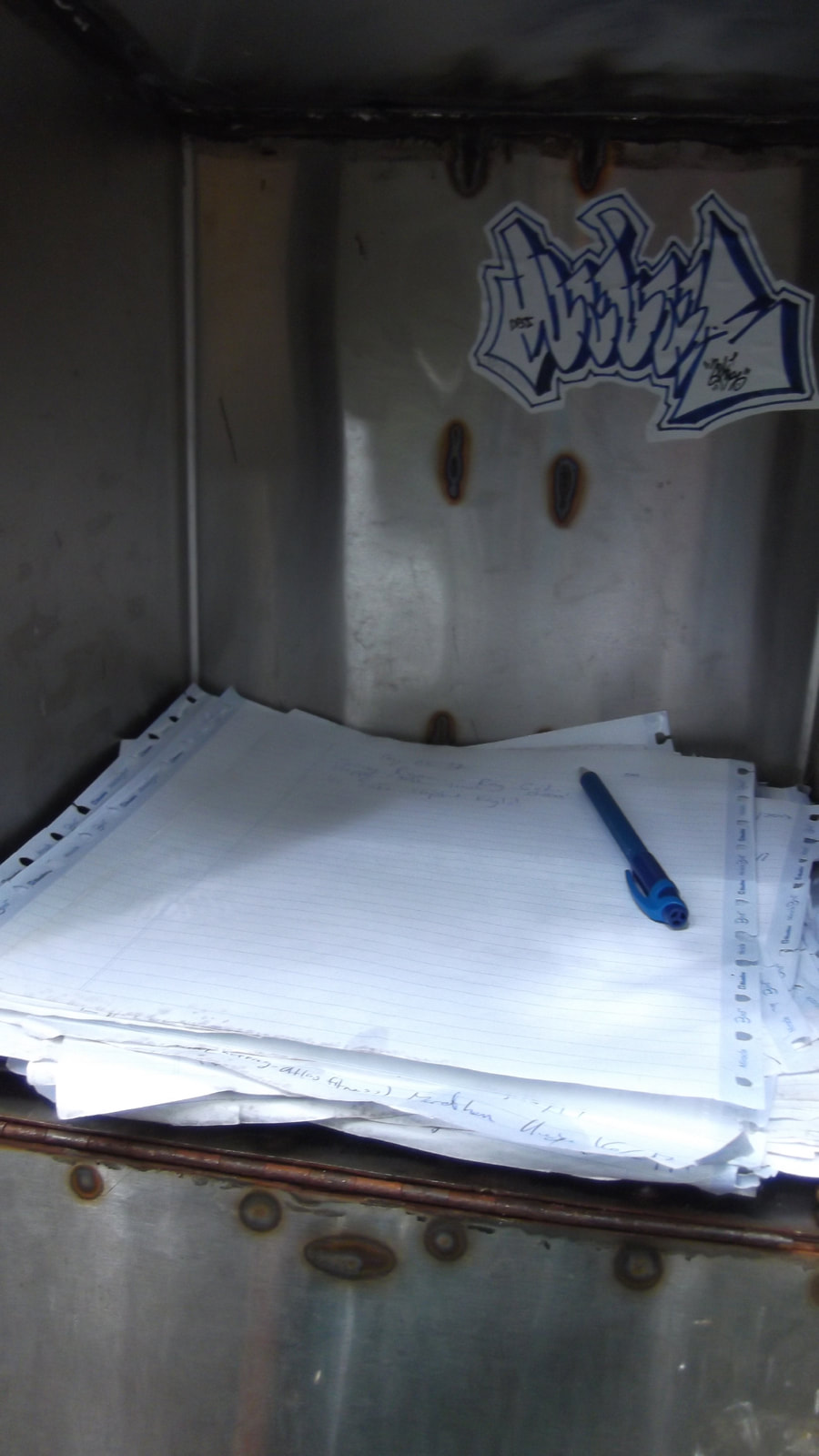
As we were nearing the suspension bridge we came upon an unexpected sight. It was a mailbox right in the middle of the forest.
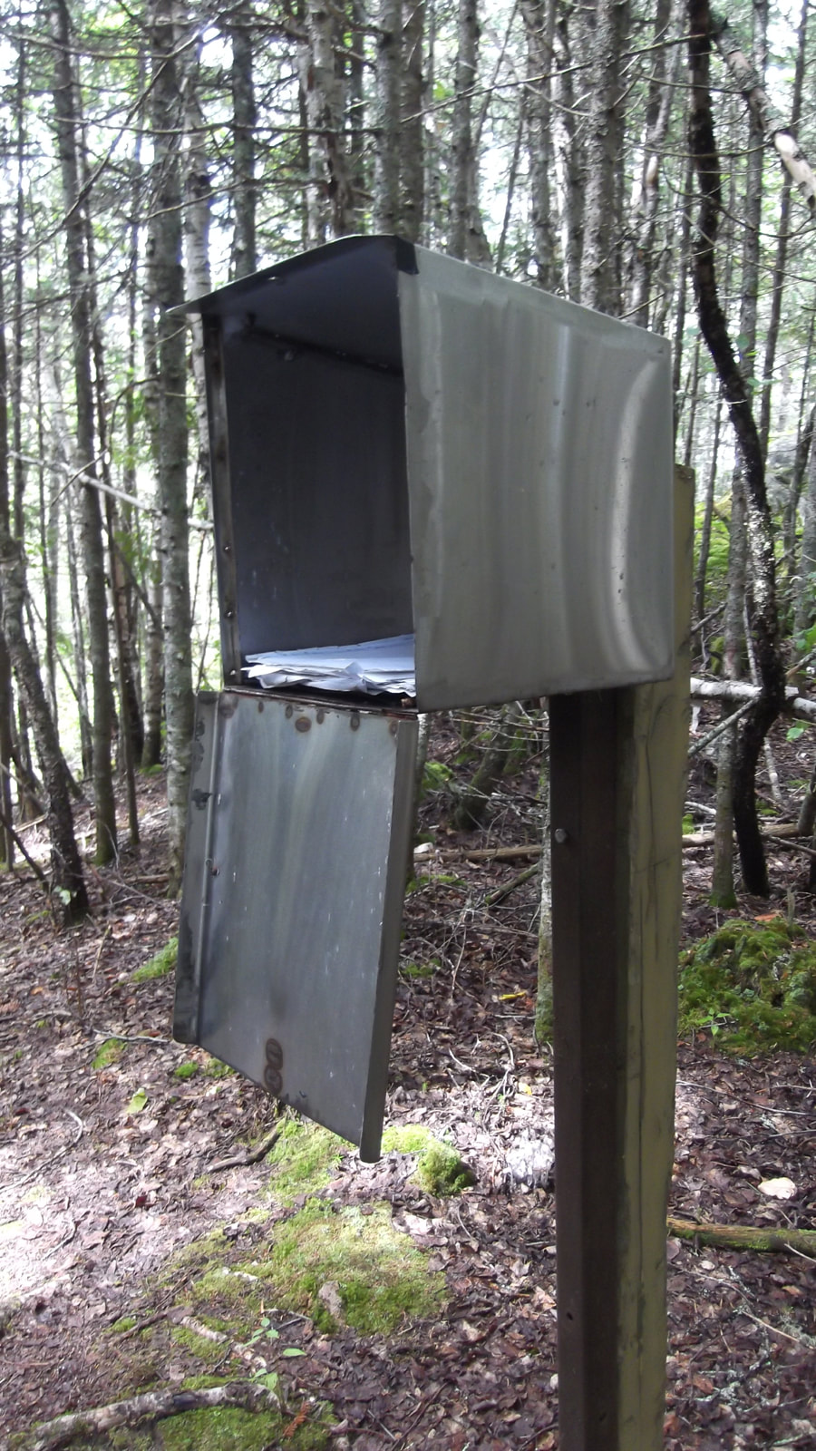
Inside the mail box were some papers and a pen. It was like a guest book where people left their name and wrote little blurbs.
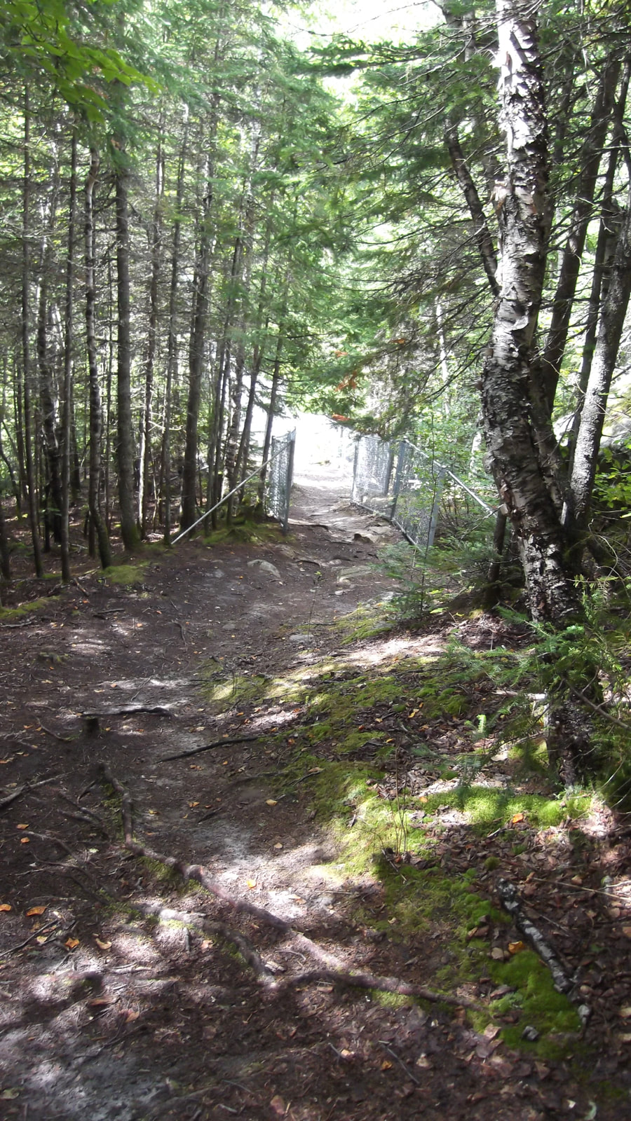
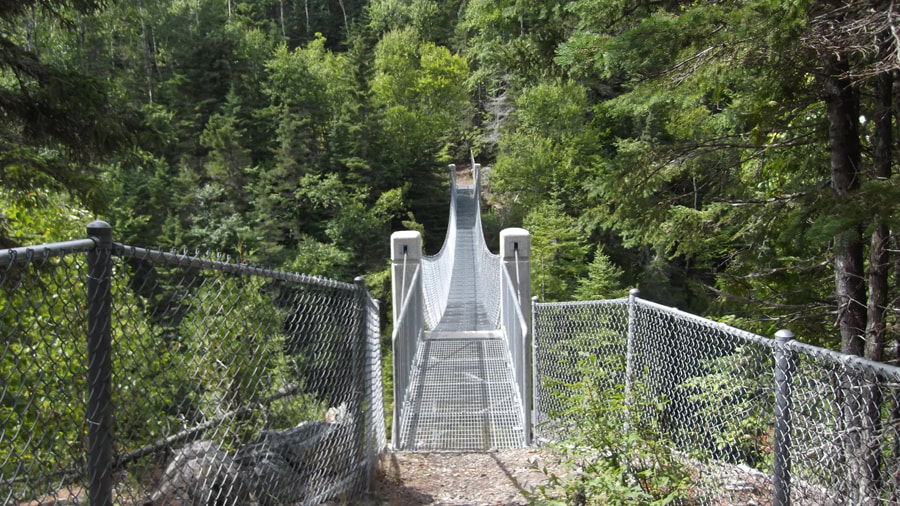
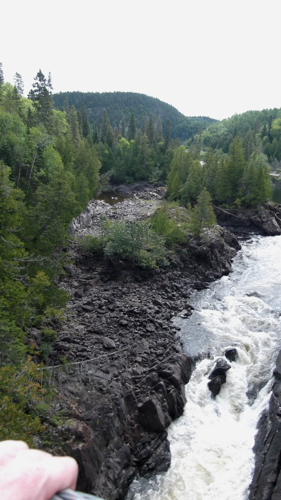
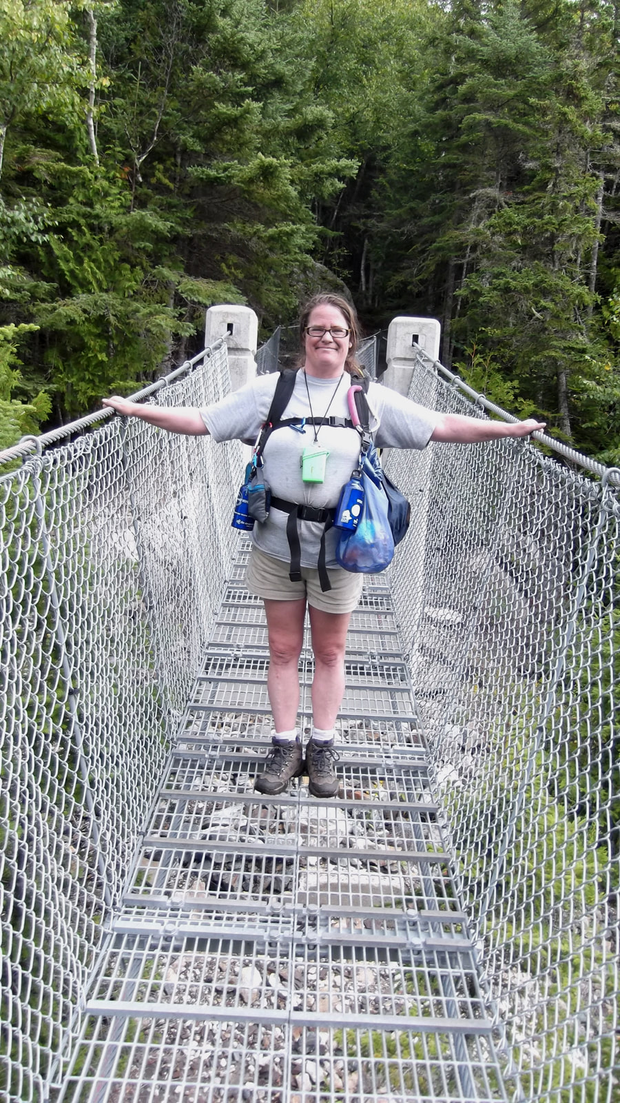
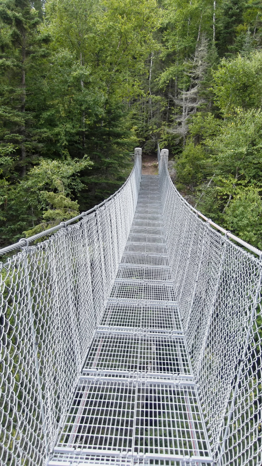
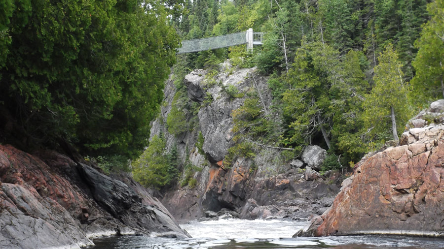
Within moments we could see the trees opening up ahead and saw the beginnings of some fencing. We knew that we had made it to the suspension bridge! We got there at 1:35 pm.
We were pleasantly surprised that it had only taken us about 2 and a half hours to get to the suspension bridge. And we travel slower than most people so I am sure that others would have made it there in no time flat.
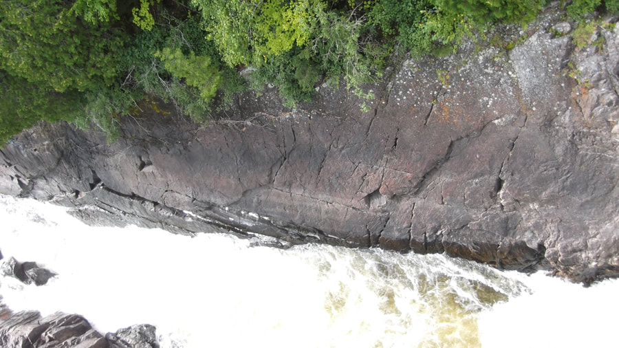
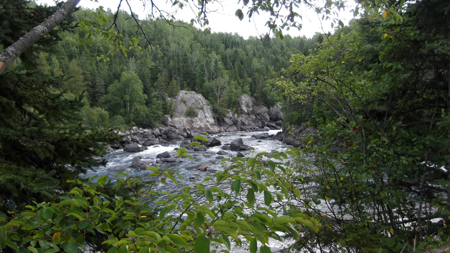
The view to the right was spectacular. You could see all the trees way off in the distance and the rushing water and the rocks below.
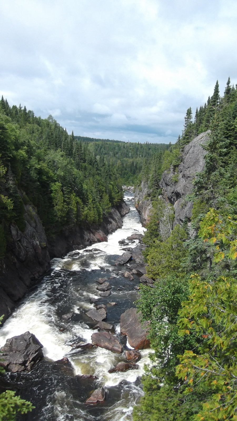
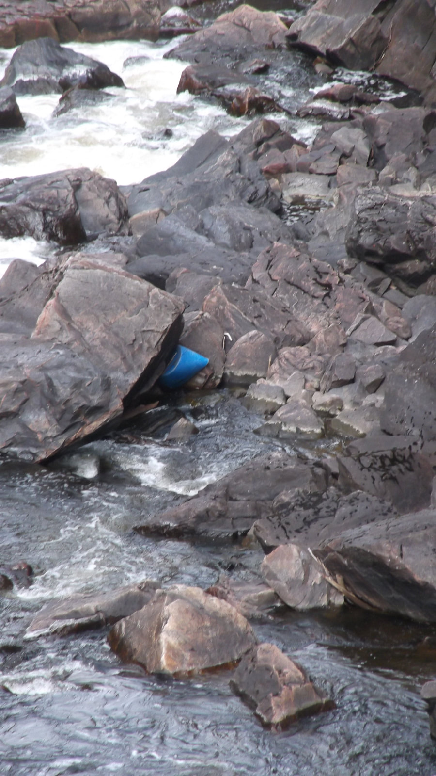
As we looked closer, we noticed that someone's blue kayak was wedged between the rocks and the rushing water. There didn't seem to be anyone around or in need of assistance. We were so far up above that it would have taken us quite some time to get down there even if they did need help. We just hoped that who ever the kayak belonged to was safe somewhere on dry land.
To the left were more trees but there was a wide area that looked something like a rock quarry.
The view was amazing and we really liked it here. We were happy that we made it to our number one goal destination.
Far below our feet the water rushed underneath us.
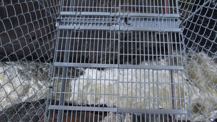
As we walked across the slatted steel and cables the bridge bounced up and down. If I were afraid of heights this might have been traumatic but it since I am not, it was kind of fun to bounce up and down across the bridge.
When we got to the other side of the bridge we sat down and took our packs off and rested for awhile. We had considered staying a bit longer but we were tired and just wanted to go get our campsite set up. We decided to continue on and if we weren't too tired then maybe we would come back to the suspension bridge later on in the day and just hang out for awhile.
I had been looking at the map the last few days and I had thought that our campsite we were going to (site # CH1) was not too far from the suspension bridge. So I was anxious to get going and figured it was just over the hill and right around the bend. But instead, all we found around the bend was a sign indicating more trail and a portage. The trail came to a T. We didn't know if we were supposed to go to the right and up the hill or to the left and down the hill.
Down the hill through the trees we could see the beginning of the portage and some inviting rocks to sit on. So we headed down there to sit for a bit and check our map.
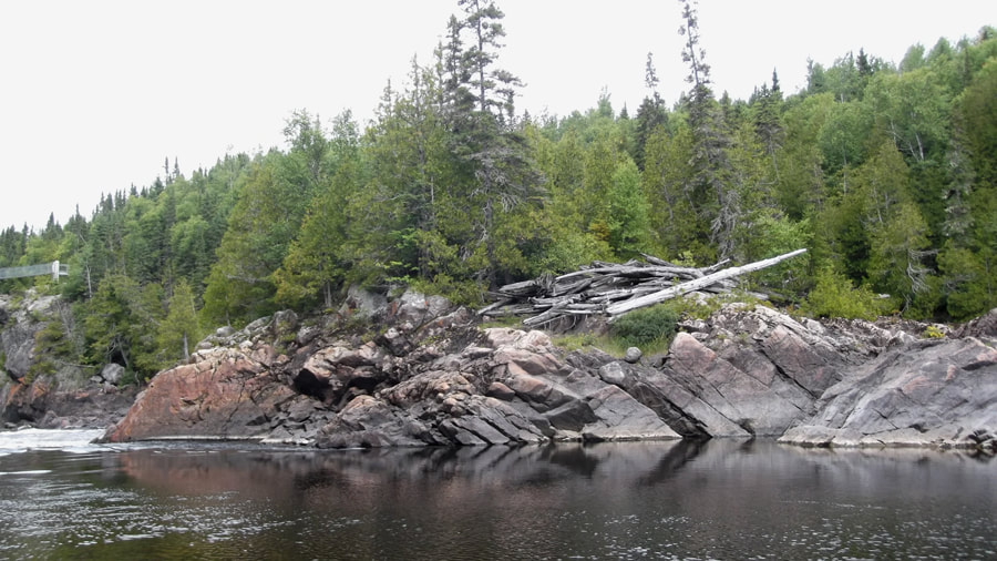
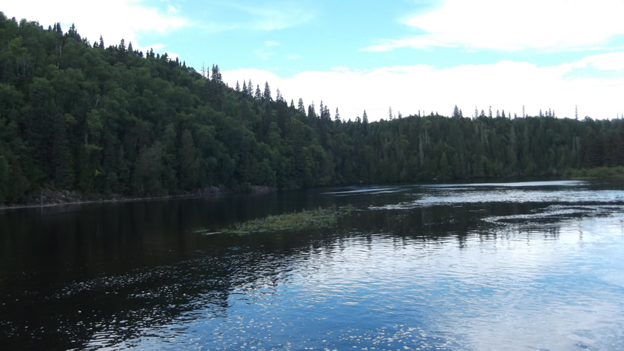
The portage opened up to a nice view of White River flowing past us. Across the river you could see some driftwood logs perched up on the rocky outcrop beneath some pine trees. I wondered if the water used to once be that high and that is how they got there or if they were put there by people; perhaps left over from a logging project many years ago.
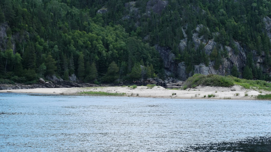
To the right, in the direction of Hooks Falls there was a huge sandbar off in the distance. I thought that it would be a good spot for a bear to go fishing at. But we didn't see any bears.
And to our left, off in the distance we could see the suspension bridge high above the water. It was interesting to see where we had just come from not all that long ago. I imagine we would have looked pretty tiny from this distance.
So we sat at the portage for a bit and checked our map. It really wasn't very clear which direction we should go in to get to our campsite. As far as we could tell it was back up the hill the way we came. Of course if we were wrong then we would be travelling an extra distance more than we wanted to.
So we made the decision to climb back up the portage hill and we crossed our fingers that we were going in the right direction. We knew that since it was a portage that the trail had to go back to the water at some point so if we were going in the wrong direction then we would just stop and have lunch at the other end of the portage before turning around. At about 1:50 pm we started off again. We wondered if the guy we had met on the trail the day before (the one we figured would be our neighbour at the site we were headed to) would be there before us or not. It was still pretty early in the day and he had farther to go than we did so we figured we would probably be there before him.
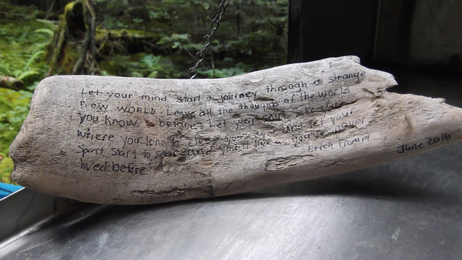
Near the top of a hill just past the portage sign we came across another guest book mailbox.
Near the top of a hill just past the portage sign we came across another guest book mailbox.
Inside this mailbox someone had left a piece of driftwood with some writing on it. It had been sitting there for over a year. It said " Let your mind start a journey through a strange new world. Leave all the thoughts of the world you know behind. Let your soul take you where you long to close your eyes and let your spirit start to soar and you will live as you have never lived before. - Erich Fromm June 2016
(Erich Fromm is a German philosopher and psychologist who wrote "The Art Of Loving" among other things)
(Erich Fromm is a German philosopher and psychologist who wrote "The Art Of Loving" among other things)
This portage turned out to be probably the worst part of the entire hike. It was all steep uphill climbing with tons of roots. It was difficult with packs on so I can't imagine how it would be for canoers who had to carry a canoe and all their gear over this terrain. There were a whole lot of big ups and downs on this portage.
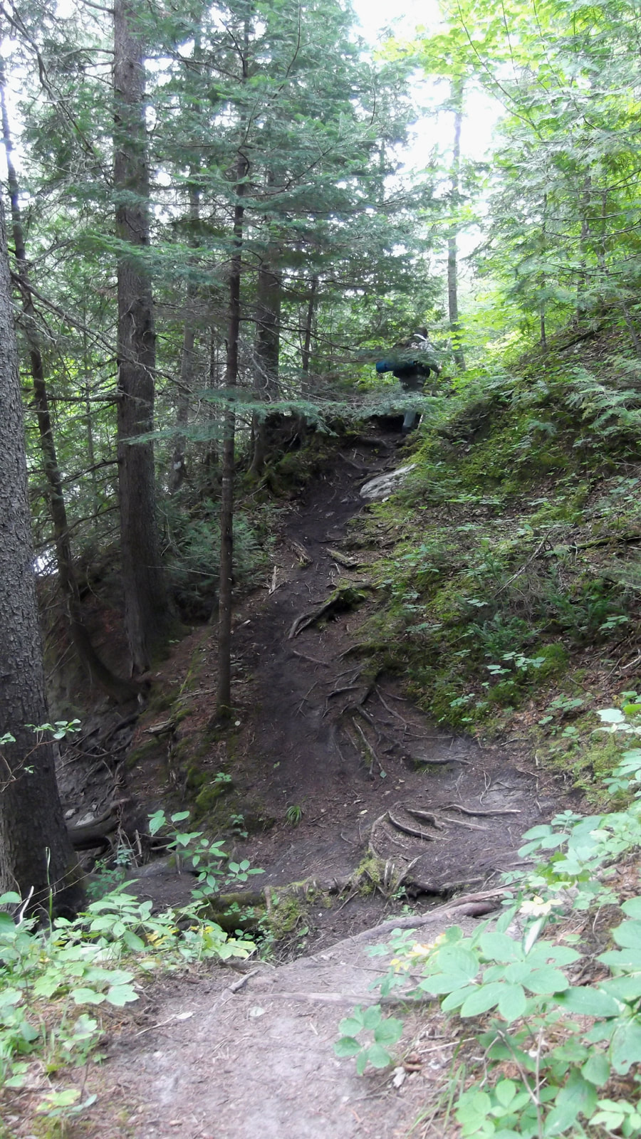
To make matters worse, since it had rained the night before, everything was very muddy and very slippery. There were logs laying across the path that were intended to act as stairs, however, they were just as slippery as the muddy hill and you couldn't trust them.
All of a sudden Heather lost her footing on the muddy hill and fell down onto her butt and started sliding down the hill. For a moment or two she couldn't stop and she just kept sliding. All I could do was watch helplessly. If it weren't for the logs lying across the path she might not have stopped until she reached the bottom. By the time she finally managed to stop again she was covered in mud. Once I knew she was OK we had to laugh. But all of this was wearing on us and we were beginning to get tired and we just wanted to be at the campsite already. We dreaded having to go back up this muddy hill again tomorrow.
For the rest of the way we grabbed on to saplings and plants along the side of the path and held on tight so that we wouldn't go sliding any further down the hill.
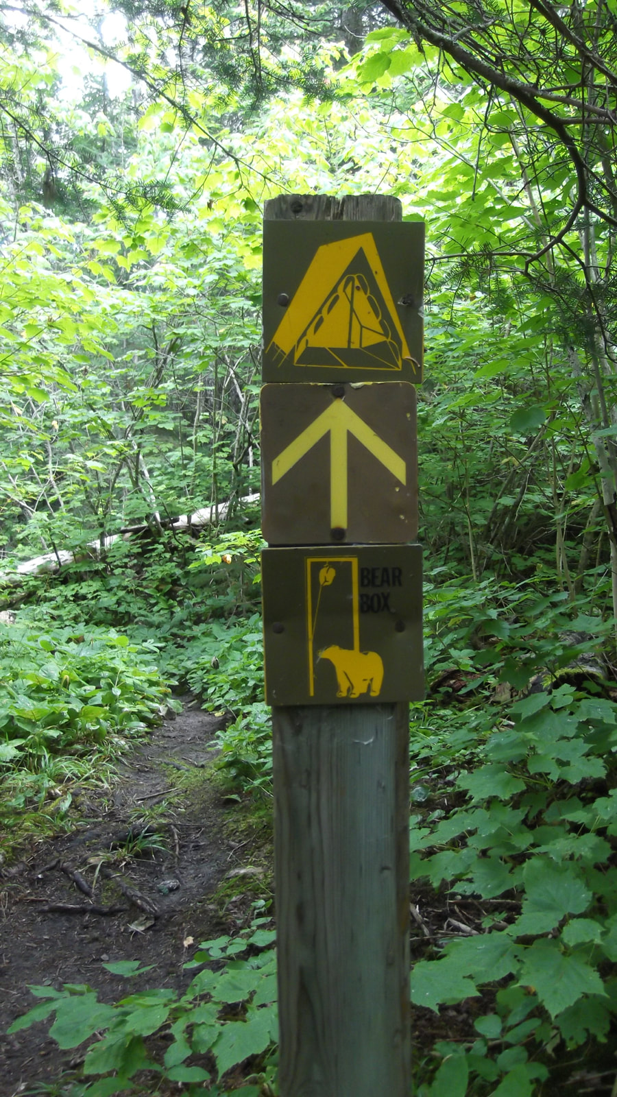
After what seemed like forever we finally saw the sign indicating that we had come to the campsite and that there was a bear box ahead.. We were very happy that we had chosen the right direction and that we were almost there!
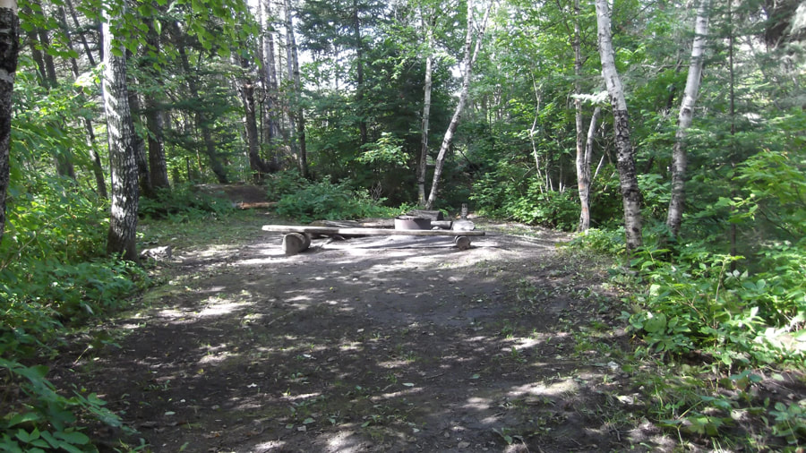
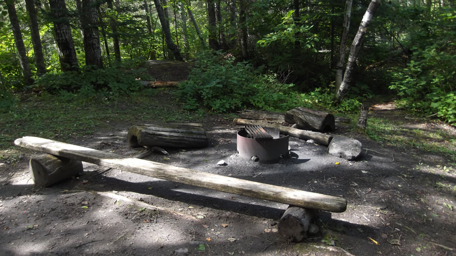
After about a minute of following a short side trail we arrived in a big open area with a campfire pit. It was nice enough but it was completely surrounded by trees and had no real view and not much access to the water. And it was empty. Our neighbour had not arrived before we did.
I knew from studying the online map before we left home that there should be two sites here and that we were on the furthest of the two sites. I had purposely chosen it that way so that we wouldn't be close to a bunch of people. So although this site was right in front of us we began a search for the other site.
This site had many small trails all over it. After exploring a couple trails we ventured across a bear bin as well as an out house. We were disappointed to discover that there was only one bear bin and only one outhouse to be shared by two campsites. Unfortunately both the bear bin and the bathroom were close to site CH2 and not close to ours at all. Also, the bathroom door doesn't lock. We were not sure that we were going to like it here but it was only for one night so we would make do.
It took us a fair bit of time to find our site because there were no signs anywhere telling you where to go. We had to go through to the other side of site CH2 and down a long path to get to it.
It took us a fair bit of time to find our site because there were no signs anywhere telling you where to go. We had to go through to the other side of site CH2 and down a long path to get to it.
Finally we found our site and it was much nicer than site CH2. It was about 3 p.m. by this point. This site was more open and less shady. We were quite happy with it (except of course for the lack of bathroom and bear bin) and our spirits began to lift again.
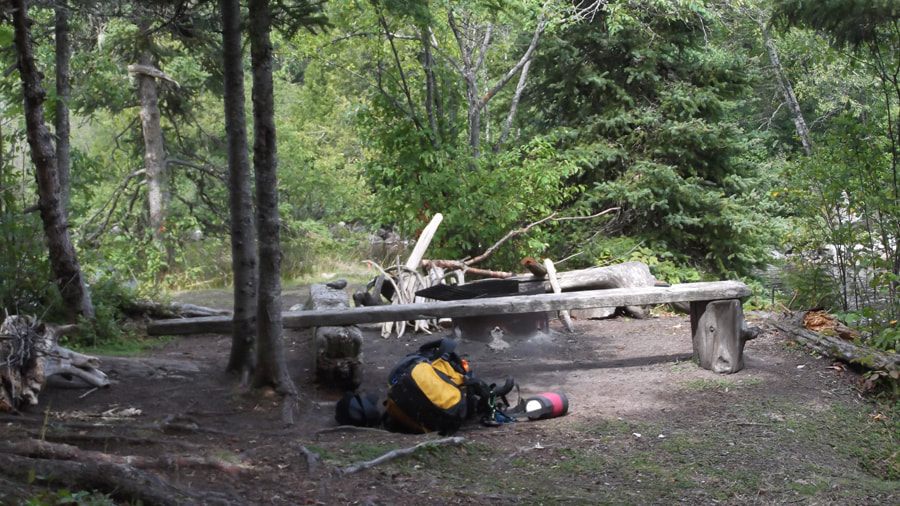
As an added bonus, the previous occupants had left us a small pile of kindling.
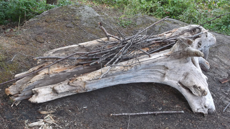
And off to one side was another small pile of dry wood. Most of it was drift wood. It was almost a shame to burn some of the pieces because they were nicely weathered.
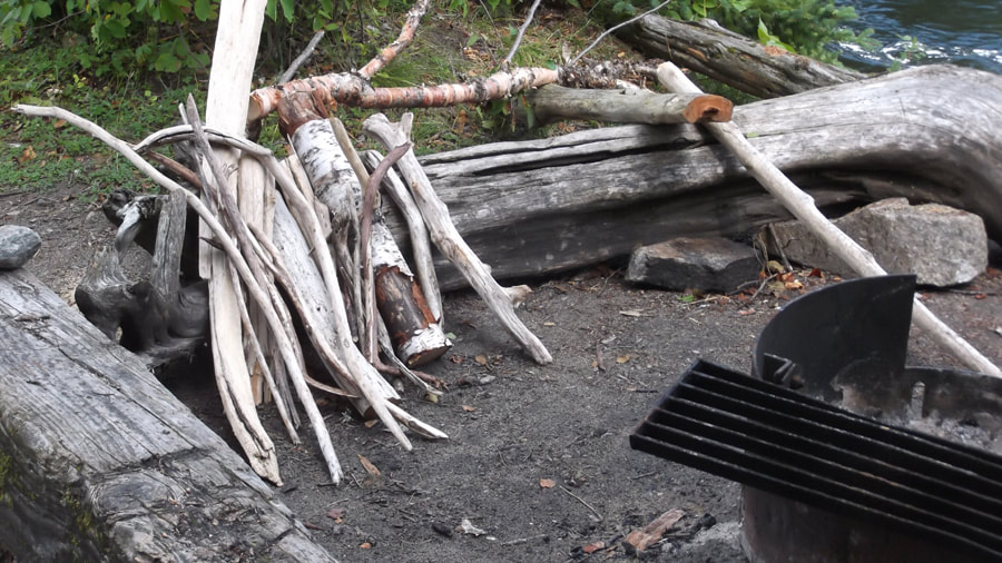
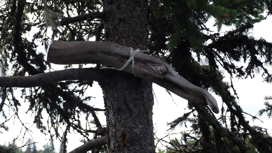
Tied up in the tree, above our heads, someone had secured a piece of driftwood that looked like the head of a duck or a bird. I imagine it may have been the same person who wrote the quote by Erich Fromm on the driftwood back at the mailbox.
The site was situated on a rocky point that over looked the rapids. To the right you can see the swirling water of the rapids as it finishes it comes to the end of the rocky pass. If you walk through the trees you can climb down the rocks to the waters edge.
To the left you can walk through the trees to a rocky cliff. This path does not easily go down to the waters edge; unless of course you were to fall down it.
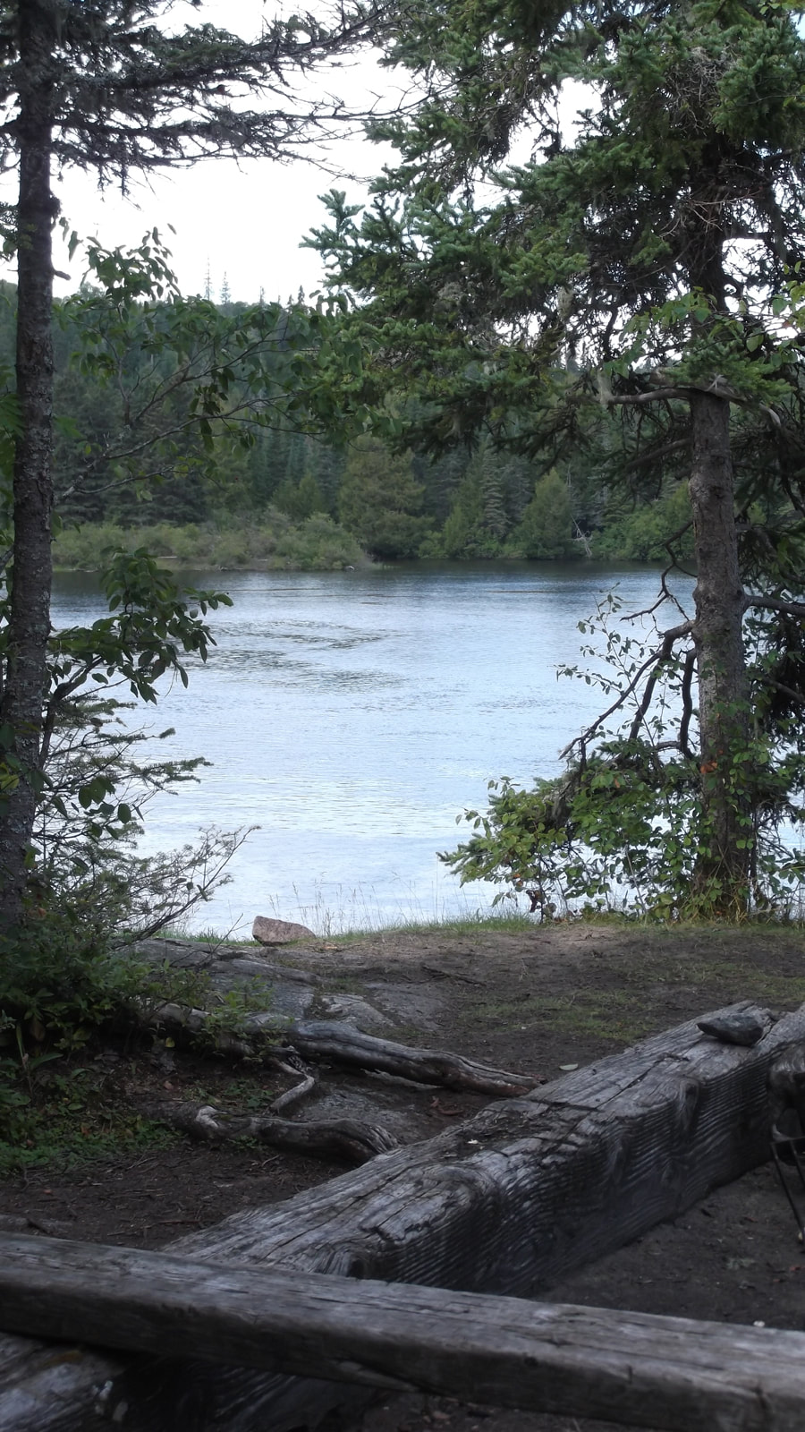
But if you walk out to the edge you get a fantastic view of the calmer part of the river and where the other end of the portage is. Straight across from here is a campsite that can only be reached by canoe.
We began to set up the tent. It was still wet from the rain that we had the night before, but out on this rocky point it was very windy and the tent dried out in no time at all. It was so windy and rocky, in fact, that we couldn't peg down the tent and we had to find large rocks and bring them into the tent to weigh down each of the corners so that it wouldn't blow away.
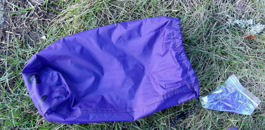
Heather and I had both bought new bedrolls from online before we went on this trip. These bedrolls are extremely light weight and are perfect for backpacking. They weigh only about one pound.
Heather and I had both bought new bedrolls from online before we went on this trip. These bedrolls are extremely light weight and are perfect for backpacking. They weigh only about one pound.
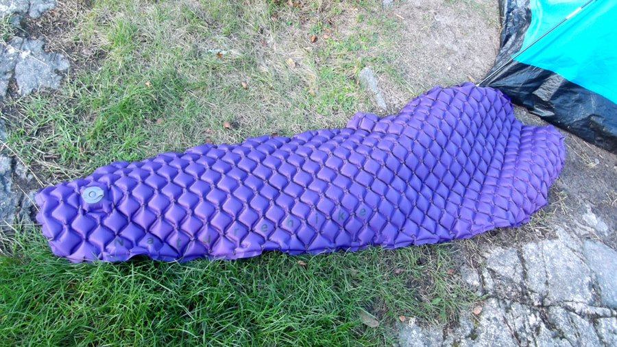
You can blow them up in about 8 large breaths (yes, we counted) and they roll up very small. They come in a little bag and have a repair kit too. I was worried that they wouldn't be comfortable enough but, although your sleeping bag does slide off of it a bit, they are not too bad in terms of comfort. Since they don't take up too much space or weight, you have room for other tings in your pack.
 |  |
Once the tent was up and the beds were made we sat down to have a lunch of egg salad sandwiches. As we sat eating we noticed some very dark clouds coming in towards us. And they were moving very fast! We could see the rain coming towards us. We scarfed down our sandwiches and ran around gathering up everything that we didn't want to get wet, including a bit of kindling wood for later.
Within 5 minutes the rain was upon us! We barely got everything in on time. As a matter of fact, Heather's coffee water was still outside boiling on the portable stove.
Within 5 minutes the rain was upon us! We barely got everything in on time. As a matter of fact, Heather's coffee water was still outside boiling on the portable stove.
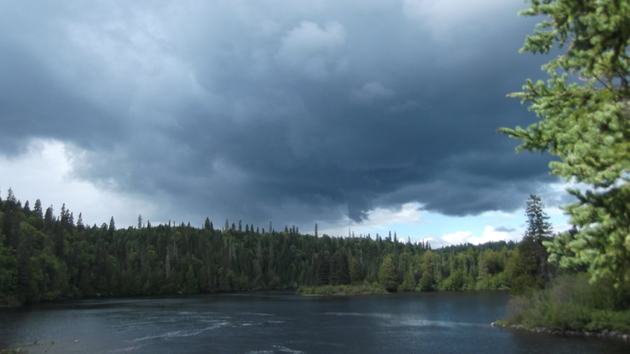
We decided to play a game of Yahtzee while we waited out the rain. We hadn't been playing for more than 5 minutes when the rain stopped. It was a very short lived rain shower and it blew right by us as quickly as it had come in. The sun came out but it was still very windy and the clouds would block the sun from time to time.
We finished our game and then went in search of fire wood. We gathered a bit more for ourselves but we also gathered a bunch for our neighbour who we were expecting tonight in case he came in late. We knew that it was possible that he might get lost considering that the trails did not have very good signs on them. This gave us a chance to explore the site a bit more too. There were lots of birds near the other campsite and there was a light green moss growing from the branches of the pine trees. I loved that you couldn't hear much more than the birds and the sound of the water falls.

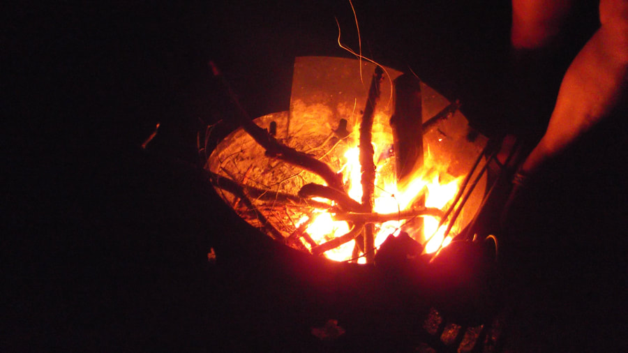
At about 7 p.m. we got a fire going and we started cooking our supper. It was not long after that when we heard a "Hello there!" coming from behind us. We turned expecting to see our neighbour but instead saw a different young man and his girlfriend coming towards us up the path. At first I thought he might be one of the rangers because he was dressed in the same colour and style of clothes that some of the provincial rangers wear. But with his next sentence I knew that he was not a ranger, but was just our actual neighbour. He said "I think that you are on our site." We had a discussion about how the sites were not really labelled and he tried to show me on his map that we were on the wrong site. I explained to him that on the website it shows the farthest site as being CH1, which was the one we were on. The map we had in hand didn't even show that were 2 sites at all actually; only one.
The guy seemed a bit upset that we weren't giving in. The girl just stood back shyly listening to what everyone was saying. We might have considered switching but we had our fire going and our supper was still cooking and we were all settled in. Heather tried to be nice and offered them a spot to put up their tent near ours and we could share the site. But they declined and reluctantly went back towards the other site. As they were leaving he said "Well, I guess the rangers won't need to be involved over this. They probably won't mind if we are on the wrong sites". I am not sure if that was intended as intimidation or not (and we were thinking that fat chance that a ranger is going to be just wandering this far out here on a whim at this time of night anyways) but we just replied. "Sorry! Hope you have a good evening. Oh and we gathered some fire wood for you.!"
The guy seemed a bit upset that we weren't giving in. The girl just stood back shyly listening to what everyone was saying. We might have considered switching but we had our fire going and our supper was still cooking and we were all settled in. Heather tried to be nice and offered them a spot to put up their tent near ours and we could share the site. But they declined and reluctantly went back towards the other site. As they were leaving he said "Well, I guess the rangers won't need to be involved over this. They probably won't mind if we are on the wrong sites". I am not sure if that was intended as intimidation or not (and we were thinking that fat chance that a ranger is going to be just wandering this far out here on a whim at this time of night anyways) but we just replied. "Sorry! Hope you have a good evening. Oh and we gathered some fire wood for you.!"
So Heather and I went back to attending to our supper and discussing the situation. We were almost regretting that we had even gathered any wood for them. But it wasn't more than a couple of minutes when the couple returned again. We thought "Oh no, here we go again!" But we were surprised to find that they actually came back to apologize to us. They said that they looked at their map again and realized that it doesn't clearly indicate which site is which on their map either. From that point on we began having a friendly conversation. . We found out that they were from Wisconsin and had left the U.S.A. only just this morning and drove all the way to Canada and then hiked all day long (the distance that we had done in two days).
They intended to hike the Mdaabii Miikna loop. They explained how they had wanted to stay on site P1 this night (the site we had been on the night before) but someone had already booked it for tonight so they were forced to go the extra distance and come here.
I began to see what a difficult day they had been through today and they too had to go down that awful muddy portage hill to get here. They must be tired and somewhat disappointed like we were when we first got to this site. I felt a bit bad for them and a bit guilty that we were the cause of another one of their disappointments. And now I was back to being glad that we had gathered the wood for them after all.
When we were done talking they went down to the river to get some water and then went back to their own site. We ate our supper and then cleaned up. We only saw them once more that evening when we had to go through their camp to get to the bear bin to put our food away for the night. I was glad that we were on friendly terms at that point. It could have been very awkward if we had to go through their site and they were still angry with us.
When we got back to our site we sat around the fire and talked until bedtime.
When we got back to our site we sat around the fire and talked until bedtime.
As the fire died down we enjoyed the evening and looked at the stars. Our neighbours had gone to sleep hours before we did and it was peaceful and quiet.
At 11:30 p.m. we went to bed. Aside from a loud bird squawking for a minute or so at about 11:35 the only sounds you could hear was the sound of the rushing water. The night was chilly like an October night. I figured that it was because of the wind and the moisture in the air and the cold rising up from the water. I just wore a sweater to bed and bundled into my sleeping bag and drifted off to sleep,
 RSS Feed