I had been surprised to discover this winter that Halfway Lake had a backpacking trail. It was a park that wasn't too far away from home (only about 2 and a half hour drive) so I immediately went to work making plans to do the 15 km hike on their Hawk Ridge Trail. The plan was to hike the trail backwards and stay on site # 4 the first night, # 3 the second night, and #1 the third night, with an over night stay in the main campground at site #205 for the final night. A couple weeks before we were to go, the park called me up and asked if I would be willing to change from site #4 to site #5 because they wanted to allow site #4 to remain empty so that nature could reclaim it. Site # 5 was a closer destination, so I had no problem with that.
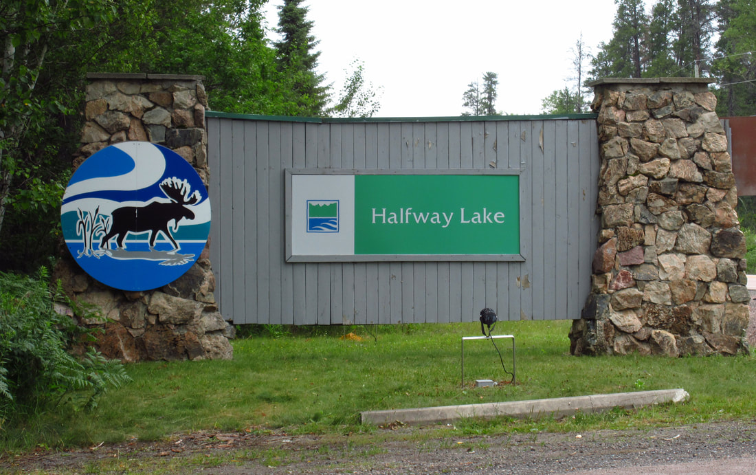
When the long awaited day finally arrived, my mom, my brother, and I left home at about 11 a.m. and a few hours later arrived at a tiny little park office.
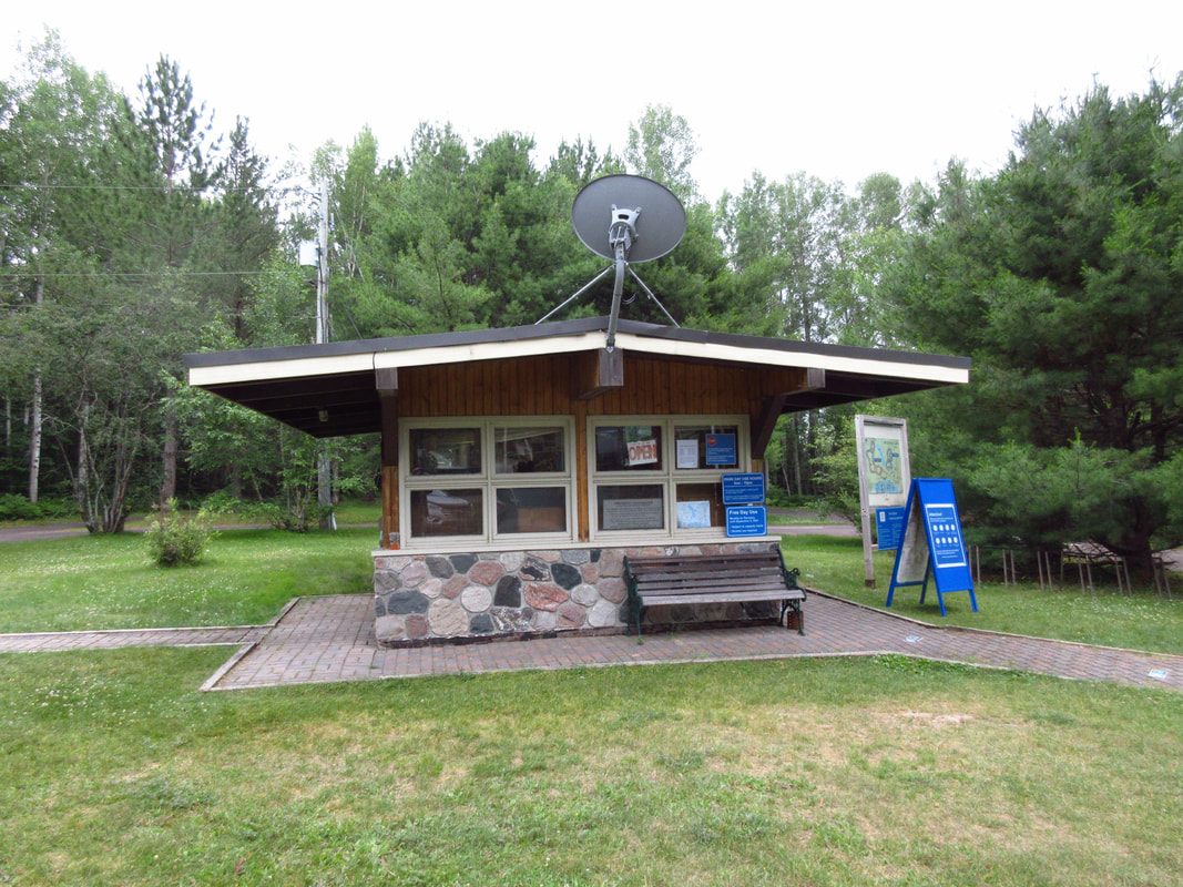
There was a sign saying only one person allowed in the office at a time, which was fine because it was so small that there was not enough room for much more than that anyways. So I got in line and waited my turn. It was a weekend so it was fairly busy that day.
When it was my turn I let them know that I was there for my reservation for the back country trail. They signed me in but they used my license plate number that they had on file, assuming that was the car I had arrived in. However, we had taken my mother's car to the park. When I pointed this out to them, they didn't know how to change it. So, they told me that they would just let the other staff members know and that it wouldn't be a problem. Later on, I just wrote my mother's license plate number down in pen on the permit.
Other parks usually ask what colour tent you have and how many are in your party and stuff like that for safety sake. They asked none of that. They only asked me to come back to the office to let them know when we were back.
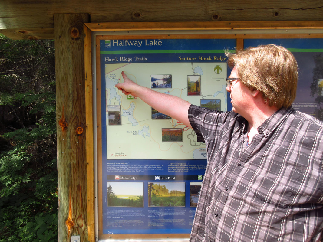
There were no really good maps of the trail. I was relying on the one that they had posted online. Although it was decent enough to use, it did not give any indication of distance. So, I had to do some deductions and come up with my own idea of how far to travel each day. The website said it was a 15 km trail. So I deduced that half way would be roughly somewhere before the Look Out. Possibly at the furthest tip. So the first half of the trail would be about 7 to 8 km. That would mean that there is roughly 2 km between each set of campsites (2 km from the half way mark to #1 , then 2 km from #1 to #2 and 3, then 2 km from # 3 to # 4 and 5, and then 2 km from # 5 to exit). But without any proper information, it was all just guesswork.
I asked them where the trail started and where the trail ended in the park so that I would know where to find the trail exit (which would be our entrance). The young man, Matt, at the desk said that "it didn't really matter where we started from". I said that yes it did, because we were not going to hike from the beginning of the trail and go most of the way around the trail to number 5 and then go back again to number 3 and 1. That would make no sense and would add huge amounts of extra hiking. He didn't seem to understand what I meant but he pointed out the trail head and the trail exit on a big map on the wall behind him just the same.
Other parks usually ask what colour tent you have and how many are in your party and stuff like that for safety sake. They asked none of that. They only asked me to come back to the office to let them know when we were back.
There were no really good maps of the trail. I was relying on the one that they had posted online. Although it was decent enough to use, it did not give any indication of distance. So, I had to do some deductions and come up with my own idea of how far to travel each day. The website said it was a 15 km trail. So I deduced that half way would be roughly somewhere before the Look Out. Possibly at the furthest tip. So the first half of the trail would be about 7 to 8 km. That would mean that there is roughly 2 km between each set of campsites (2 km from the half way mark to #1 , then 2 km from #1 to #2 and 3, then 2 km from # 3 to # 4 and 5, and then 2 km from # 5 to exit). But without any proper information, it was all just guesswork.
I asked them where the trail started and where the trail ended in the park so that I would know where to find the trail exit (which would be our entrance). The young man, Matt, at the desk said that "it didn't really matter where we started from". I said that yes it did, because we were not going to hike from the beginning of the trail and go most of the way around the trail to number 5 and then go back again to number 3 and 1. That would make no sense and would add huge amounts of extra hiking. He didn't seem to understand what I meant but he pointed out the trail head and the trail exit on a big map on the wall behind him just the same.
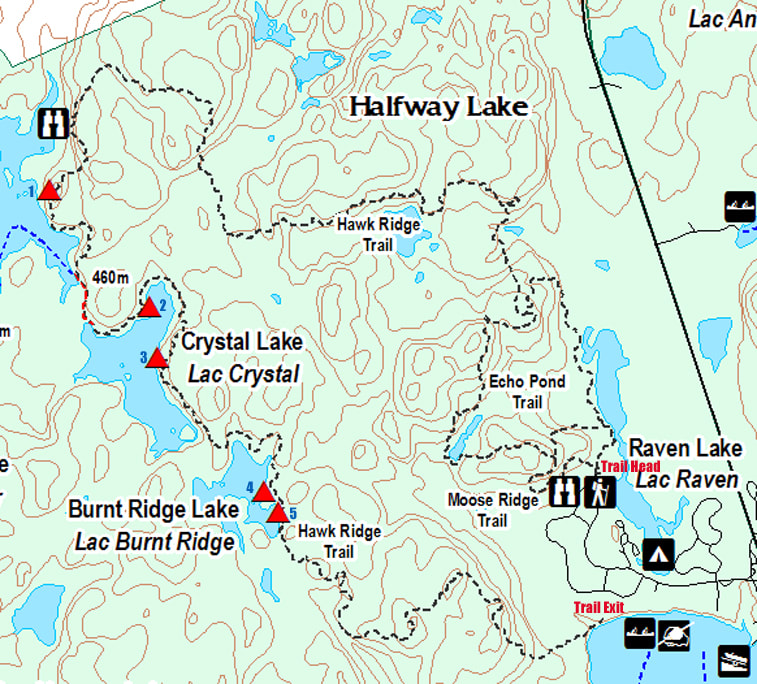
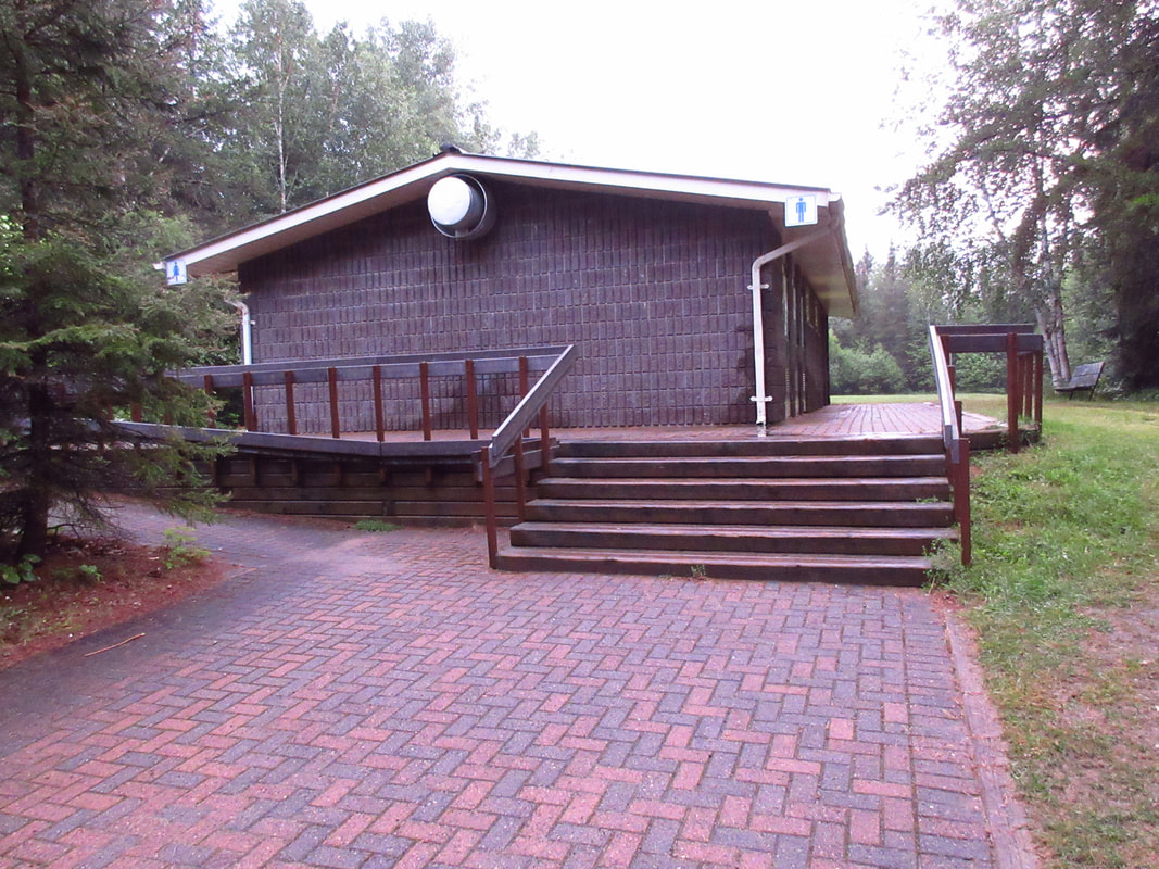
We figured out that to do the trail backwards, the best thing to do is to go to the comfort station in the Hawksnest Campground across from site 203, leave your packs there, drive your vehicle up to the parking lot at the trail head on the other end of the park and then, walk back to the comfort station to begin your hike. Of course, if you are backpacking alone then you might not want to leave your stuff unattended at the comfort station.
My mom stayed with our packs while Carsten and I dropped off the car and walked back. While we were at the trail head we took a moment to look at the map they had posted there and we discussed how far we would be travelling each day.
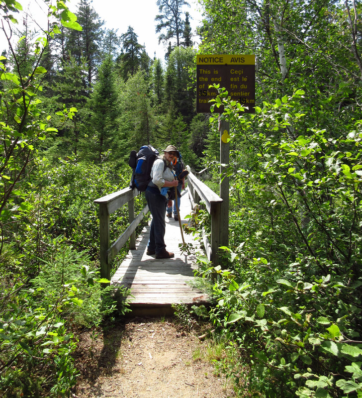
We finally began our hike at about 3 pm. When you start the trail backwards you begin at a bridge down by the beach. It was a nice start to the hike.
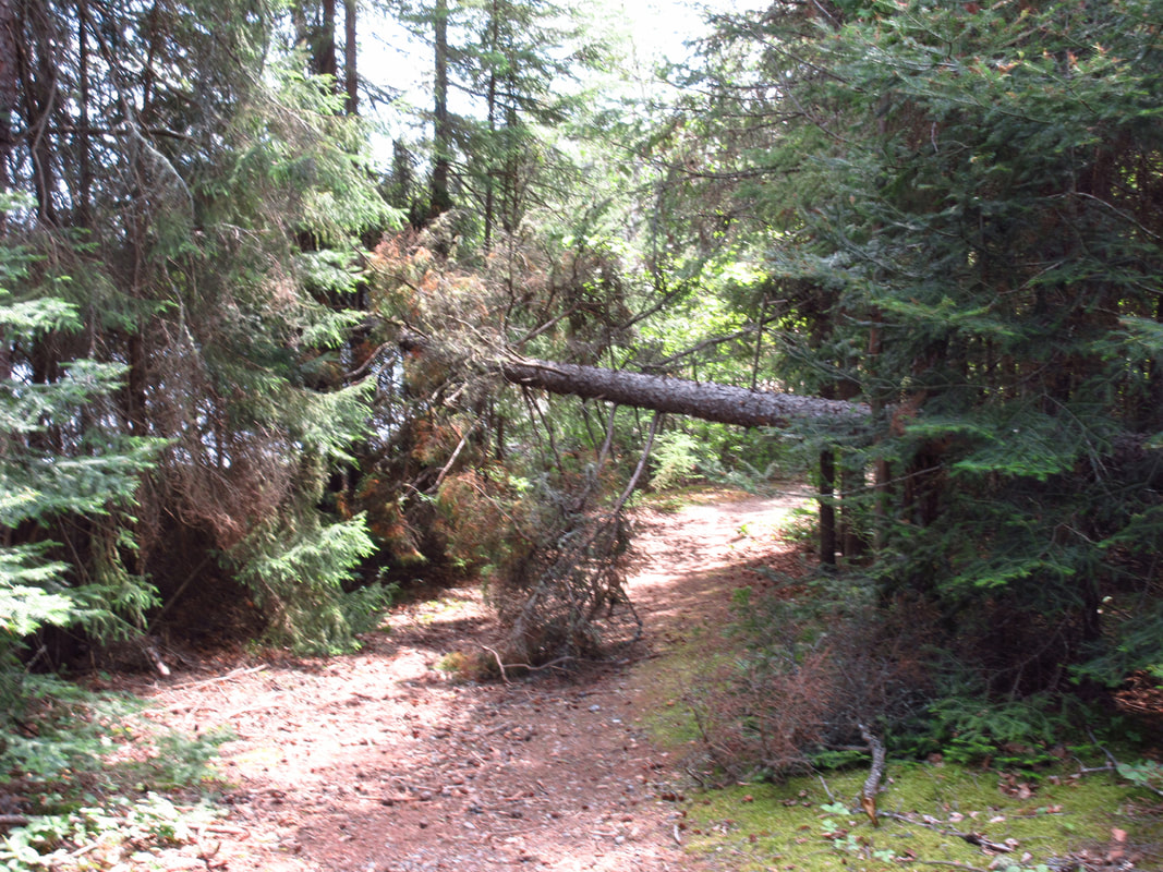
But we had only walked less than a minute when we came to our very first obstacle. A downed tree. I was surprised by this since it was so close to the end of the trail. I would have thought that the park staff would have taken care of getting this cut down long before the height of the camping season had begun.
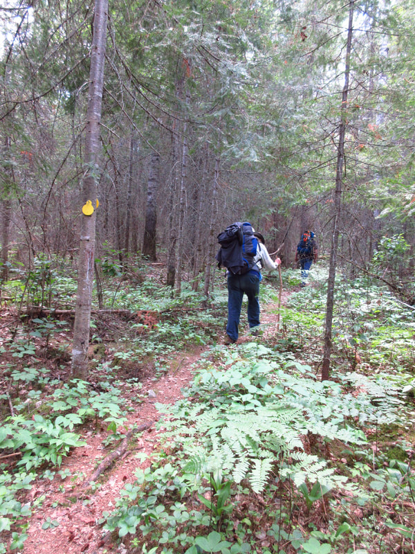
The trail started out not too bad. There were lots of pines. There were hardly any mosquitoes at all and only a couple of deer flies. But the deer flies got worse as we travelled. They were quite annoying actually. But we were in the height of deer fly season and we were wearing hats, pants and long sleeves so they weren't able to bite us very easily. It was just their presence that was unnerving.
About five minutes later, we came to our second downed tree. I was beginning to notice that this trail was not very well taken care of. This part of the trail passes through the part of the forest that was devastated by the 2002 tornado when mature trees were instantaneously flattened. However, those trees had seen the likes of a chainsaw and had been removed from the trail. These ones were much newer and should have been cleared away by now this late in the season. When we had hiked the Eastern Pines Trail in Algonquin back in May of 2019, the staff were out there with chain saws clearing away the deadfall before the height of the season. But not in this park. This was just the beginning. There were many, many more of these fallen tree obstacles to come.
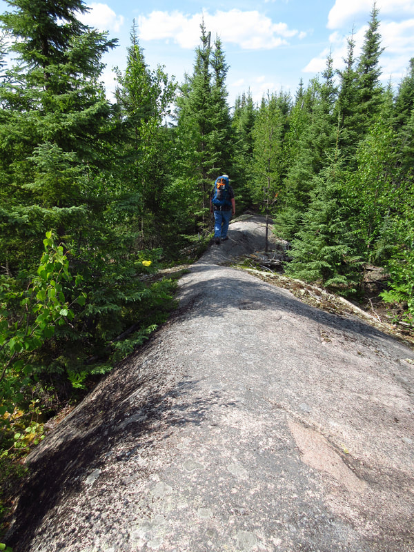
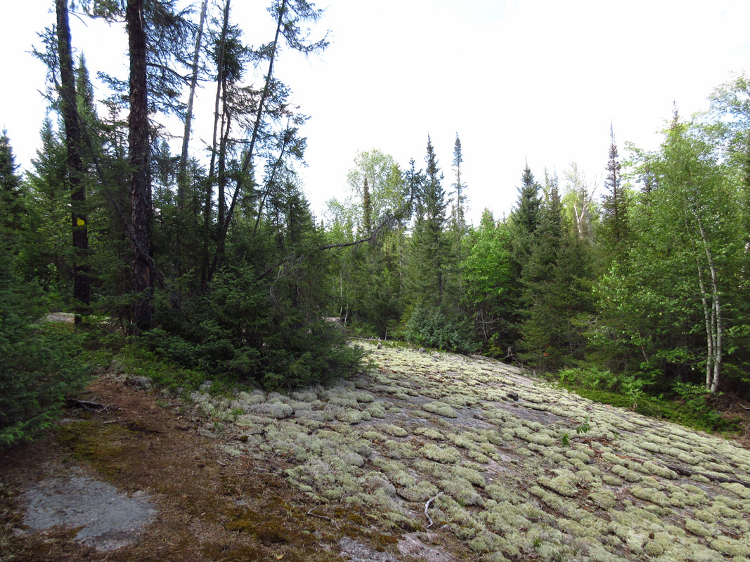
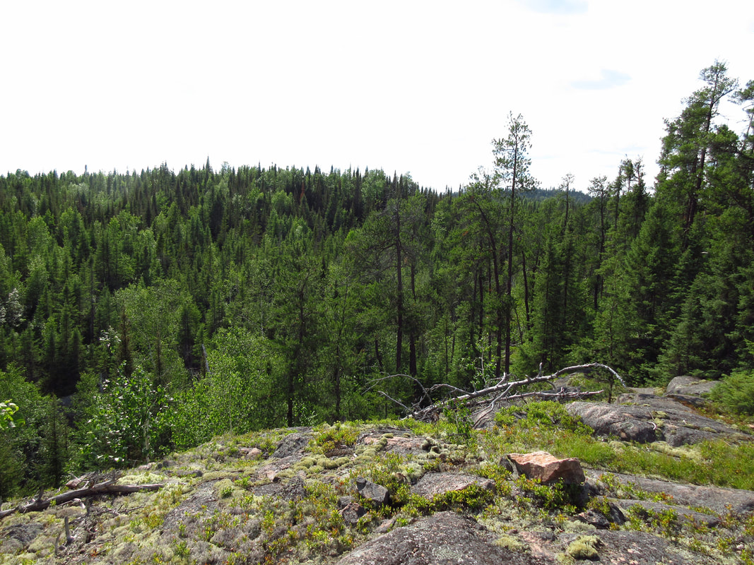
But not all of the trail was full of obstacles. There were some interesting rocky ridges that were open and easy to travel on.
And some areas were patterned in patches of deer moss. It was at about this point that my mom was having a hard time keeping up. We were only about 45 minutes into our hike when my mom said that she couldn't make it. We told her that we had come at least one kilometer and that there should only be another kilometer to go. We offered to leave a pack behind and come back for it later. She decided that it would be best for her to turn around and go back to the main campground and get a campsite there for a few days. She didn't want to hold us back. She said that she would be perfectly happy to spend some time alone just reading a book. She would text us at 6pm to let us know what site she was on. We were a bit disappointed but we understood. We said that if it turned out that the campsite was not too far ahead that we would run back for her and let her know.
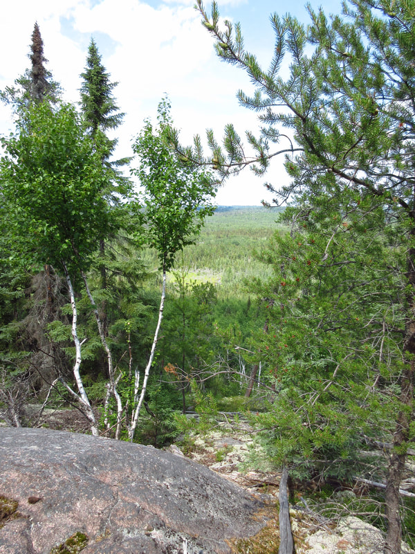
And then there were two.....The trail went on and on and there were more and more steep rocky hills. At the top of some we could see the trees far below in the distance.
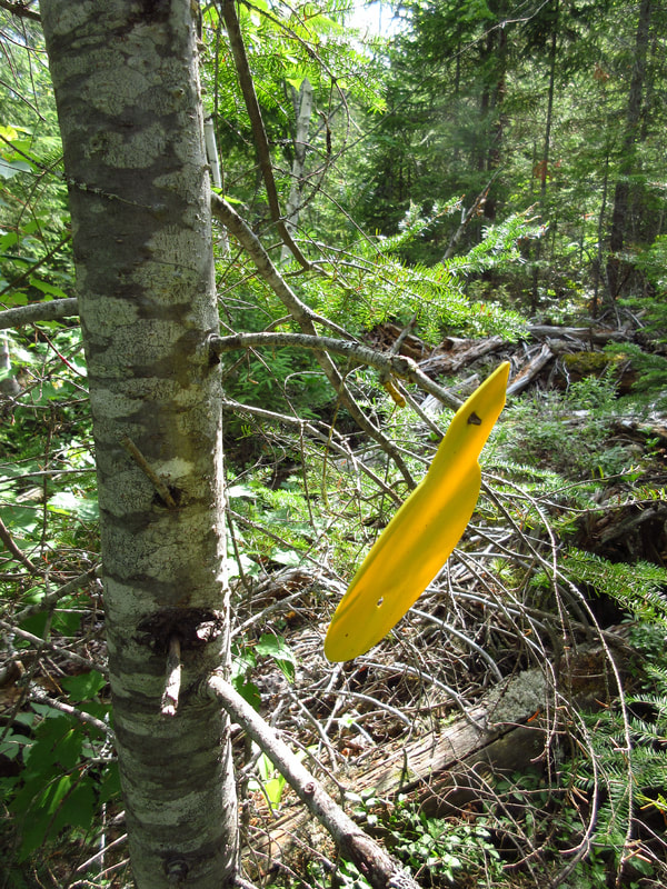
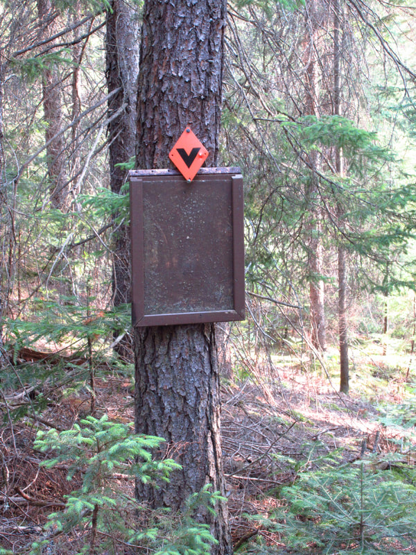
The trail markers were yellow. They too were an indication of how the trail was not well kept. Many markers were on fallen trees and some of them were not even nailed onto anything. This one was just hanging on a branch waiting to either fall off in a storm or get knocked off when the branch got broken by a careless hiker. And this was not a one-off. I saw a number of markers hanging from branches like this throughout the whole trail.
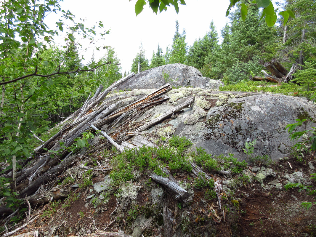
There were places on the trail where you could clearly see where the tornado had gone through years before.
The further we went the more we knew that my mom had made the right decision. The terrain was getting more difficult and the weather was hot and the packs were feeling heavy. We kept thinking that at some point the trail must start going down hill towards a lake. But it was just up and up and up.
Much of the time the vegetation was waist high and sometimes shoulder high. It was getting thicker and harder to see the trail.
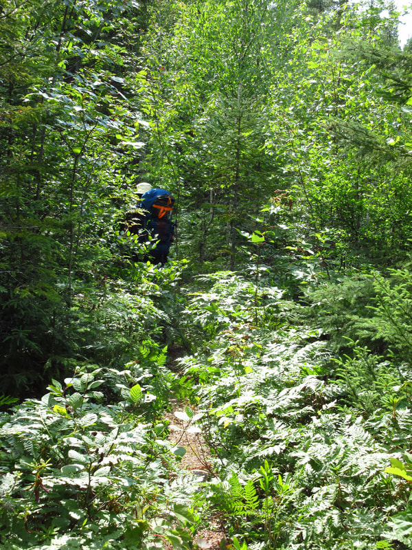
There were many areas that were so overgrown with ferns that you couldn't see your feet as you walked and you certainly couldn't see the trail. We were using our walking sticks to part the underbrush to try to find the trail beneath it. Someone definitely needs to come and do some maintenance on these trails.
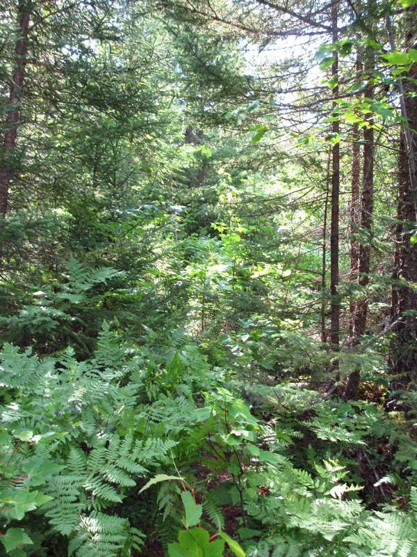
Do you see a trail here? Yeah, neither do I.
Do you see a trail here? Yeah, neither do I.
Every time we thought we were going to be going down hill, we started going back up again. Twice we could see a lake and we were headed towards it, only to be cruelly directed away from it again. I kept thinking that this seems to be the longest 2 km that I have ever hiked. How is it that we aren't there yet? Did we miss it somehow? We were stopping to rest more and more often and we were both getting tired.
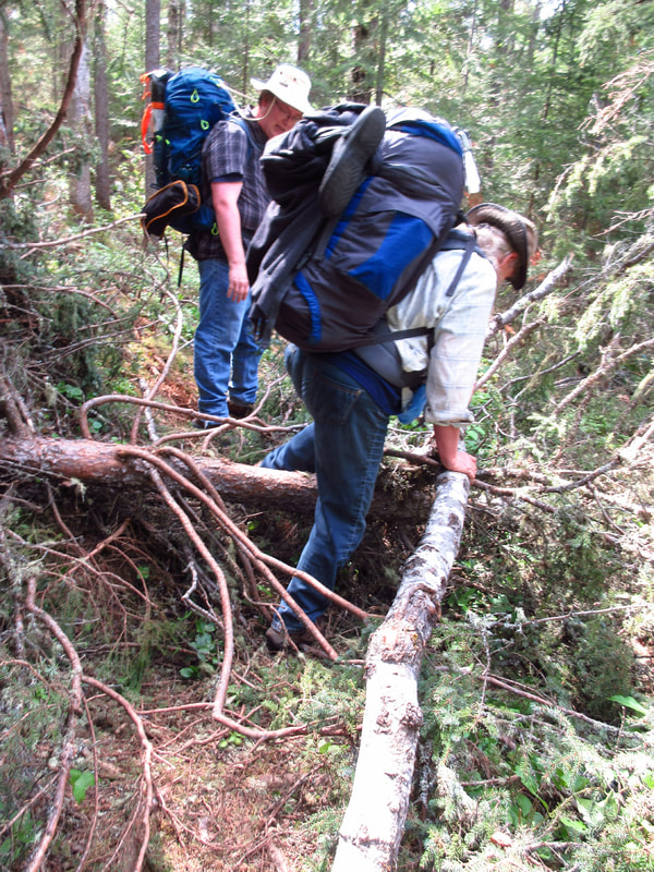
Finally we started heading down hill. However, it was so steep that at one point we had to take off our packs and throw them down over the edge of the rocks and then slide down behind them.
Then, to make matters worse, our tarp fell out of the side pocket of my pack and rolled down the side of the hill. Luckily, it didn't go too far and Carsten was able to climb down to it (barely) and rescue it for me.
Then, to make matters worse, our tarp fell out of the side pocket of my pack and rolled down the side of the hill. Luckily, it didn't go too far and Carsten was able to climb down to it (barely) and rescue it for me.
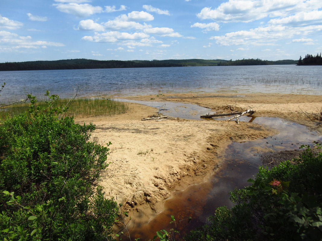
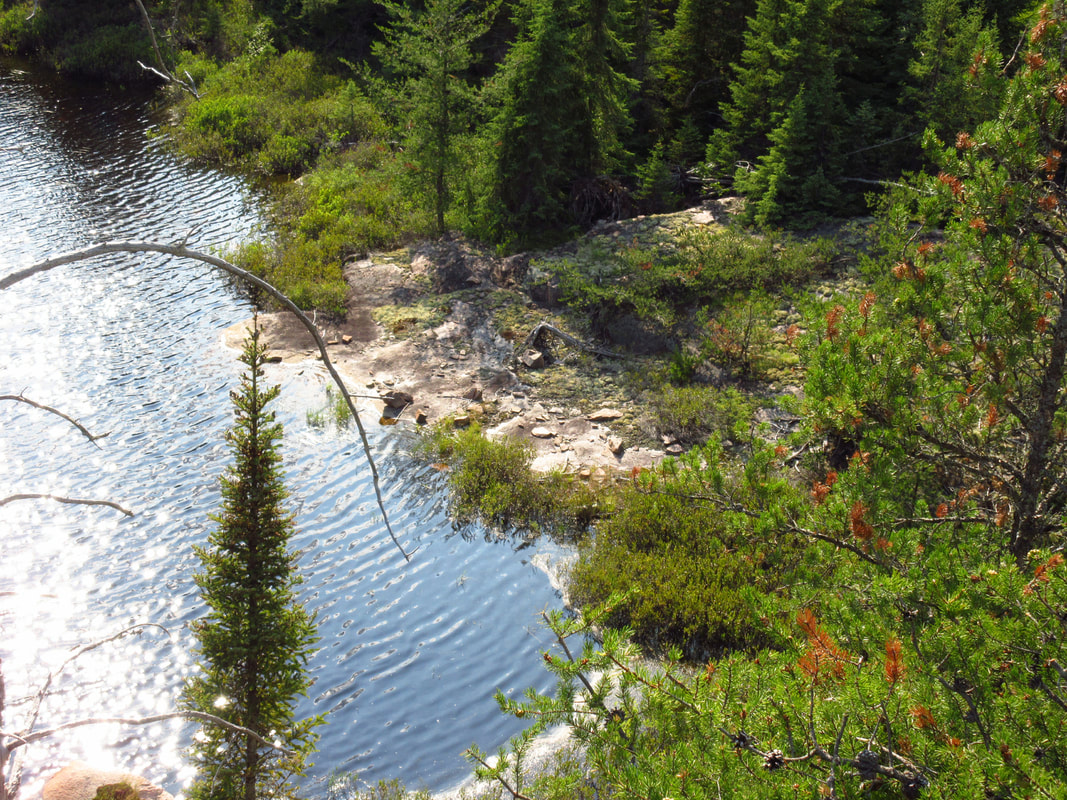
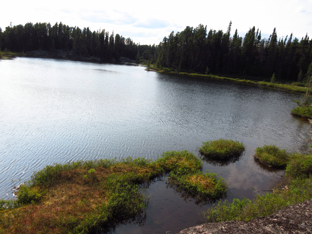
Finally we caught our first glimpse of Burnt Ridge Lake which was the lake that site number 5 was situated on. We figured that it couldn't be too far now. At least we hoped so. By this point we were glad that the park had asked us to switch from site 4 to site 5 because we were not sure we would have made it to site 4.
And there is was! The sign we had been searching for. And of course the sign was upside down and falling off. Would I have expected anything less? But despite being upside down, it was the sweetest sign to see at that point.
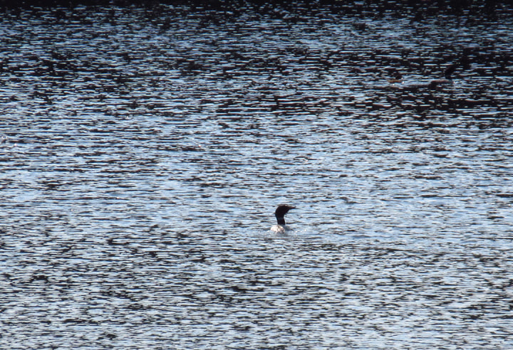
And to welcome us to our site, we were greeted by the call of a loon.
It was 6:15 pm . I texted mom to let her know we arrived and she told us that she got the last site in the whole camp (#43) but that she also got #205 for the next few nights after that (which was the site we had reserved for the day that we were coming off the trail).
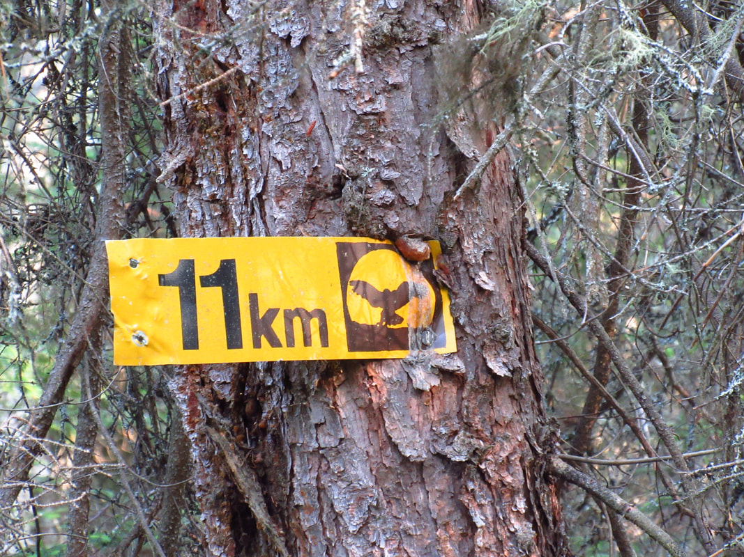
It had taken us just over 3 hours to go 2 km. I was thinking that it didn't bode well for the rest of the trip if we were travelling that slow. Then, as I looked around the site, I saw it. There was a marker in the tree saying that this was the 11 km mark. That explained everything! We had gone 4 km not 2 km! My guessing of the map had been wrong. No wonder it felt like forever to get here!
It had taken us just over 3 hours to go 2 km. I was thinking that it didn't bode well for the rest of the trip if we were travelling that slow. Then, as I looked around the site, I saw it. There was a marker in the tree saying that this was the 11 km mark. That explained everything! We had gone 4 km not 2 km! My guessing of the map had been wrong. No wonder it felt like forever to get here!
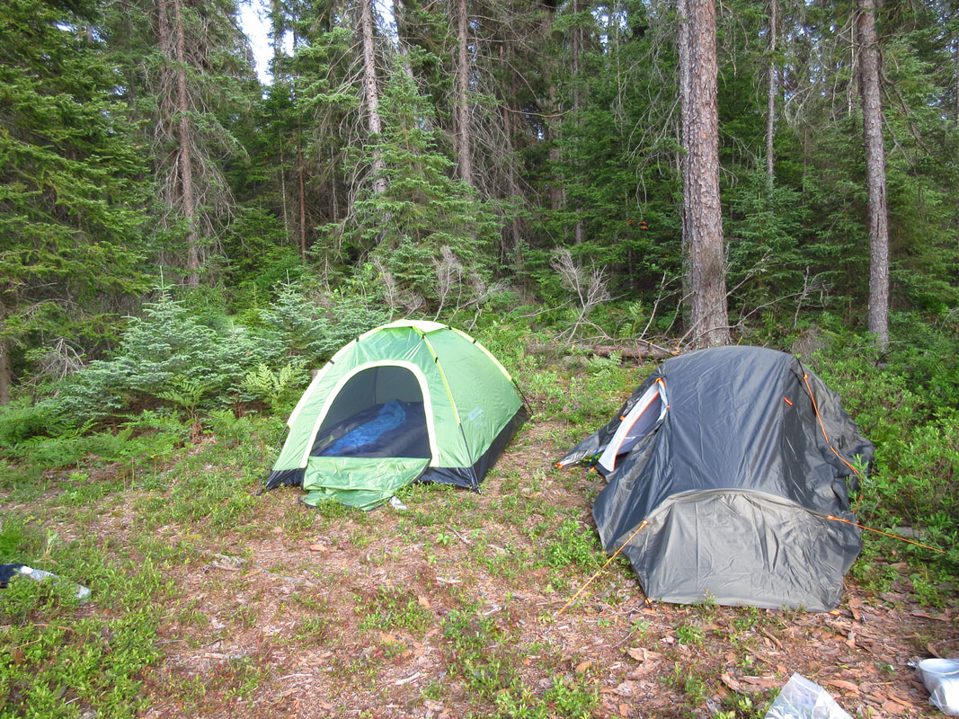
We were happy to be able to take our packs off and look around. The site was small. There was only a small clear area where the tents could go and we would have to try to fit both of them on it.
It was probably a good thing that mom turned back because I wasn't sure that there would have been space for a third tent, even though all of our tents were pretty small.
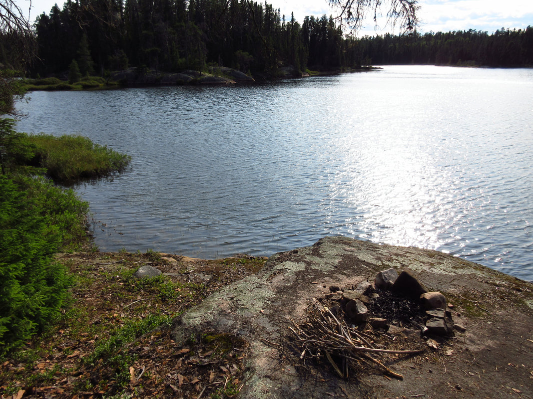
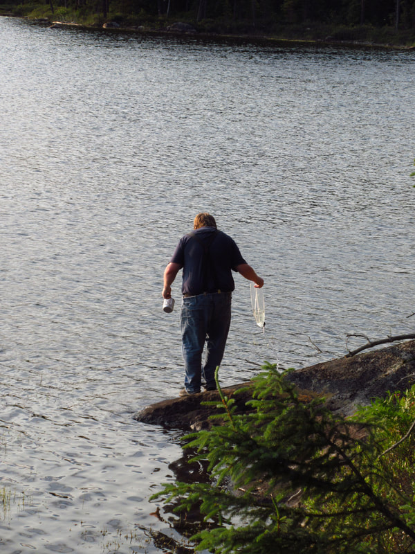
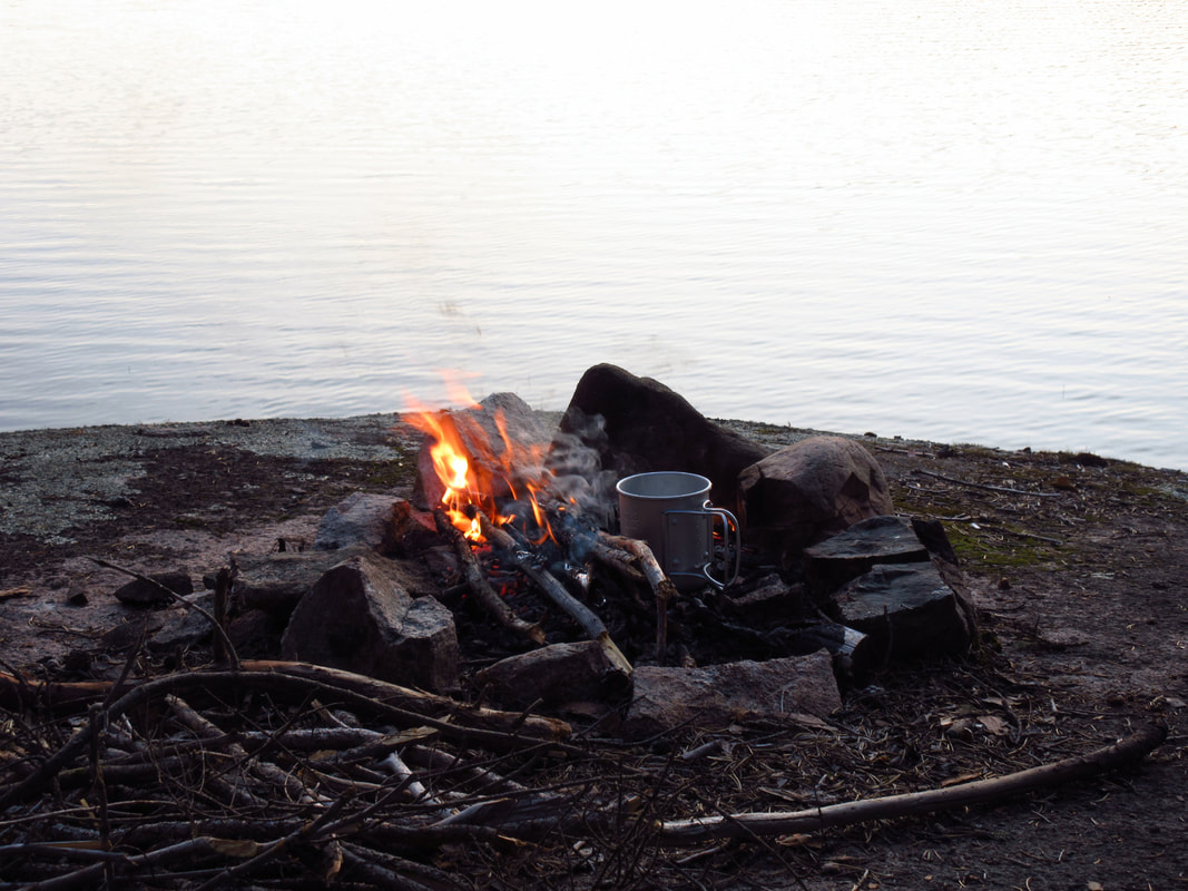
The fire pit was nicely situated on a flat rocky area by the lake. The perfect spot to watch the sunset later. There were 2 logs beside the fire that you could sit on. Direct access to water was not the easiest, but not the worst either.
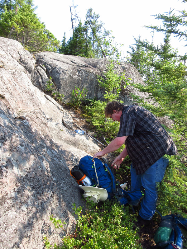
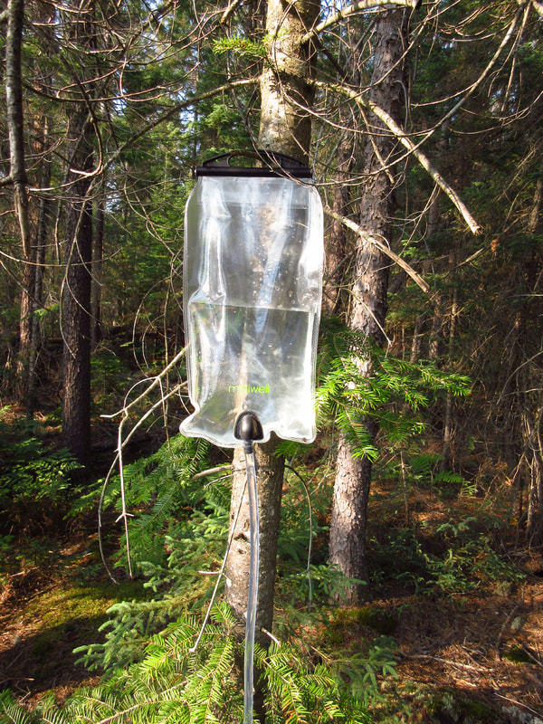
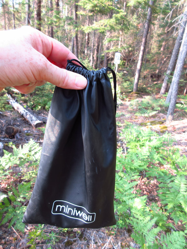
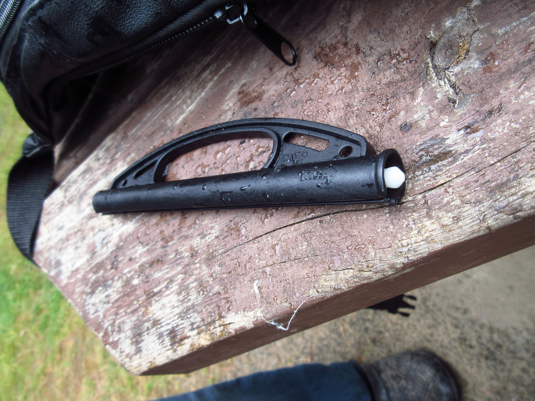
My mom had gotten a new water filtering system as a present and we took it on this trip to try it out. At first we thought we weren't going to like it because the plastic was not the same quality as the Platypus that we had been using in the years past. But there are some advantages that this MiniWell system has that we liked
. For one thing, the water seems to filter a whole lot faster than the Platypus does. Also, it comes with a little jug-like container that has a handle and a lid so that you can carry your clean water with you. This meant that I could bring it into the tent with me at night if I wanted.
. For one thing, the water seems to filter a whole lot faster than the Platypus does. Also, it comes with a little jug-like container that has a handle and a lid so that you can carry your clean water with you. This meant that I could bring it into the tent with me at night if I wanted.
 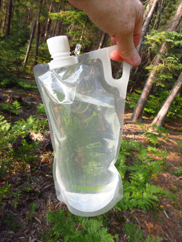 | 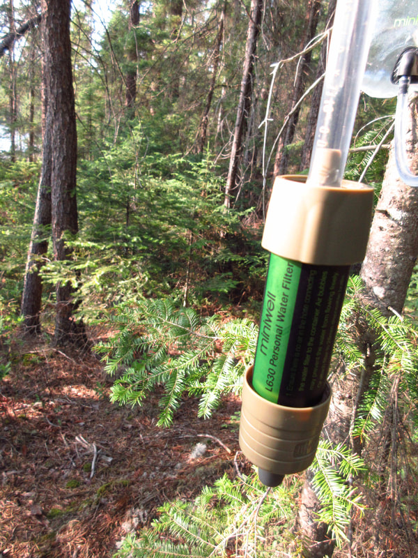  |
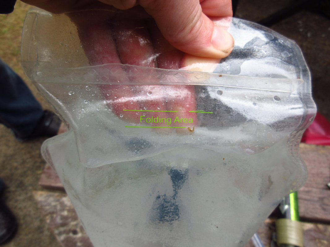
It can be a little tricky to get the seal (which also acts as a handle) onto the top of the dirty water bag. But if you line it up properly with the green lines on the bag and if you don't over fill it, then it just slides on there fairly easy. The clean water section holds only half the amount of water that is in the dirty water section. But it doesn't seem to matter really. Since it filters fast, you can refill the clean water quite quickly.
 |  |
Once the tents were up, Carsten set about getting the water set up. I looked for a Thunder box to use. There were none. So, I found a nice log that would do us for a bathroom instead. It wasn't as good as a Thunder box but it would have to do.
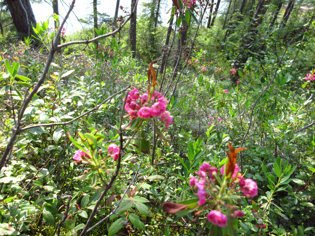
Once we were all set up, we had some time to do what we came here to do.....relax and enjoy the nature around us. There were pink flowers growing along the perimeter of the site.
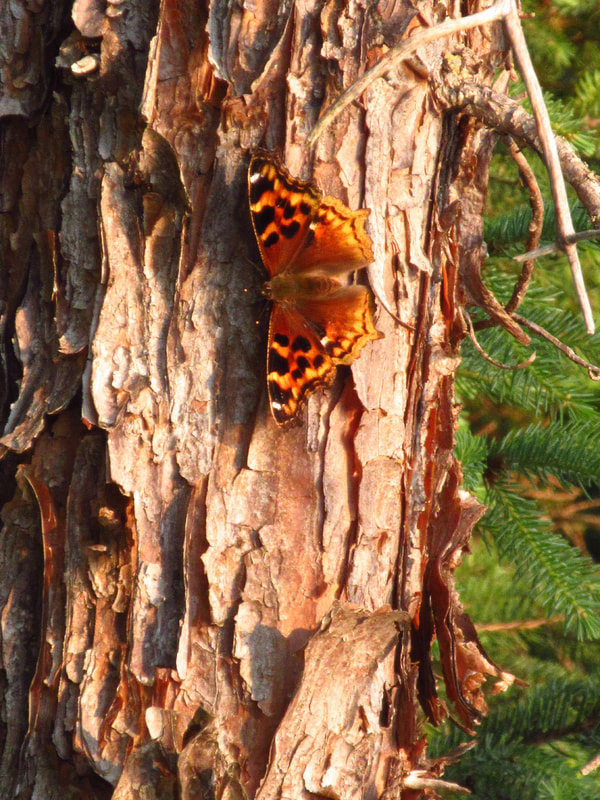
Big orange butterflies were flying and landing everywhere.
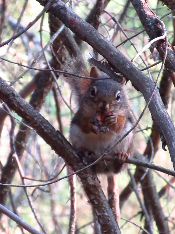
A squirrel was munching on some pine cones.
And beautiful red dragonflies were flitting about all over.
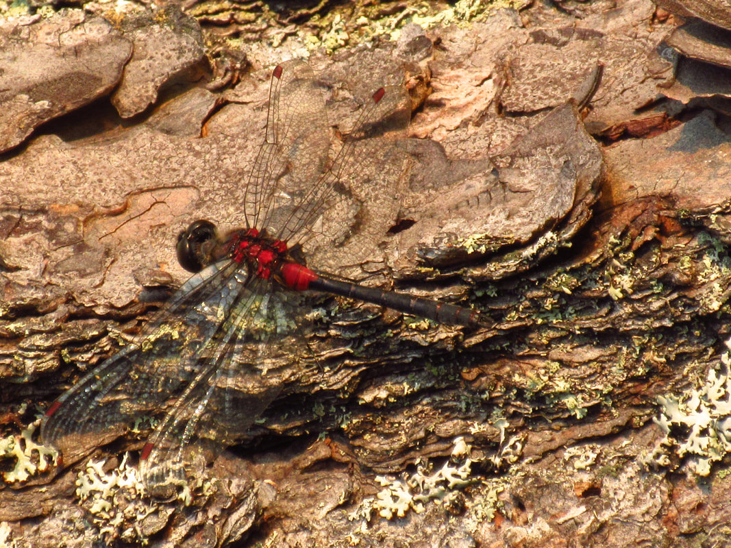
We were happy to see the dragonflies because it meant that maybe there would be fewer of the deer flies that had been plaguing us all day.
We started a small fire in the firepit. Just enough to burn our garbage.
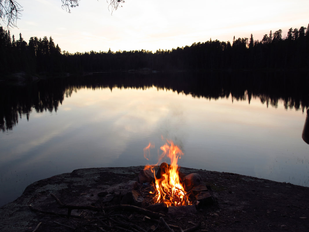
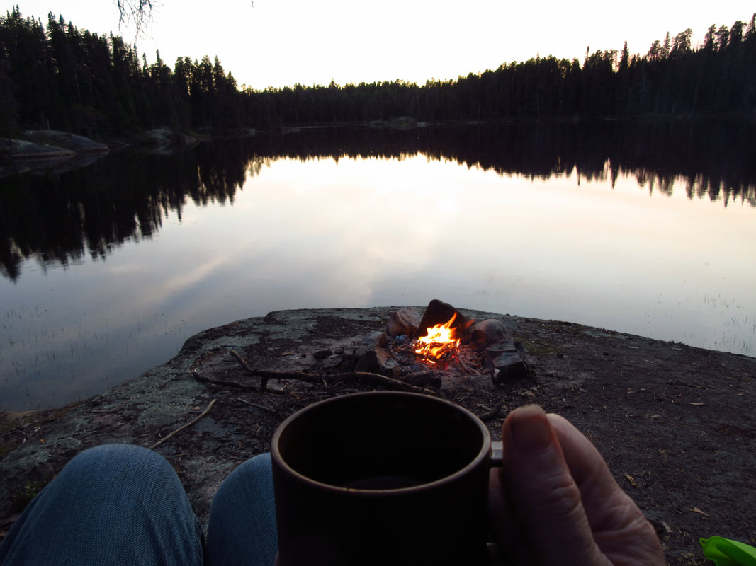
When the flames got a little lower we were able to cook our supper and boil some water for coffee and hot chocolate.
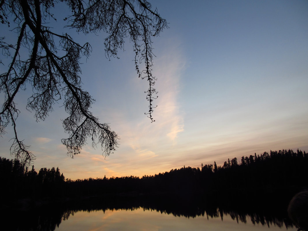
Then we sat and listened to the birds and the frogs as they started their chorus of evening songs.
We had our food bags up in the tree and we were in our tents by 9:45 pm; just as the first mosquitoes started to arrive. The sounds of the swarms of mosquitoes buzzing outside our doors was something else. But we were safe inside our tents and drifting off to sleep. It had been a long day and we were both tired. It had been the longest 2 km hike we had ever done!
 RSS Feed