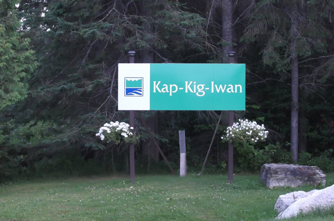
Someone please help this park! Kap-Kig-Iwan has some gorgeous scenic lookouts and some great hiking trails but the facilities and structures are falling apart. This park needs and is deserving of an infusion of money. Anyone want to start up a "Friends of Kap-Kig-Iwan" group like so many other provincial parks have?
This is a very small park and it feels like it gets over looked a lot. It is not even in the online reservation system on the Ontario Parks website (although the website does say that they will be adding this park to the reservation system as of 2020). It is mainly run by the township and when I called the first number listed on the website just before I left to ask if there were any sites available, I got the township office and had to call back on the second line (705-544-2050). There are about 61 sites in the park and when I asked if there were any sites still left open they said "Yes. 61" Sounds like I might have the whole park to myself!
This is a very small park and it feels like it gets over looked a lot. It is not even in the online reservation system on the Ontario Parks website (although the website does say that they will be adding this park to the reservation system as of 2020). It is mainly run by the township and when I called the first number listed on the website just before I left to ask if there were any sites available, I got the township office and had to call back on the second line (705-544-2050). There are about 61 sites in the park and when I asked if there were any sites still left open they said "Yes. 61" Sounds like I might have the whole park to myself!
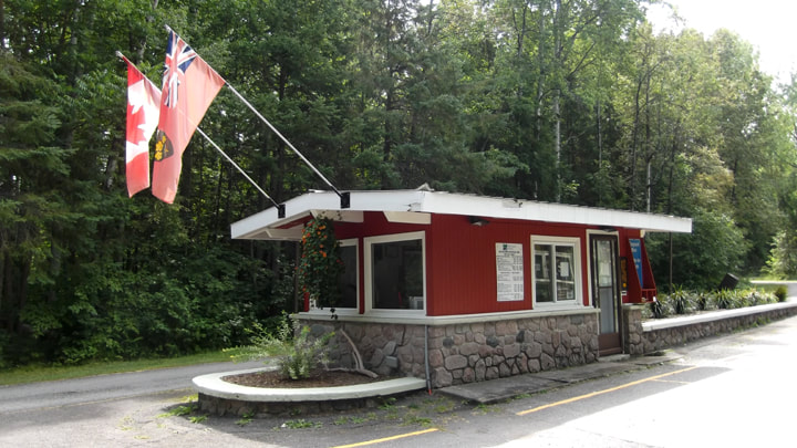
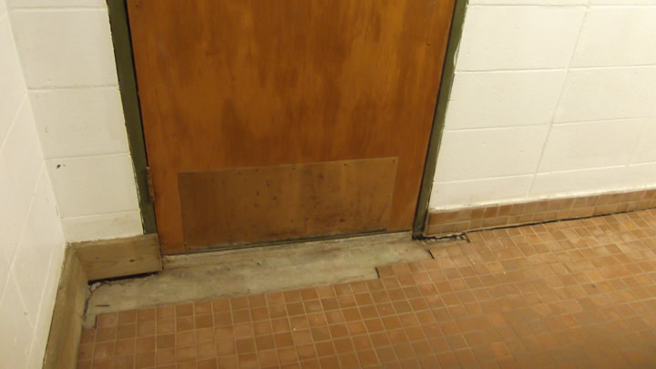
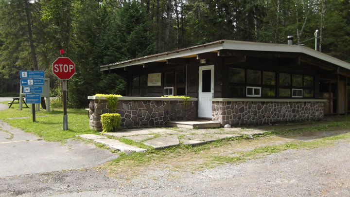
I pulled in on a Friday evening just before the staff was ready to go home for the night. The gatehouse is a tiny but cute little structure just off of Hwy 11 in the town of Englehart. I told the girl at the gatehouse that I would be staying 2 nights. She pulled out some forms to fill out and explained that they had no internet here, therefore, no computer system to pull up my information based on my phone number like the other parks do. She seemed apologetic about it, but it didn't matter to me.
Unfortunately, no internet also meant no debit machine. And I hadn't had time to go get money out of my account before I left. She was completely understanding of this (I am sure this happens more often than she would like here) and when I said that I would just run to the store that I passed about a kilometer back and get money from the ATM there, she said not to worry about it. She was about to go home and wouldn't be there by the time I got back. Instead, she said that I could pay the next day and that if no one was in the office, there were self serve envelopes to put the money in. This was easier for both her and I so we agreed to that. Besides, she already had my license plate number and address so she could track me down if I didn't pay up. She told me I could choose any site I wanted and to just put the permit on the post.
Unfortunately, no internet also meant no debit machine. And I hadn't had time to go get money out of my account before I left. She was completely understanding of this (I am sure this happens more often than she would like here) and when I said that I would just run to the store that I passed about a kilometer back and get money from the ATM there, she said not to worry about it. She was about to go home and wouldn't be there by the time I got back. Instead, she said that I could pay the next day and that if no one was in the office, there were self serve envelopes to put the money in. This was easier for both her and I so we agreed to that. Besides, she already had my license plate number and address so she could track me down if I didn't pay up. She told me I could choose any site I wanted and to just put the permit on the post.
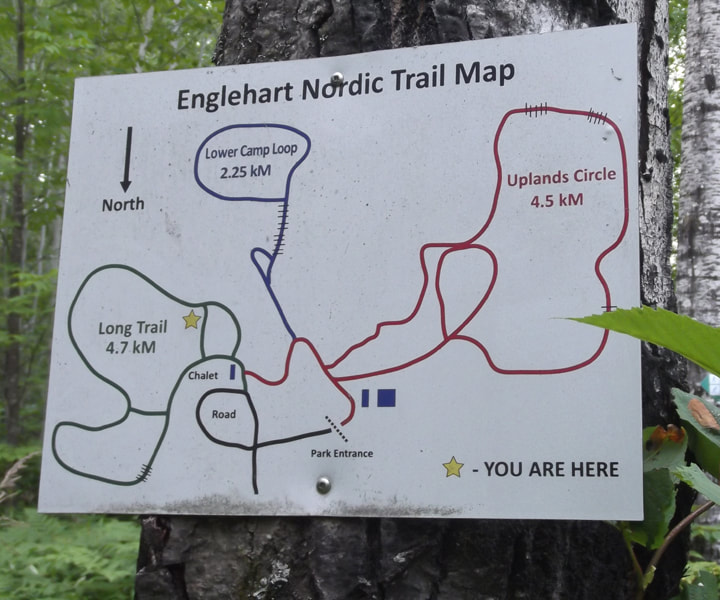
She handed me a colourful, map of the campground, complete with cute cartoon characters. She also apologized that everything on it was so tiny. It was a shame that it was so tiny because the map was actually well done and I could tell that a lot of effort had gone into designing it.
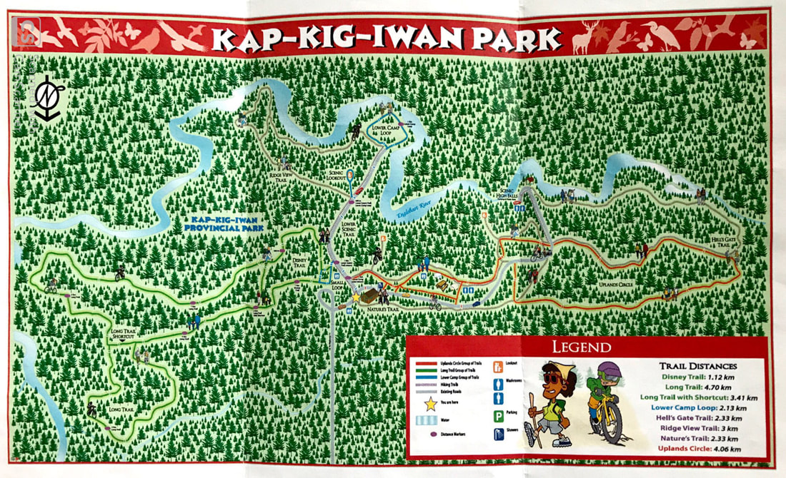
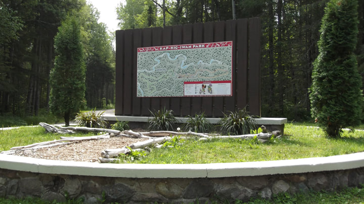
She did point out though, that there was a giant version of the map posted up on a billboard just on the other side of the office. So, if I couldn't read something then I could read it better from there. Neither the small, nor the large map showed the individual campsites on it though (I made my own versions when I got home and posted them here. Perhaps once they get on the online reservation system there will be better maps of the individual sites)
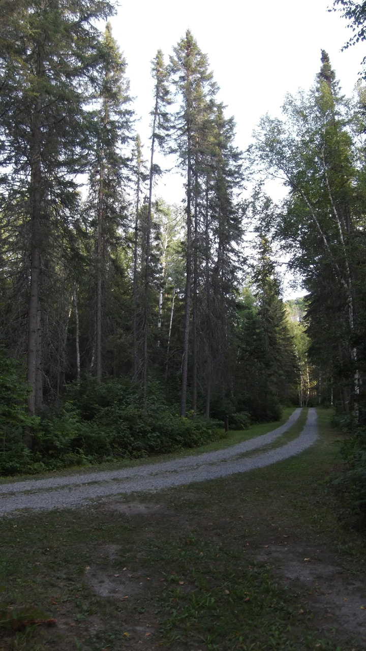
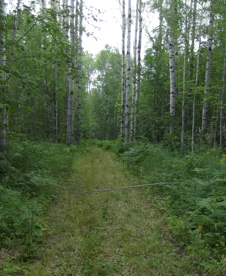
The tenting area is down in the section called the "Lower camp Loop" (There is a section for RVs up closer to the office). At first I wasn't sure I was going the right way. Especially when I came to a rather steep hill that was a bit washed out and had suffered greatly from frost heaves over the winter. This section of the road really needs to be paved or at the very least leveled out.
I drove around the entire loop looking for the best one. There was only one other camper on the campground and they had site number 11. (Guess I didn't have the whole park to myself after all, ah well). I chose site number 5 and noticed that the post for putting your permit in had seen better days.
I drove around the entire loop looking for the best one. There was only one other camper on the campground and they had site number 11. (Guess I didn't have the whole park to myself after all, ah well). I chose site number 5 and noticed that the post for putting your permit in had seen better days.
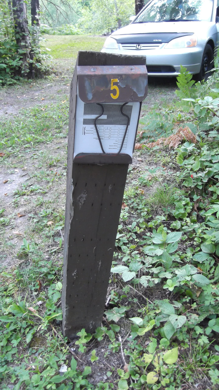
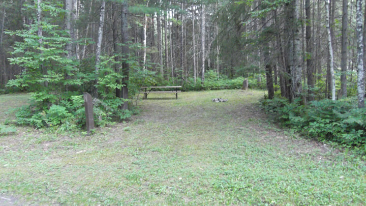
I chose site number 5 because it was a very big site. It was nice and flat and open.
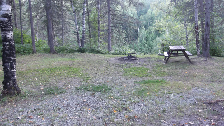
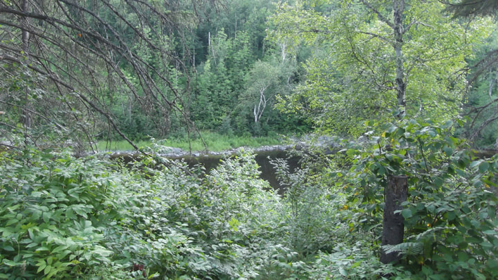
And it had one of the better views of the Englehart River in the ravine down below. None of the sites had a fantastic view of the river, but at least I could see some of the river from here.
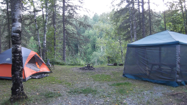
I set to work putting up my tents before it got too dark and before the mosquitoes got bad.
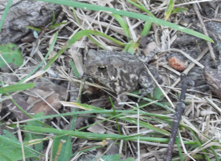
A little toad came to watch me as I worked.
After setting up and grabbing a quick bite to eat, I decided I wanted to walk the loop and look for the water faucets and the bathrooms. The map didn't show either of these on it. I looked down the road to see if I wanted to go right or left. I noticed how very tall the trees were here. My camping neighbour had already passed by towards the left (presumably looking for or going to water/bathrooms like I was). I figured he might already know the right direction for these things so it would probably be smart to just go in the same direction he had gone. I grabbed my water container and headed to the left.
| I wasn't sure what to make of some of the sites. Some of them were long and narrow with no fire pits; as though intended for an RV. But there was no electricity and I had been under the impression that this section was for tents only. Maybe I was mistaken on that point. Although the sites looked very well cared for, I noticed most of the permit posts were falling apart and needed numbers repainted on them.  | 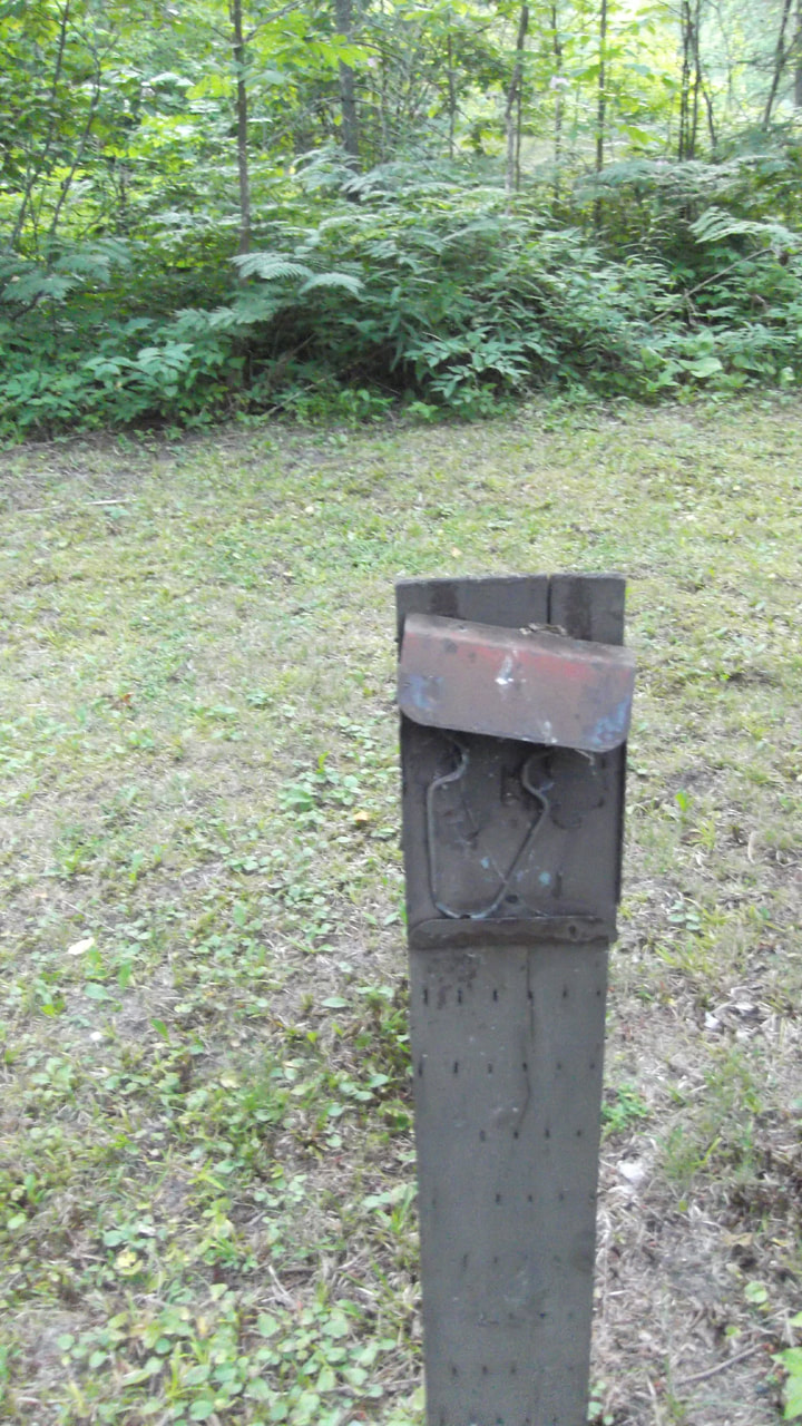 |
Other sites were very spacious and would certainly hold a number of tents. They were great sites for camping.
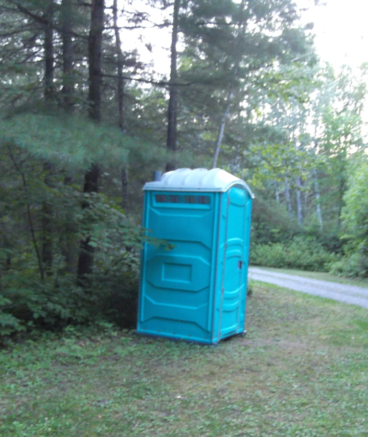
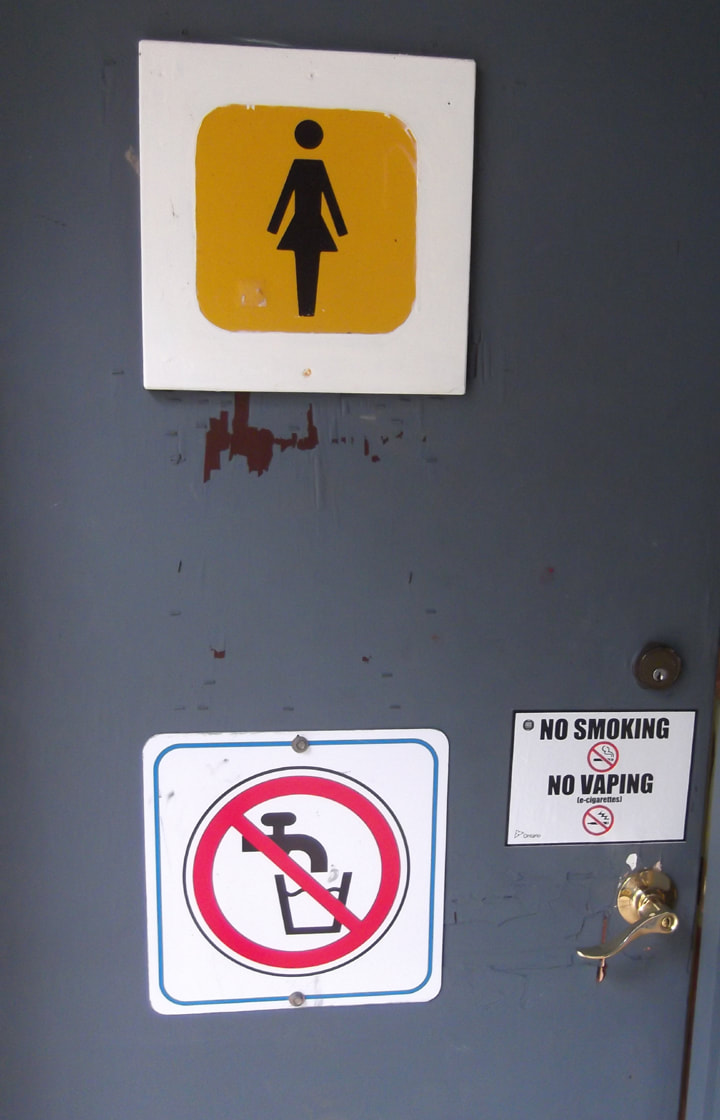
My search for a bathroom resulted in locating a port-a-potty. Definitely not what I was expecting. It was the only one on the entire loop. It was clean though and didn't smell bad like many of those vault toilets do so I could count my blessings there. I was just thankful that there wasn't a whole bunch of people camping here at the same time or the line up for the port-a-potty could get lengthy and uncomfortable.
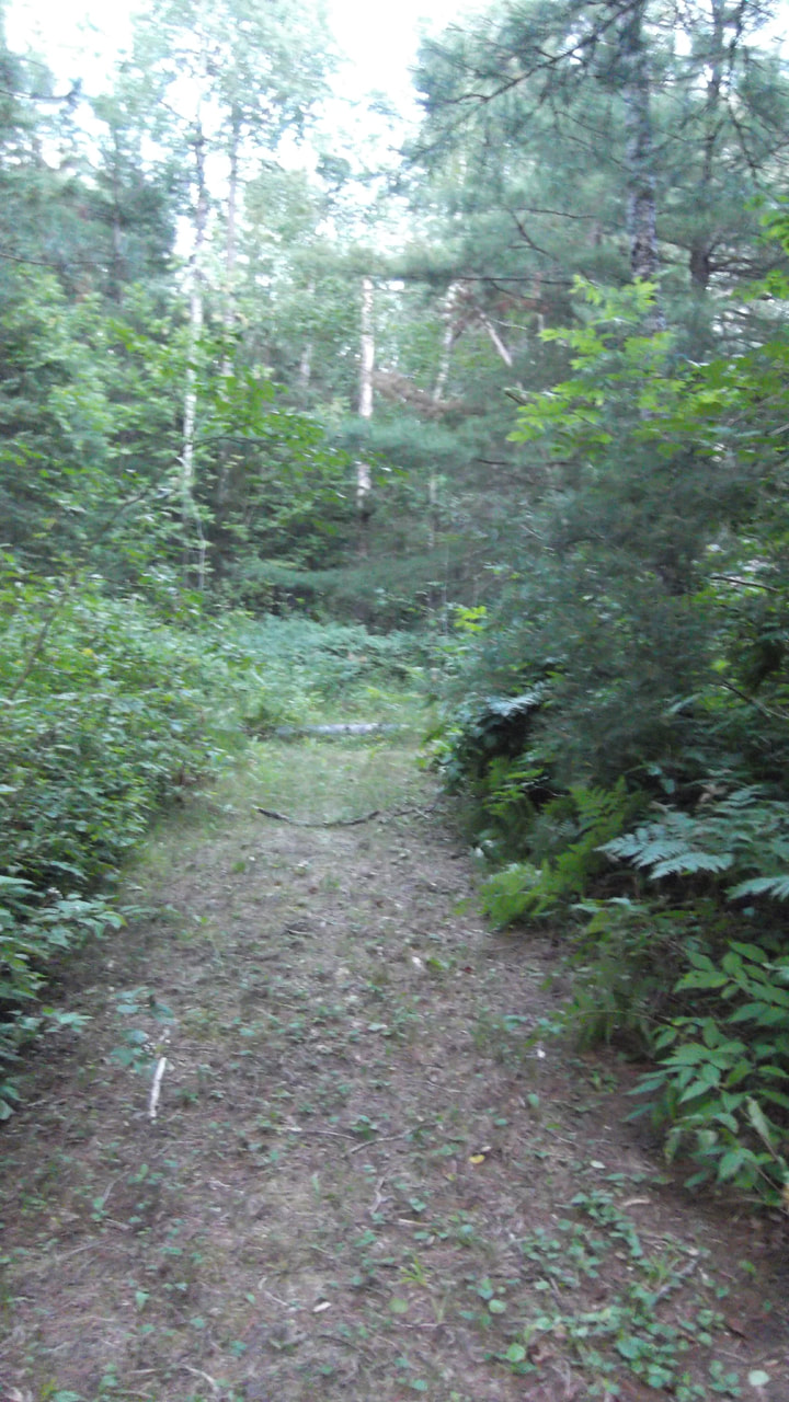 | I had almost completely finished walking the loop when I could see a building in the center of the loop. I wondered what it was and how to get to it since there was a bunch of trees between me and it. After a bit of searching I discovered an over grown road jutting in to the center of the loop and subsequently to the building. The further down the road I went the more over grown it became, until I was climbing over deadfall and the ferns were whipping at my pant legs. 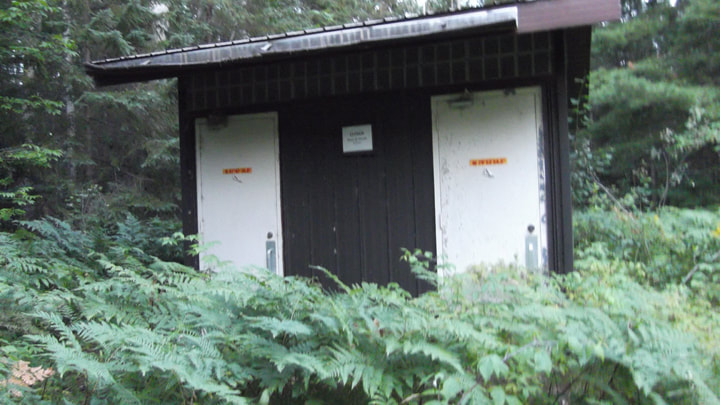 And what was this mysterious building? It was, at one time, the bathroom for this part of the campground. One look told me that this building hadn't been used in a very long time and there was a sign on it saying "Closed. Please Do Not Use". I wondered if it was closed because it was falling down or because there was no water. I wondered this because I realized that I hadn't found a single water faucet on my search. So I had no water. |
Before bed I texted my family to let them know that I had arrived safe. Cell signal is spotty here so sometimes messages would go through right away and other times it would take some time. In one of my conversations my mom said that she and my dad were going to meet up with me to do some camping too. But instead of camping here they wanted to try out Esker Lakes Provincial Park. So it looks like I was only going to be spending one night here instead of two. So it worked out that I hadn't paid for the site yet.
I didn't have a campfire because I hadn't bought any wood and the office was closed. There didn't seem to be a park store in the first place. I don't know if they even had any wood for sale, come to think of it.
It is so quiet and peaceful here, which isn't surprising considering there is hardly anyone here. I did end up with more neighbours who pulled in to the site next to me at about midnight. But all in all, there were not a lot of people here. It was almost as quiet as it is when I am backpacking. I was actually thinking that most backpackers wouldn't mind this at all. We are used to not having a bathroom, running water, or people when we are in the back country. Not much different.
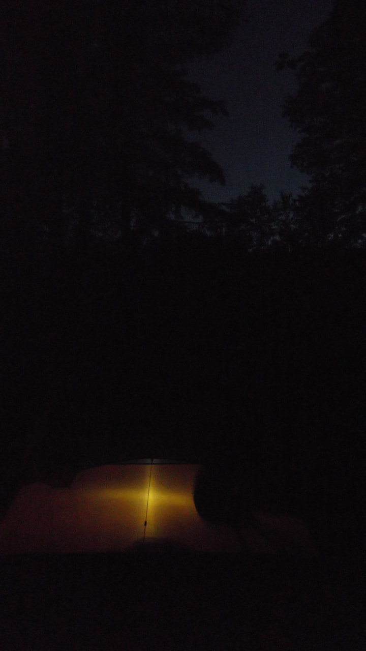
The moon came out and shone very brightly and the sound of the river was soothing. It was a gorgeous night for camping.
I didn't have a campfire because I hadn't bought any wood and the office was closed. There didn't seem to be a park store in the first place. I don't know if they even had any wood for sale, come to think of it.
It is so quiet and peaceful here, which isn't surprising considering there is hardly anyone here. I did end up with more neighbours who pulled in to the site next to me at about midnight. But all in all, there were not a lot of people here. It was almost as quiet as it is when I am backpacking. I was actually thinking that most backpackers wouldn't mind this at all. We are used to not having a bathroom, running water, or people when we are in the back country. Not much different.
The moon came out and shone very brightly and the sound of the river was soothing. It was a gorgeous night for camping.
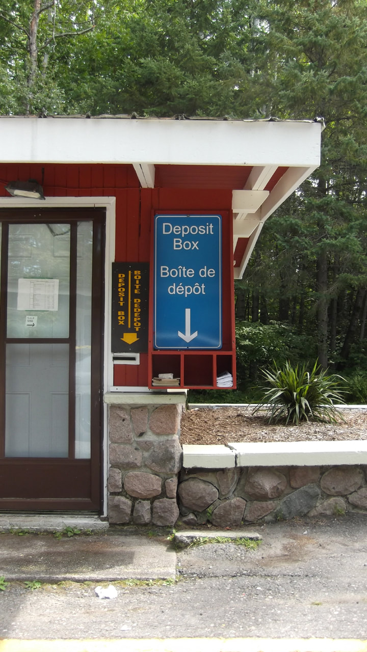
In the morning, after breakfast, I made a quick trip to the store with the ATM and got the money to pay for the night I had just spent here. No one was at the office when I got there so I put the money in the self serve envelope and placed it in the deposit box. I was just about to leave when the park ranger truck pulled up and two of the staff members were inside. I explained that I had paid for the night and put it in the deposit box and they thanked me for that. Then I asked them if they had any of the passport stickers that I had been collecting. But unfortunately this park doesn't have a sticker even designed for it yet (another example of how this park seems to be overlooked by the powers that be). Then I asked them what time I needed to be off the site by because I had some time to kill before meeting up with my parents at Esker Lakes. I was surprised that their answer was " Leave whenever you want". They seem completely unconcerned about how long I stayed on the site for. I guess when there is not a high demand for sites, the level of worrying about how long one stays is very much diminished. Needless to say I was happy with that answer.
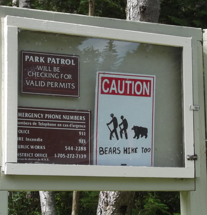
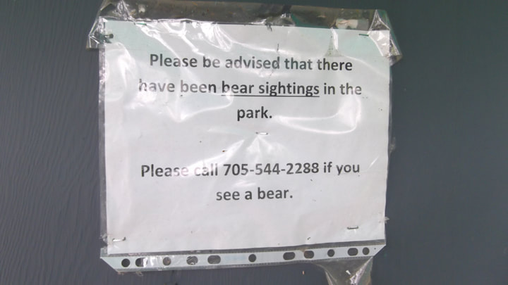
Next on my list of things to do was to explore the park a little and check out some of the trails and scenic look outs. This park seems to have quite a few of these. I noticed, as I was leaving the office, a sign that said "Caution. Bears Hike Too". While I realize that this sign is supposed to be a warning sign, I found it to be somewhat amusing and it made me smile. I dunno...anyone else find this amusing or is it just me? I just pictured this couple hiking the trails when along comes a bear and says "It's a lovely day for a hike. Mind if I join you?" And then off the three of them go hiking through the woods checking out flowers and doing some bird watching together.
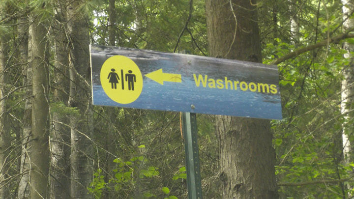
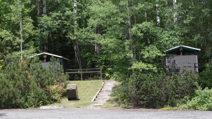
Just when I thought the park only had a port-a-potty for a bathroom I discovered the comfort station up near the RV campsites.
The comfort station is a cute little stone building.
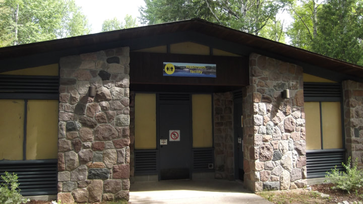
I noticed the sign on the door indicated that there was no drinking water here either.
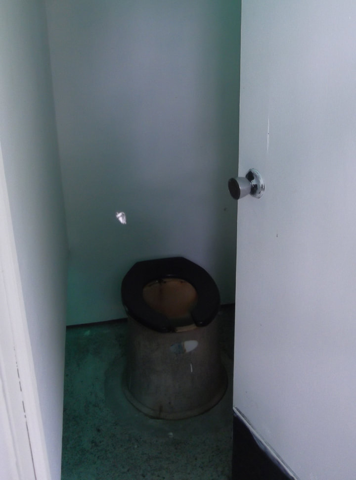
| The outside of the building was nice looking and nicely landscaped. The inside though, could do with some updating. It made me think, once again, how much this park could really use some money. I was seeing all over the place where this need was great, but at the same time, they did marvelously with what ever funds they do have. The park signs were all new and beautiful. The grounds were well kept. The campsites were well kept. There is love and care going into the place, It's just that you can tell that there is no money available to bring this park out of the past and into the present. | 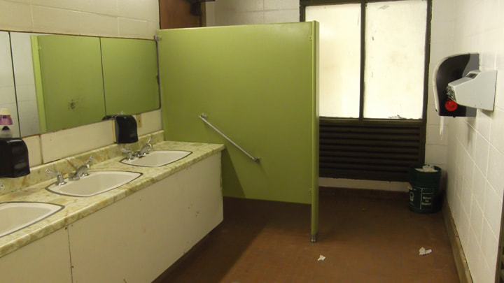 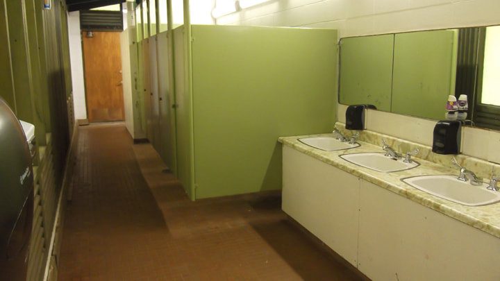 |
The showers were just stalls with slated closet doors on them. The tiles inside seemed relatively new but the doors and the floors were calling out for some help.
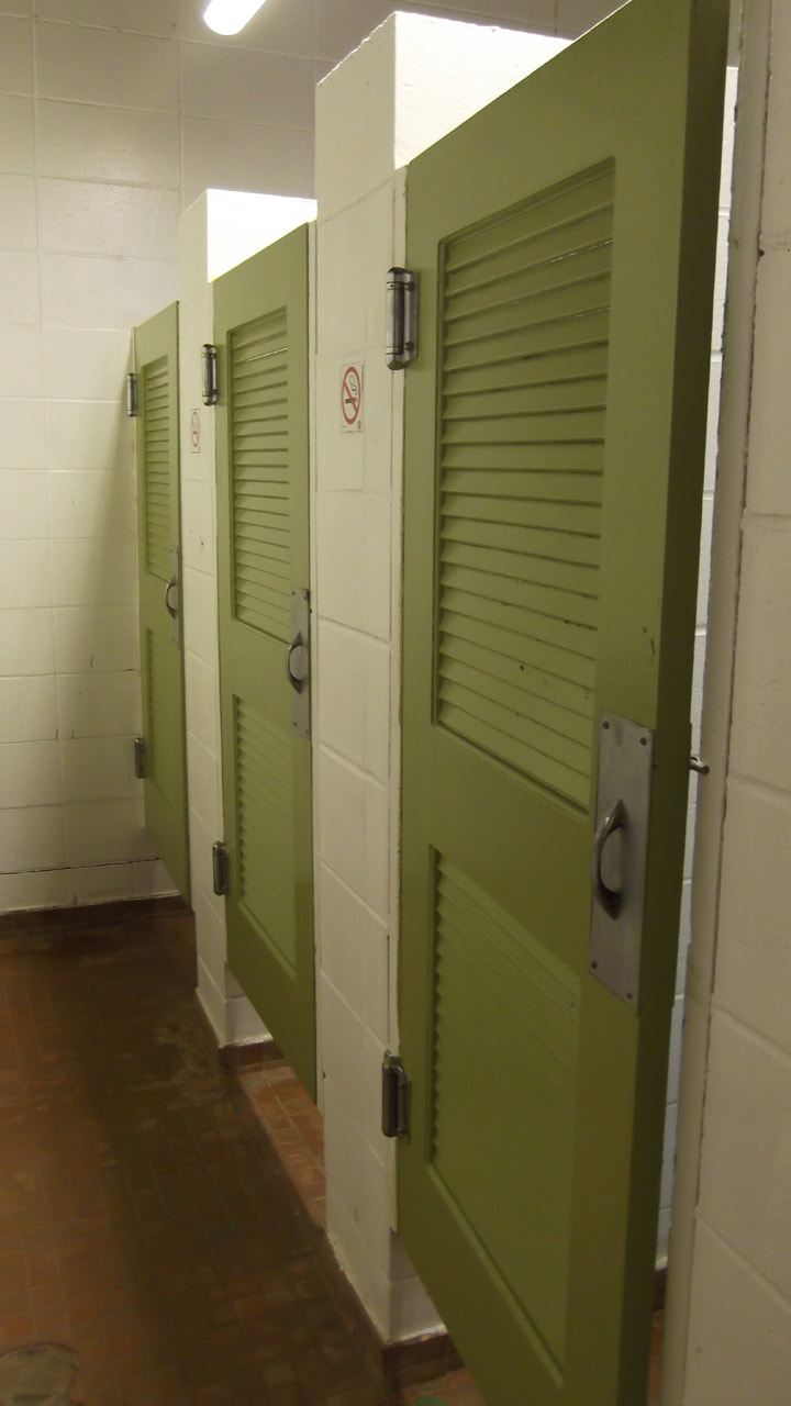 | 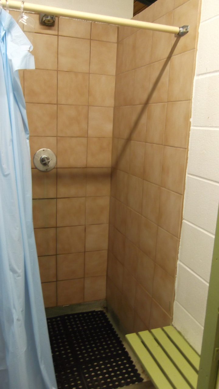 |
The floors in particular are pretty bad off and need re-tiling.
Right outside the comfort station is the path to one of the scenic lookouts.
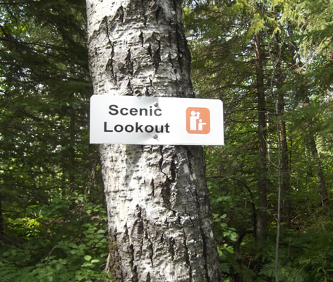
The path is actually a road and you can drive a car right up to the lookout.
There is a picnic table there in the event you would like to have lunch at the look out.
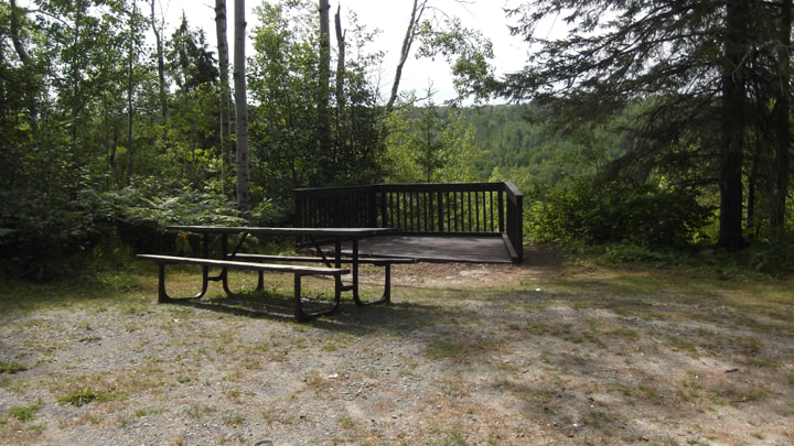
And the view is very nice.
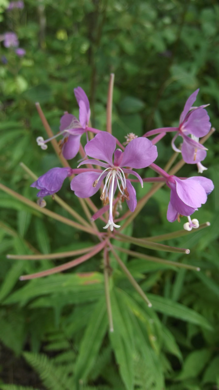
The Fireweed flowers were all in bloom.
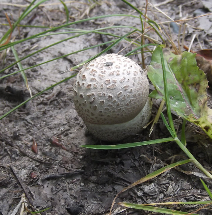
And Puffball mushrooms were growing here and there.
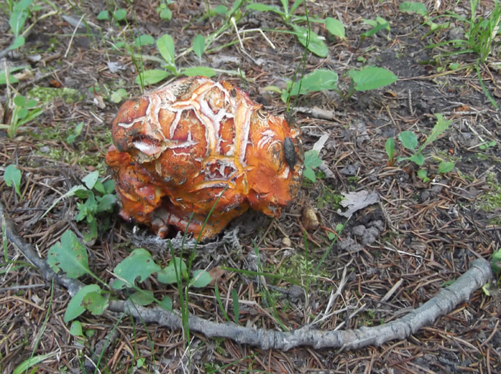
And then I came across this strange mass of orange fungi growing on the ground. I had never seen anything like it before. Once I got home I submitted the photo to iNaturalist.org for identification. I am told this is a Lobster Mushroom.
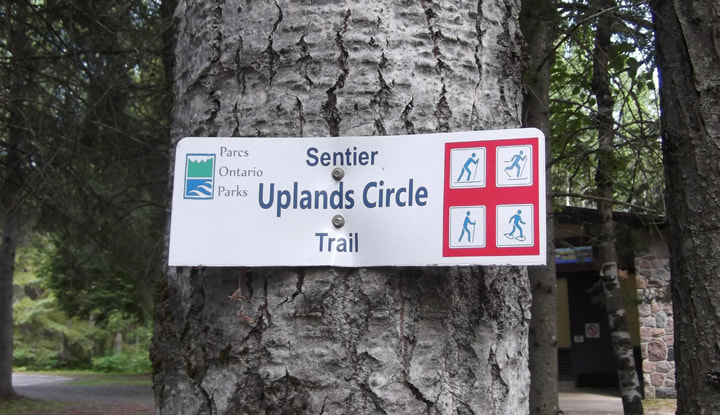
From comfort station you can find one of the trails to the Uplands Circle hiking trail. I didn't get a chance to hike this trail because my time was limited and this is one of the longer trails.
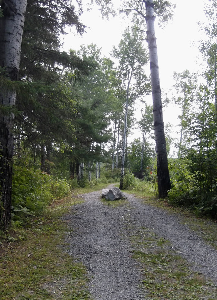
I hopped in the car and drove down the road to the next scenic lookout. The second scenic lookout also has a road leading up to it but there is a boulder in the middle of it so you can't drive right up to it.
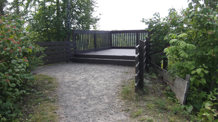
The railing for the scenic lookout is similar to the last one, but there was no picnic table at this one.
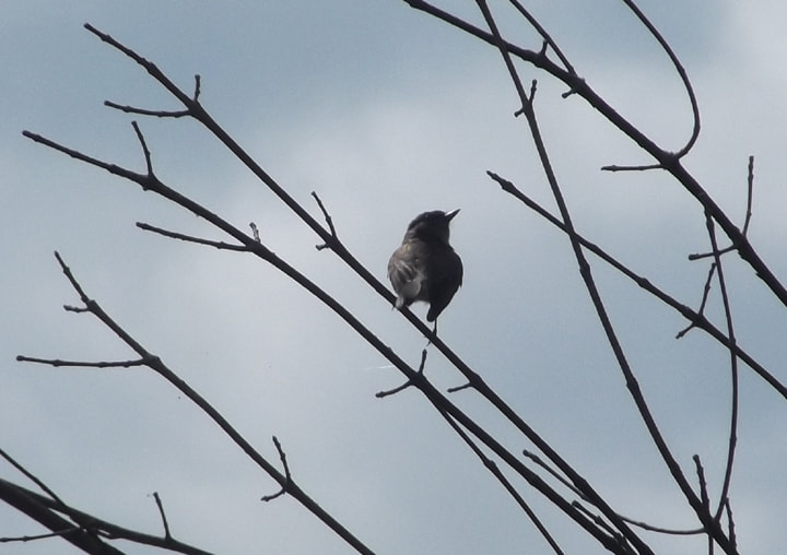
A raven joined me in looking out over the horizon from the lookout.
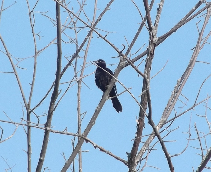
Someone had left some birdseed on the railing for the birds.
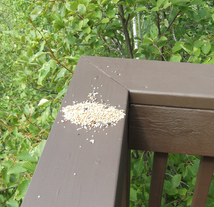
But the birds seemed more interested in the berries in the tree.
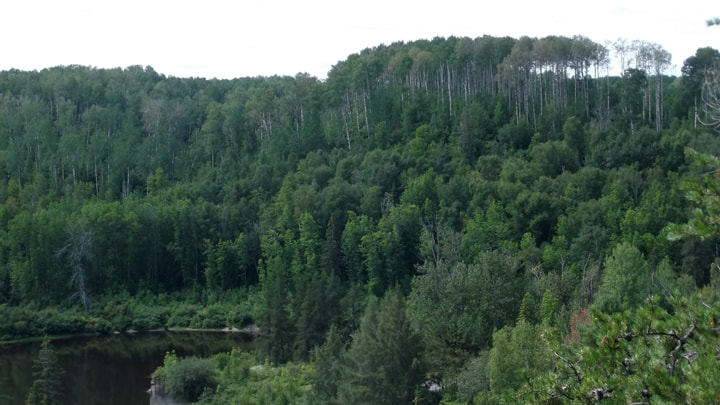
I noticed that the some of the trees here were not only tall, but had no branches or leaves except at the very top.
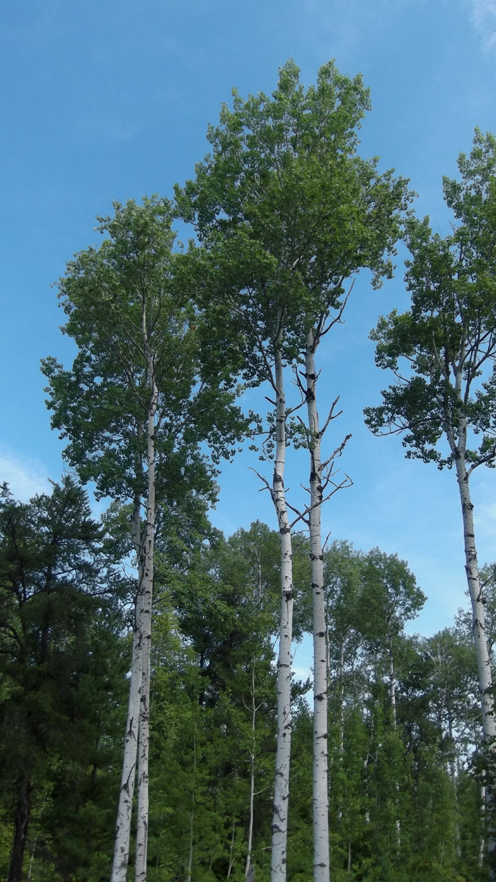
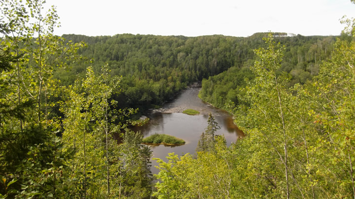
And when I looked out over the ravine I could see more of these trees standing much taller than all the other trees in the distance.
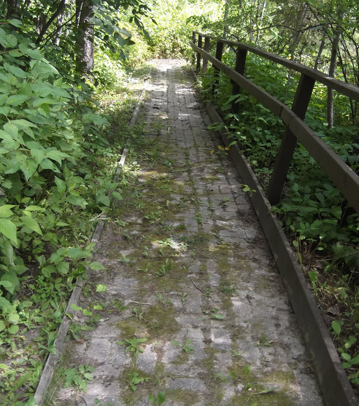
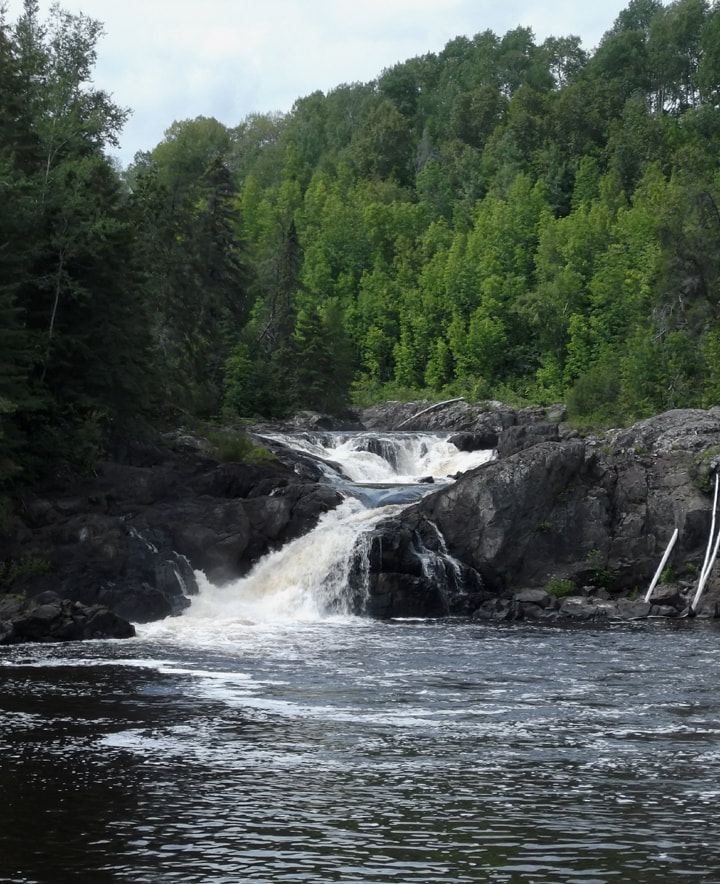
Down below I could see some falls and a long wooden bridge.
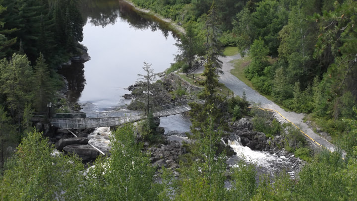
With a closer look at the bridge I could see that, unfortunately, the bridge was broken.
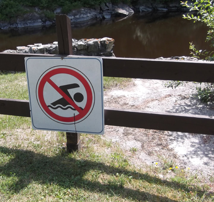
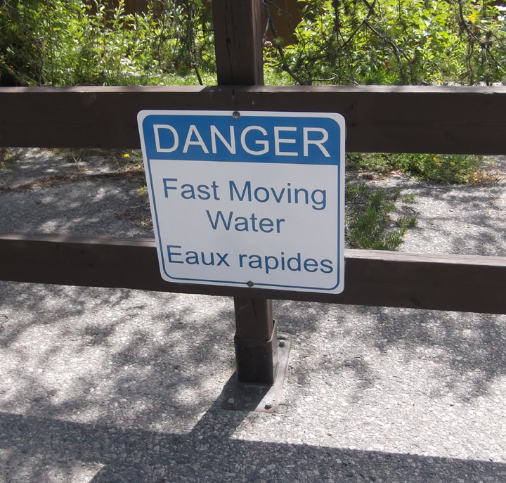
I got in the car again and drove further down the road. I came to a parking lot and parked the car and got out. I was at the beginning of High Falls Trail. Another couple was there too and they began walking the trail. I stayed behind to look around. There were multiple signs telling people not to swim here.
 |  |  |
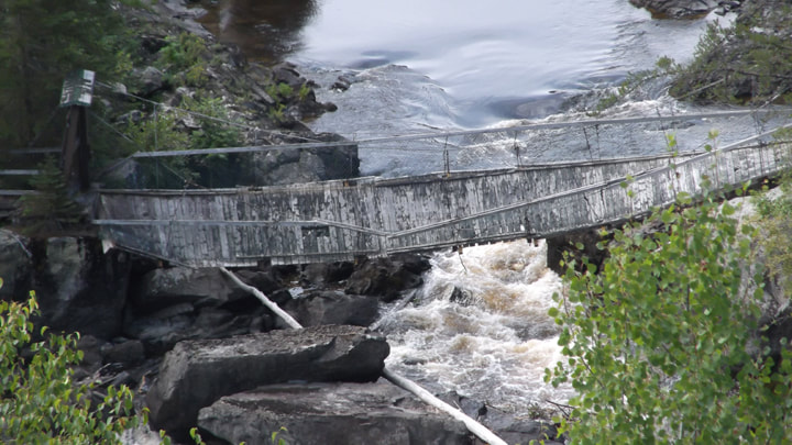
And there was the broken bridge that I had seen from the lookout up above.
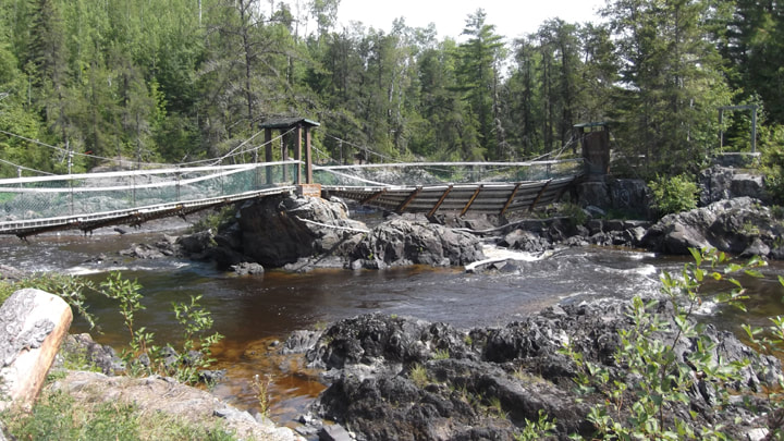
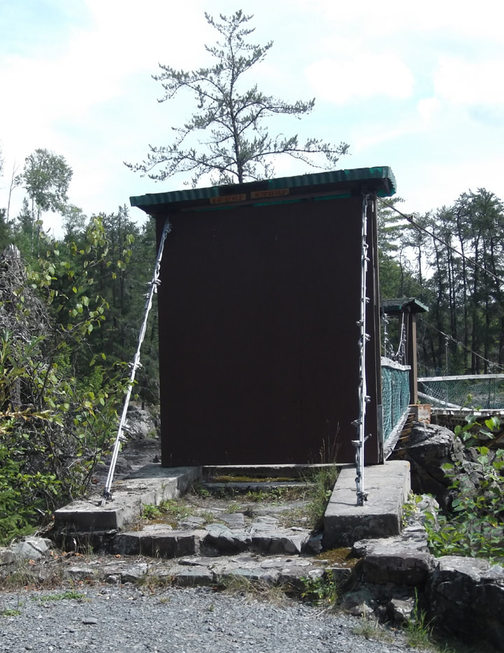
The entrance to the bridge was barricaded at both ends to prevent the public from using it. It was once a nice bridge across Englehart River. It was disappointing to see it sitting there getting older and more broken as time goes by without anyone coming to fix it. I looked it up online when I got home and apparently this bridge has been broken for at least 10 years. It's sad think that it has sat there neglected and forgotten for so long. What a shame.
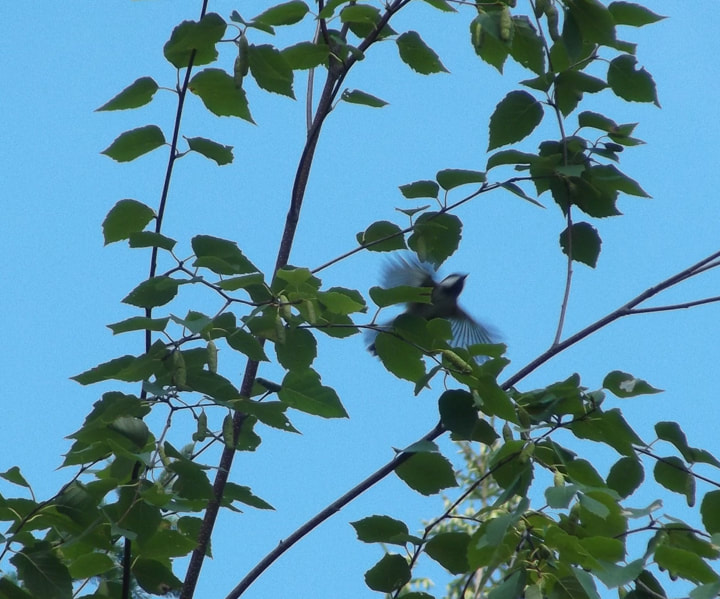
There were plenty of birds down by the river. Chickadees flew by.
While other small birds sat in the tree branches.
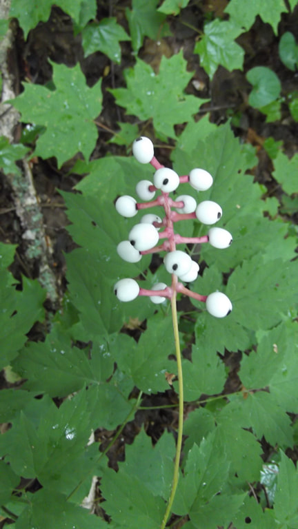
The berries on the Round-leaf Dogwoods were starting to make an appearance.
At the far end of the parking lot I noticed another set of bathrooms. I wondered if these bathrooms were also shut down so I decided to go and check them out.
They were not shut down. They were just your everyday vault toilets.
There was a ramp up the side for wheel chair access. But it was looking a little old and worn.
On the bathroom door was another warning about bears in the area.
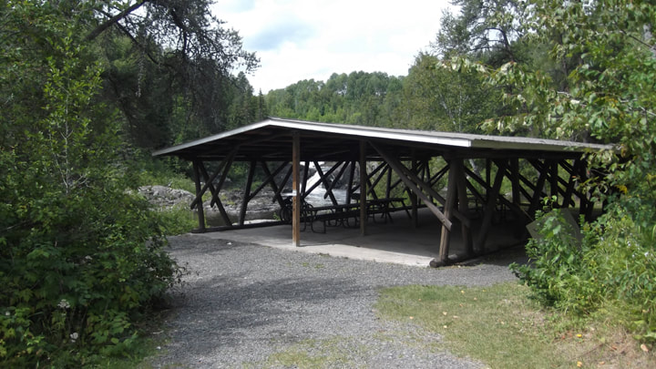
It was getting close to the time for tearing down camp because I was going to meet my parents at Esker Lakes Park and I still wanted to check out the Disney Trail (with a name like that it made me curious). So I got into my car and began to head back to the campsite. I was just about to leave the parking lot when I noticed a trail to the picnic area that I had missed on the way in. So, I parked the car again and got out and walked over to the picnic area to check it out. The picnic area was actually in pretty good condition. The structure looked good and the picnic tables were in good shape too.
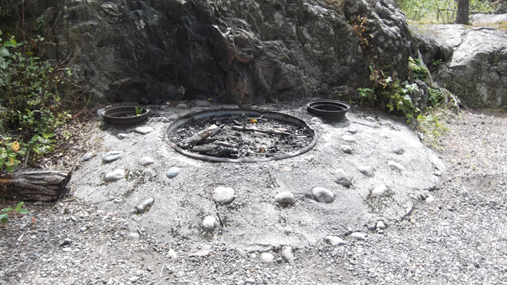
There was an interesting looking fire pit built into a cement and stone pit. There were two other metal rings situated a little farther up. I am not sure what they were for. If I had to guess I would say maybe they were planters with no plants in them. But considering how close they were to the fire pit it doesn't seem likely. Unless, of course, the large ring wasn't intended to be a fire pit at all. Maybe there were supposed to be flowers there too and someone just used it as a fire pit.
The picnic area has one of the best views of the falls. I sat and enjoyed it for awhile. But eventually I had to go back to my site and break camp.
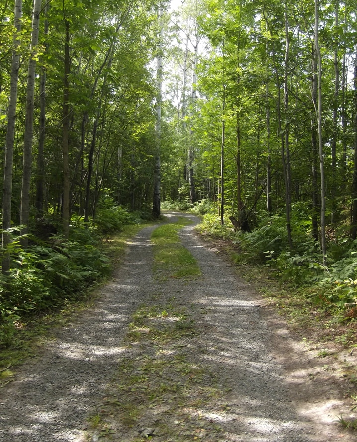
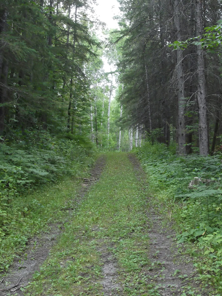
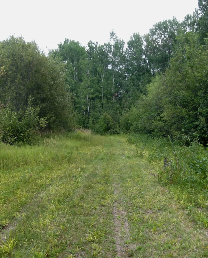
After breaking camp I decided that I might have just enough time to be able to squeeze in a quick hike on the Disney Trail. The Disney trail is a small loop that is part of the Long Trail.
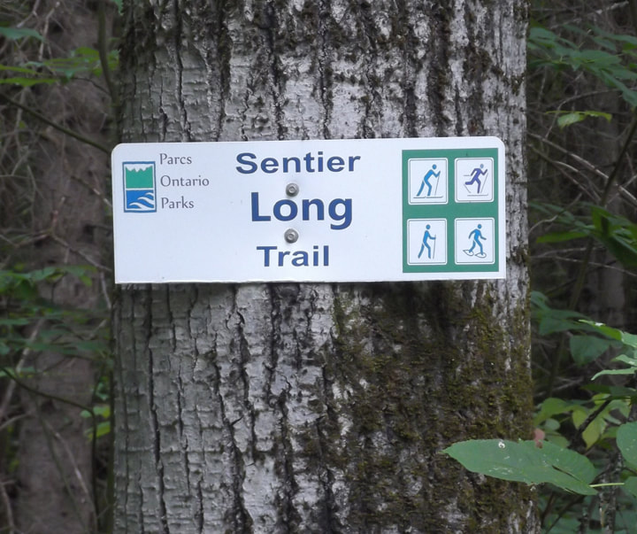
The long trail looks more like a road that runs through the woods than a trail. It is very wide and easy going.
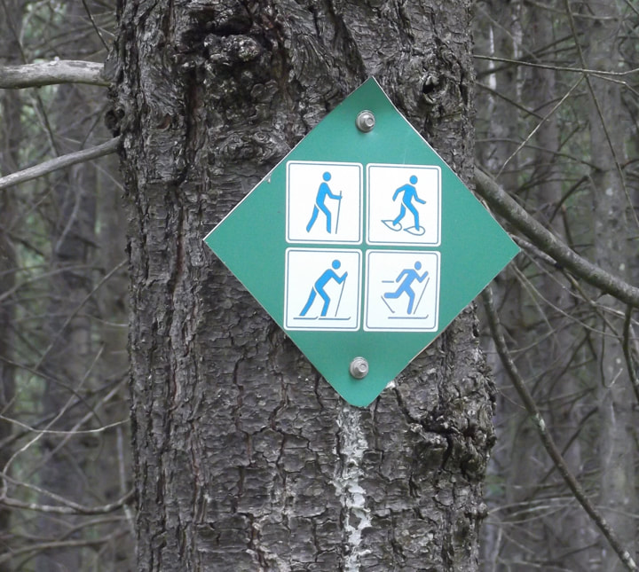
The trail markers looked pretty new and are much nicer than those I see in other parks. As a matter of fact all the trail signs look much nicer than those in other parks. It was clear to me that the emphasis on this park is more about the trails and the look outs than about the camping. The trails are used year round here.
The trail took a bit of a turn to the left and all of a sudden I was out of the trees and into an area that looked more like a meadow. It was more open and grassy.
The grassy area didn't last long and soon I was back in the trees again. There is a map posted on one of the trees indicating the ski trails that are available in the winter time. I was starting to wonder if I was ever going to find the Disney trail because it wasn't noted on this map and I hadn't seen a sign for it yet. I had passed a split off of the trail not far back but I had thought that was the "Small Loop" so I didn't venture down it. Now I was beginning to doubt myself.
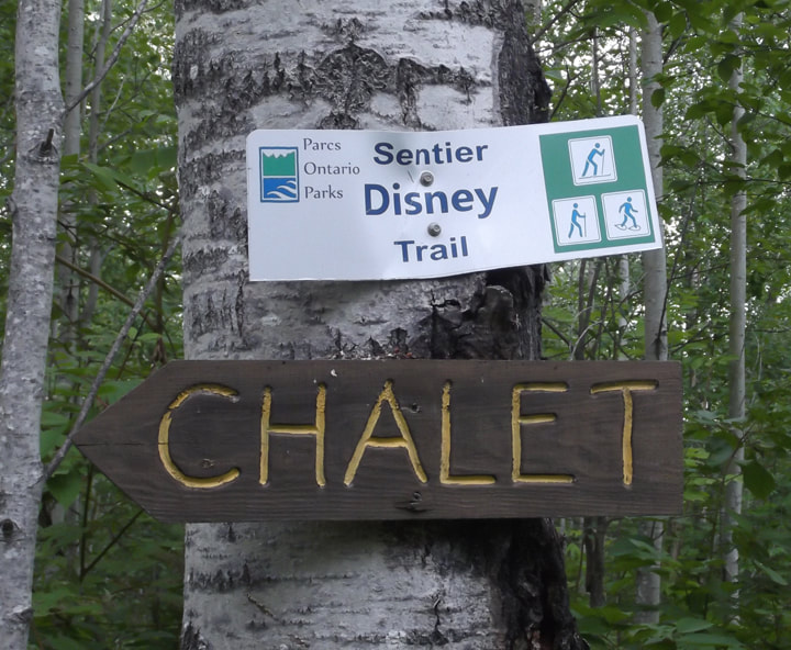
But just a wee bit further and I found the sign for the Disney Trail. Under it was a sign for the chalet that I presume people use to warm up in or to put on skis or snowshoes in the winter time. I never got that far so I never found out. The Disney Trail didn't look any different than the rest of the trail. There were no Disney characters pictured anywhere like I had imagined there might be. It was a bit of a let down. I began to ponder the reasoning behind naming it the Disney Trail. The only thing I could think of was maybe this is the kids loop on the Long Trail for skiing and snowshoeing. So, maybe they wanted to give it a name that would be in keeping with a kids trail. This is all just a wild guess though.
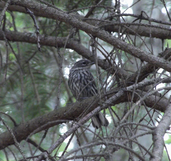
By this time I was debating about whether to turn around and going back or continue going forward. I was aware that I was running out of time before I would become late to meet up with my parents and the trail was not offering much of interest really. The most interesting thing about the trail so far was the birds. A White-throated sparrow was being friendly and not playing shy at all. So, I stopped to watch if for a few moments and to take some pictures.
That was when I heard a very loud crashing noise in the trees not far from where I was. It sounded like a tree falling. And maybe it was, but of course I had seen the warning signs about bears in the area so my mind went straight to that. I stood perfectly still for a moment. I didn't see or hear anything else. Nothing large was moving in the bush. Up ahead the trees seemed to swallow up the path and I thought to myself "Decision made! Just to be on the safe side I am going to turn around and go back the way I came!
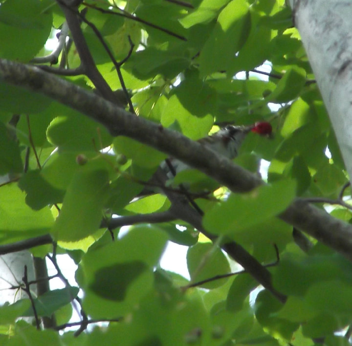
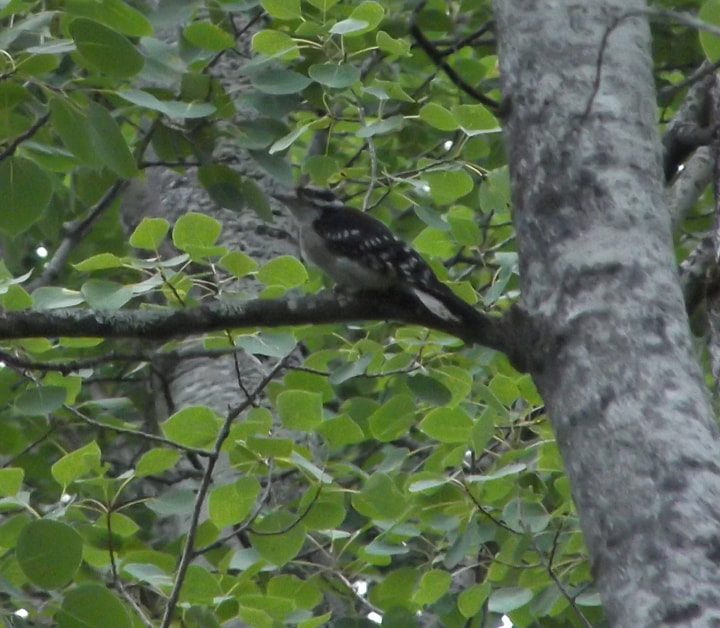
I turned around and walked back. I nervously listened and looked back from time to time to see if anything was following me. But there wasn't. So after awhile I began to relax again. I started to notice the flowers and the birds again. I caught sight of a Downy woodpecker hanging out in the trees.
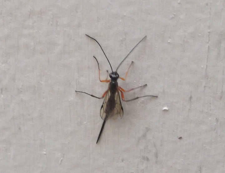
The orange abdomen of a Prionyx wasp also caught my eye. I don't see these wasps very often. They are mostly solitary and they hunt grasshoppers. The female will paralyze a grasshopper and bury it in a hole in the ground. Then it lays an egg on the grasshopper and seals up the burrow. The grasshopper becomes food for the baby wasp.
In no time at all I was off of the trail and back to my car. It was time to leave. As I passed by the office, I saw the 4 park employees hard at work. They were cleaning and maintaining the park lawns and such. I waved good-bye as I drove away.
So, what I formulated from my visit to this park is that although things are falling apart here, there is still much care given to the place. I see new things (new signs and picnic tables) but I also see a lot of old.As a day-use park this park is pretty nice. As a tenting park, it leaves something to be desired. I have not figured out if they are slowly upgrading things as money comes in or if they have given up on some things. I like to think that they are working on updating things and that it is just a slow process. If so, then in a few years from now this park could be spectacular. I can just imagine how much greater this park could be if it had the money needed to support it. (Getting internet here for the office would be a big win!) For now, it is just stuck in the past.
So, what I formulated from my visit to this park is that although things are falling apart here, there is still much care given to the place. I see new things (new signs and picnic tables) but I also see a lot of old.As a day-use park this park is pretty nice. As a tenting park, it leaves something to be desired. I have not figured out if they are slowly upgrading things as money comes in or if they have given up on some things. I like to think that they are working on updating things and that it is just a slow process. If so, then in a few years from now this park could be spectacular. I can just imagine how much greater this park could be if it had the money needed to support it. (Getting internet here for the office would be a big win!) For now, it is just stuck in the past.
 RSS Feed